Descripción:
University of Chicago Press, 2020 4to (29 cm),VII, 199 pp. Publisher's cloth and dust jacket. "The first English-language book to tell Rome’s rich story through its maps, 'The Eternal City' beautifully captures the past, present, and future of one of the most famous and enduring places on the planet. Jessica Maier considers Rome through the eyes of mapmakers and artists who have managed to capture something of its essence over the centuries. Viewing the city as not one but ten “Romes,” she explores how the varying maps and art reflect each era’s key themes. Ranging from modest to magnificent, the images comprise singular aesthetic monuments like paintings and grand prints as well as more popular and practical items like mass-produced tourist plans, archaeological surveys, and digitizations. The most iconic and important images of the city appear alongside relatively obscure, unassuming items that have just as much to teach us about Rome’s past. Through…
Leer más Resultados de búsqueda: Cartography from Leopolis Volodymyr Dmyterko
Has buscado:
- Librería: Leopolis Volodymyr Dmyterko
- Tema: Cartography from Leopolis Volodymyr Dmyterko
Resultados: 21 - 40 de 78

The Eternal City: A History of Rome in Maps
de Maier, Jessica
- Nuevo
- Tapa dura
- First
- Estado
- Nuevo
- Encuadernación
- Hardcover
- ISBN 10 / ISBN 13
- 9780226591452 / 022659145x
- Cantidad disponible
- 1
- Librería
-
Kraków, Poland
- Precio
-
EUR 32.55EUR 15.11 enviando a USA
Mostrar detalles
Precio
EUR 32.55
EUR 15.11
enviando a USA

Europa in Carta. Rappresentazioni grafiche e descrizioni geografiche dell'Europa del Cinquecento e del Seicento
- Usado
- near fine
- Tapa blanda
- Estado
- Usado - Near Fine
- Encuadernación
- Paperback
- Cantidad disponible
- 1
- Librería
-
Kraków, Poland
- Precio
-
EUR 16.28EUR 15.11 enviando a USA
Mostrar detalles
Descripción:
Cremona: Biblioteca Statale 8vo (24 cm), 74 pp. Printed wrappers. Illustrated catalogue of an exhibition held in Cremona 10 May - 29 June 1996. = Mostra bibliografica in occasione del semestre di presidenza italiana del Consiglio di cultura dell'Unione Europea, 10 maggio - 29 giugno 1996. Catalogo a cura di Francesco Maria Liborio.
Precio
EUR 16.28
EUR 15.11
enviando a USA

The Gallery of Maps
de Paolucci, Antonio
- Usado
- as new
- Tapa blanda
- Estado
- Nuevo
- Encuadernación
- Paperback
- ISBN 10 / ISBN 13
- 9788882711108 / 8882711102
- Cantidad disponible
- 1
- Librería
-
Kraków, Poland
- Precio
-
EUR 34.88EUR 15.11 enviando a USA
Mostrar detalles
Descripción:
Edizioni Musei Vaticani, 2011 4to (26.5 cm), 122, [6] pp. Laminated wrappers with flaps. A guide to the Gallery of Maps in the Vatican. "The Gallery of the Geographical Maps is 120 meters long and represents one of the most fascinating areas within the Vatican Museums. In 1581 the then Pontiff, Pope Gregory XIII, commissioned the famous cosmographer, geographer and mathematician of the time, Ignazio Danti, to manage the ambitious project of depicting the entire Italian peninsula along the gallery walls. The friar was joined in the Capital by a well-known group of artists, such as the brothers Matteo and Paolo Bril, Girolamo Muziano and Cesare Nebbia. They decorated the walls with forty maps depicting the Italian regions and islands including perspective views of its most prominent port cities (Genoa, Venice, Civitavecchia and Ancona) as well as two fundamental episodes from the history of Christianity: the Siege of Malta by the Turks, and the Battle of Lepanto with the defeat of the Turkish…
Leer más Precio
EUR 34.88
EUR 15.11
enviando a USA

Geographical Oddities or Curious, Ingenious, and Imaginary Maps and Miscellaneous Plates Published in Atlases. Map Collectors' Circle, No. 1
de Tooley, R. V.
- Usado
- Muy bueno
- Tapa blanda
- Estado
- Usado - Muy bueno
- Encuadernación
- Paperback
- Cantidad disponible
- 1
- Librería
-
Kraków, Poland
- Precio
-
EUR 20.92EUR 15.11 enviando a USA
Mostrar detalles
Descripción:
London: Map Collectors' Circle, 1963 8vo (24.5 cm), 22 pp, 20 plates. Printed wrappers (ex-library copy with stamp on title, title written along spine, number back of title but clean copy). The first volume of the Map Collectors' Circle.
Precio
EUR 20.92
EUR 15.11
enviando a USA
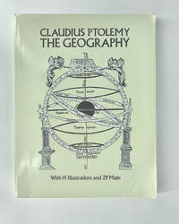
The Geography
de Ptolemy, Claudius
- Usado
- Muy bueno
- Tapa blanda
- Estado
- Usado - Muy bueno
- Encuadernación
- Paperback
- ISBN 10 / ISBN 13
- 9780486268965 / 0486268969
- Cantidad disponible
- 1
- Librería
-
Kraków, Poland
- Precio
-
EUR 46.50EUR 15.11 enviando a USA
Mostrar detalles
Descripción:
Dover Publications, 1991 4to (31 cm), XVI, 288 pp. Laminated wrappers (corners slightly bumped, collector's stamps on half-title and title). Unabridged Dover republication of Geography of Claudius Ptolemy, published in a limited edition of 250 copies by the New York Public Library in 1932.
Precio
EUR 46.50
EUR 15.11
enviando a USA

Gerard Mercator en de geografie in de zuidelijke Nederlanden/ Gerard Mercator et la geographie dans les Pays-Bas meridionaux
de Nave, F. de e.a. (red.)
- Usado
- Muy bueno
- Tapa blanda
- Estado
- Usado - Muy bueno
- Encuadernación
- Paperback
- Cantidad disponible
- 1
- Librería
-
Kraków, Poland
- Precio
-
EUR 16.28EUR 15.11 enviando a USA
Mostrar detalles
Descripción:
Antwerp: Museum Plantin-Moretus, 1994 4to (29.5 cm), 176 pp. Laminated wrappers (lamination slightly creased at the bottom, ex library with stamp and number on the title but clean and firm copy). Illustrated catalogue of an exhibition held at the Plantin-Moretus Museum. Featuring 72 entries presented in Dutch and French.
Precio
EUR 16.28
EUR 15.11
enviando a USA

Gerard Mercator, cartograaf 1512-1594 (Dutch Edition)
- Usado
- near fine
- Tapa blanda
- Estado
- Usado - Near Fine
- Encuadernación
- Paperback
- ISBN 10 / ISBN 13
- 9789050661379 / 9050661378
- Cantidad disponible
- 1
- Librería
-
Kraków, Poland
- Precio
-
EUR 20.92EUR 15.11 enviando a USA
Mostrar detalles
Descripción:
Gemeentekrediet, 1994 4to (29.5 cm), 160 pp. Laminated wrappers (minor shelf-wear). Contents include: Mercator in de verzamelingen van de Koninklijke Bibliotheek Albert I te Brussel, Mercator in de verzamelingen van het Museum Plantin-Moretus te Antwerpen, Mercator in de verzamelingen van het Mercatormuseum te Sint-Niklaas.
Precio
EUR 20.92
EUR 15.11
enviando a USA

Giacomo Cantelli: Geografo del Serenissimo (Italian Edition)
- Usado
- Muy bueno
- Tapa blanda
- Estado
- Usado - Muy bueno
- Encuadernación
- Paperback
- ISBN 10 / ISBN 13
- 9788880810476 / 8880810472
- Cantidad disponible
- 1
- Librería
-
Kraków, Poland
- Precio
-
EUR 34.88EUR 15.11 enviando a USA
Mostrar detalles
Descripción:
Grafis, 1995 Square 4to (27 x 27 cm), 202 pp. Laminated wrappers (wrappers slightly rubbed at extremities, corners somewhat scuffed, ownership entry on the front free endpaper). Illustrated catalogue of an exhibition held 18 November 1995 - 31 January 1991 in the Rocca di Vignola. 90 entries.
Precio
EUR 34.88
EUR 15.11
enviando a USA

Graphic design techniques on maps from world atlases 1570-1662 and their influence on the creation of cartographic principles
de Medyńska-Gulij, Beata
- Usado
- as new
- Tapa blanda
- Estado
- Nuevo
- Encuadernación
- Paperback
- ISBN 10 / ISBN 13
- 9788362662920 / 8362662921
- Cantidad disponible
- 1
- Librería
-
Kraków, Poland
- Precio
-
EUR 20.92EUR 15.11 enviando a USA
Mostrar detalles
Descripción:
Poznań: Bogucki Wydawnictwo Naukowe, 2011 8vo (24 cm), 106 pp. Laminated wrappers with flaps.
Precio
EUR 20.92
EUR 15.11
enviando a USA

Great Maps
de Brotton, Jerry
- Usado
- as new
- Tapa dura
- Estado
- Nuevo
- Encuadernación
- Hardcover
- ISBN 10 / ISBN 13
- 9781409345718 / 1409345718
- Cantidad disponible
- 1
- Librería
-
Kraków, Poland
- Precio
-
EUR 20.92EUR 15.11 enviando a USA
Mostrar detalles
Descripción:
DK, 2014 4to (30.5 cm), 256 pp. Publisher's laminated boards. "A superbly illustrated guide to 64 maps from all around the world: from examples of medieval Mappa Mundi and the first atlas to Google Earth and maps of the moon, this captivating maps book is a must-have for all history and geography enthusiasts and explorers. Maps are much more than just geographical data. They are an accurate reflection of the culture and context of different time frames in history. This remarkable geography book puts cartography on the map! It tells the stories behind great maps through stunning pull-out details and reveals how they have helped people make sense of the world." (from the publisher's synopsis)
Precio
EUR 20.92
EUR 15.11
enviando a USA

Holy Land in Maps
de Kadmon, Naftali; Rubin, Rehar
- Usado
- Aceptable
- Tapa dura
- Estado
- Usado - Aceptable
- Encuadernación
- Hardcover
- ISBN 10 / ISBN 13
- 9780847824120 / 0847824128
- Cantidad disponible
- 1
- Librería
-
Kraków, Poland
- Precio
-
EUR 27.90EUR 15.11 enviando a USA
Mostrar detalles
Descripción:
Rizzoli, 2001 4to (27.5 cm), 164 pp. Publisher's cloth & dust jacket. From the blurb: "The history of the mapping of the Holy Land epitomizes the history of cartography itself. Situated at the crossroads of Africa, Asia, and Europe, the Holy Land has been the focus of intense interest for countless generations; under its various names--Canaan, The Promised Land, Palestine, or Terra Sancta -- it evinces the longest unbroken sequence of mapping in the world. Two principal cartographic traditions dominate this fascinating history: the religious one, based primarily on the Bible and its exegeses; and the classical tradition, represented by Ptolemy, which laid the foundations of modern cartography. The present volume brings together for the first time an historical panorama of these maps: from a 6th-century mosaic from Jordan; through early Hebrew, Christian, and Islamic maps; to maps of the recent past. We see the 13th-century Hereford World Map, with Jerusalem at its center, and the…
Leer más Precio
EUR 27.90
EUR 15.11
enviando a USA

Imago Lithuaniae. Lietuvos Didžiosios Kunigaiǩstystès žemèlapiai ir dokumentai iš Tomaszo Niewodniczańskio rinkiniu
de Niewodniczański,Tomasz; Braziūnienė, Alma; Linka, Kazys
- Usado
- Aceptable
- Tapa blanda
- Estado
- Usado - Aceptable
- Encuadernación
- Paperback
- ISBN 10 / ISBN 13
- 9789986092445 / 9986092442
- Cantidad disponible
- 1
- Librería
-
Kraków, Poland
- Precio
-
EUR 220.88EUR 15.11 enviando a USA
Mostrar detalles
Descripción:
Vilnius: Magi Raštai, 2002 4to (25.5 cm), 224 pp. Laminated wrappers with flaps. In Lithuanian, Polish, and English. This publication features maps and documents from the Grand Duchy of Lithuania, sourced from the collections of Tomasz Niewodczański (1933-2010), a Polish physicist, entrepreneur, collector, and bibliophile. He assembled one of the world's largest private cartographic collections.
Precio
EUR 220.88
EUR 15.11
enviando a USA

Imago Mundi The Journal of the International Society for the History of Cartography Volume 44
- Usado
- Muy bueno
- Tapa dura
- Estado
- Usado - Muy bueno
- Encuadernación
- Hardcover
- ISBN 10 / ISBN 13
- 9780905776170 / 0905776178
- Cantidad disponible
- 1
- Librería
-
Kraków, Poland
- Precio
-
EUR 55.80EUR 15.11 enviando a USA
Mostrar detalles
Descripción:
London: Imago Mundi, Ltd., 1992 4to (30.5 cm), frontispiece in color, 178 pp. Publisher's cloth, gilt-lettered spine and front board (binding slightly rubbed and stained, bookplate tipped in verso of the title page). Contents include articles: "A Tibetan map of lHo-kha in the South-Eastern Himalayan borderlands of Tibet" by Toni Huber; "The Aslake world map" by Peter M. Barber & Michelle P. Brown; "Paolo Forlani: Compiler, engraver, printer, or publisher?" by David Woodward; "Mapping new worlds: Culture and cartography in sixteenth‐century Venice" by Denis Cosgrove; "L'émergence des nouvelles cartes marines: L'oeuvre de Beautemps‐Beaupré à la fin du XVIIIème et au début du XIXème siècle" by Olivier Chapuis; "Medieval Hebrew manuscript maps" by E. Wajntraub & G. Wajntraub; "The Royal Geographical Society, E. G. Ravenstein, and a map of eastern equatorial…
Leer más Precio
EUR 55.80
EUR 15.11
enviando a USA

Más fotos
Imago Poloniae. Dawna Rzeczpospolita na mapach, dokumentach i starodrukach w zbiorach Tomasza Niewodniczańskiego = Das Polnisch-Litauische Reich in Karten, Dokumenten und alten Drucken. 2 vol. [complete set]
- Usado
- Aceptable
- Tapa dura
- Estado
- Usado - Aceptable
- Encuadernación
- Hardcover
- Cantidad disponible
- 1
- Librería
-
Kraków, Poland
- Precio
-
EUR 337.12EUR 15.11 enviando a USA
Mostrar detalles
Descripción:
Warsaw: Agencja Reklamowo-Wydawnicza Arkadiusz Grzegorczyk, 2002 2 volumes 4to (33.5 cm), 388 pp; 324 pp. Laminated boards (minor shelf-wear). Tomasz Niewodczański (1933-2010), a Polish physicist, entrepreneur, collector, and bibliophile, assembled one of the world's largest private cartographic collections. "Imago Poloniae" serves as a catalog for the Polish-Lithuanian segment of the collection, now housed in the library of the Royal Castle in Warsaw. Volume one encompasses highlights, manuscripts, and printed books, while volume two is a comprehensive catalog of maps. Published in conjunction with exhibitions in Berlin, Warsaw, Kraków, and Wrocław during 2002-2003, this catalog, along with "Imago Lithuaniae" (2002) and the unpublished "Imago Ukrainae," stands as the premier reference for maps of the Polish-Lithuanian Commonwealth. The text is presented in both Polish and German.
Precio
EUR 337.12
EUR 15.11
enviando a USA

Investing in Maps
de Baynton-Williams, Roger
- Usado
- near fine
- Tapa dura
- First
- Estado
- Usado - Near Fine
- Encuadernación
- Hardcover
- ISBN 10 / ISBN 13
- 9780214650666 / 0214650669
- Cantidad disponible
- 1
- Librería
-
Kraków, Poland
- Precio
-
EUR 11.62EUR 15.11 enviando a USA
Mostrar detalles
Descripción:
Barrie & Rockliff, 1969 4to (30.5 cm), 160pp. Publisher's cloth and dust jacket (dj slightly rubbed at extremities and clipped). A guide to map-collecting, encompassing the first printed maps, early British country maps, 18th & 19th century British maps, French & German maps, sea charts, town plans, and oddities.
Precio
EUR 11.62
EUR 15.11
enviando a USA

Más fotos
Katalog dawnych map Rzeczypospolitej Polskiej w kolekcji Emeryka Hutten Czapskiego i innych zbiorach. T. 1: Mapy XV-XVI wieku. T. 2: Mapy XVII wieku [complete set]
- Usado
- near fine
- Tapa dura
- Estado
- Usado - Near Fine
- Encuadernación
- Hardcover
- Cantidad disponible
- 1
- Librería
-
Kraków, Poland
- Precio
-
EUR 372.00EUR 15.11 enviando a USA
Mostrar detalles
Descripción:
Wroclaw: Ossolineum, 1978 2 folders 34 x 24 cm, 164 pp, 28 folding maps; 250 pp, 48 folding maps. Cloth backed folders (minor shelf wear). A catalog of early maps of the Polish-Lithuanian Commonwealth from the collection of Emeryk Hutten Czapski (1822-1896), a significant coin, book, and map collector. His esteemed collections have been transferred to the National Museum in Krakow, where they are currently exhibited in the Hutten Czapski House. Volume 1 encompasses maps from the XV to XVI centuries, while Volume 2 features maps from the XVII century.
Precio
EUR 372.00
EUR 15.11
enviando a USA

Katalog rękopisów geograficznych w zbiorach Poznania i Kórnika
de Urszula, Puckulanka; Rzepa, Zbigniew
- Usado
- near fine
- Tapa blanda
- Estado
- Usado - Near Fine
- Encuadernación
- Paperback
- Cantidad disponible
- 1
- Librería
-
Kraków, Poland
- Precio
-
EUR 27.90EUR 15.11 enviando a USA
Mostrar detalles
Descripción:
Warszawa: Instytut Geografii PAN, 1972 8vo (20.5 cm), 76 pp. Printed wrappers. In Polish. A catalogue of geographical manuscripts in libraries of Poznań and Kórnik. Descriptions of 80 manuscripts including Marco Polo (the second half of 15th century), Mikolaj Radziwill' Peregination to the Holy Land (1596), Lippomano' Relations from Poland (end of 16th century), Ricaut' Descriptions of Turkey (1668).
Precio
EUR 27.90
EUR 15.11
enviando a USA

Katalogus van de Kaartenverzameling (Buitengewone uitgaven van de Koninklijke Oudheidkundige Kring van het Land van Waas, 2)
de Gucht, A. Van der
- Usado
- near fine
- Tapa blanda
- Estado
- Usado - Near Fine
- Encuadernación
- Paperback
- Cantidad disponible
- 1
- Librería
-
Kraków, Poland
- Precio
-
EUR 5.81EUR 15.11 enviando a USA
Mostrar detalles
Descripción:
Sint-Niklaas, 1980 4to (29.5 cm), 173, [3] pp. Printed wrappers. A catalogue of the unbound maps that are the property of the "Koninklijke Oudheidkundige Kring van het Land van Waas" and kept in the archives of this association or exhibited in the Museum of the City of St-Niklaas. 606 entries and various indexes.
Precio
EUR 5.81
EUR 15.11
enviando a USA

L'Italia prima dell'Italia. Carte geografiche e tipografiche dell'Italia dal 1478 al 1861
de Valerio, Vladimiro
- Usado
- Aceptable
- Tapa blanda
- Estado
- Usado - Aceptable
- Encuadernación
- Paperback
- ISBN 10 / ISBN 13
- 9788887867350 / 8887867356
- Cantidad disponible
- 1
- Librería
-
Kraków, Poland
- Precio
-
EUR 32.55EUR 15.11 enviando a USA
Mostrar detalles
Descripción:
Dominioni, 2011 Square 8vo (24 x 23 cm), 155 pp. Laminated wrappers with flaps.
Precio
EUR 32.55
EUR 15.11
enviando a USA

L'Italia del Cavaliere Rizzi Zannoni. Carte a stampa dei territori italiani
- Nuevo
- Tapa blanda
- Estado
- Nuevo
- Encuadernación
- Paperback
- Cantidad disponible
- 1
- Librería
-
Kraków, Poland
- Precio
-
EUR 26.74EUR 15.11 enviando a USA
Mostrar detalles
Descripción:
Associazione "Roberto Almagià"; Associazione Italiana Collezionisti di Cartografia Antica Roma, 2014 8vo (20 cm), 118 pp. A catalogue of Giovanni Antonio Rizzi Zannoni maps of Italy.
Precio
EUR 26.74
EUR 15.11
enviando a USA

¿No has encontrado lo que estabas buscando?
Prueba a añadir esta búsqueda a búsquedas guardadas Cada día se añaden millones de libros a Biblio. Cuando uno de ellos encaje con tu búsqueda, te enviaremos un correo para avisarte. Y lo mejor de todo, ¡es gratis!
Añadir a búsquedas guardadas

¿Eres un lector habitual o un coleccionista de libros?
Únete al Biblioclub y ahorra 10% en cada compra, ¡cada día! Hasta un máximo de 20$ en cada pedido

Responsabilidad social
¿Sabías que desde 2004 Biblio ha destinado sus beneficios a la construcción de 16 bibliotecas públicas en zonas rurales de Latinoamérica?
