Ordnance Survey - Wye Valley, Scale Of One Inch To One Mile
de
Ejemplares disponibles
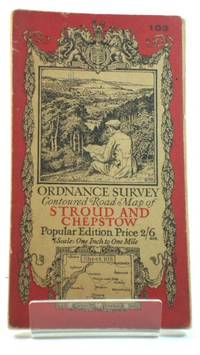
Ordnance Survey: Contoured Road Map of Stroud and Chepstow: Sheet 103
- Estado
- Usado - Good
- Published
- 1919
- Encuadernación
- Paperback
- Cantidad disponible
- 1
- Librería
-
Didcot, Oxfordshire, GBR
- Precio
-
EUR 14.27
Mostrar detalles
Descripción:
Ordnance Survey, 1919. Fold out map in good condition. Road corrections to 1929; railways to 1928. Lightly marked and worn cover. Minor marks and age related wear to the interior. Pen and embossed stamp on the margin. The main content remains clear. Scale: one inch to a mile. CM. Paperback. Good. Used. Precio
EUR 14.27
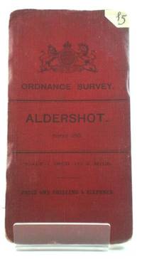
Ordnance Survey: Aldershot: Sheet 285
- Estado
- Usado - Good
- Published
- 1904
- Encuadernación
- Paperback
- Cantidad disponible
- 1
- Librería
-
Didcot, Oxfordshire, GBR
- Precio
-
EUR 41.63
Mostrar detalles
Descripción:
Ordnance Survey, 1904. Fold out map in good condition. Lightly marked and worn cover. Sticker on the front. The rear lower edge and its leading corner are peeling. Minor marks and age related wear to the interior, however the main content remains clear. Scale: one inch to a mile. CM. Paperback. Good. Used. Precio
EUR 41.63
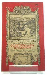
Ordnance Survey: Contoured Road Map of Clacton on Sea and Harwich: Sheet 98
- Estado
- Usado - Good
- Published
- 1921
- Encuadernación
- Paperback
- Cantidad disponible
- 1
- Librería
-
Didcot, Oxfordshire, GBR
- Precio
-
EUR 29.74
Mostrar detalles
Descripción:
Ordnance Survey, 1921. Fold out map in good condition. Lightly marked and worn cover. Minor marks and age related wear to the interior, however the main content remains clear. Scale: one inch to a mile. CM. Paperback. Good. Used. Precio
EUR 29.74

Más fotos
Ordnance Survey: Map of Monastic Britain - South Sheet (Archaeological and Historical Maps series)
- Estado
- Usado - Good
- Edición
- 2nd Edition
- Published
- 1954
- Encuadernación
- Soft cover
- Cantidad disponible
- 1
- Librería
-
nr Canterbury, Kent, GBR
- Precio
-
EUR 13.08
Mostrar detalles
Descripción:
Ordnance Survey, 1954. 2nd Edition . Soft cover. Good. 8vo - over 7¾ - 9¾" tall. 28pp, very large colour fold-out map in rear. Laminated, illustrated light card covers. Stapled booklet tipped-in at rear. 8vo. Chipping to edges and wear to covers; large fold on front, has cause local delamination. Booklet staples oxidising, price on booklet… Saber más sobre este artículo Precio
EUR 13.08
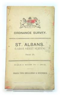
Ordnance Survey: St. Albans. (Large Sheet Series). Sheet 29.
- Estado
- Usado - Good
- Published
- 1906
- Encuadernación
- Paperback
- Cantidad disponible
- 1
- Librería
-
Didcot, Oxfordshire, GBR
- Precio
-
EUR 28.25
Mostrar detalles
Descripción:
Southampton: Ordnance Survey, 1906. Paperback map in good condition. Scale - 2 miles to 1 inch. Map is tanned, stained and edge-worn. One or two leading corners are creased. Sticker on reverse of map. Map remains clear throughout. HCW. Paperback. Good. Used. Precio
EUR 28.25
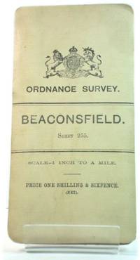
Ordnance Survey: Beaconsfield: Sheet 255
- Estado
- Usado - Good
- Published
- 1904
- Encuadernación
- Paperback
- Cantidad disponible
- 1
- Librería
-
Didcot, Oxfordshire, GBR
- Precio
-
EUR 41.63
Mostrar detalles
Descripción:
Ordnance Survey, 1904. Fold out map in good condition. Lightly marked and worn cover. Minor marks and age related wear to the interior, however the main content remains clear. Scale: one inch to a mile. CM. Paperback. Good. Used. Precio
EUR 41.63

ORDNANCE SURVEY: YEOVIL AND BLANDFORD (large Sheet Series) Sheet 133. One inch to a mile. Price two shillings.
- Estado
- Usado - VG-
- Published
- 1908
- Encuadernación
- Paperback
- Cantidad disponible
- 1
- Librería
-
WINTERTON, Lincolnshire, GBR
- Precio
-
EUR 15.27
Mostrar detalles
Descripción:
GB: Ordnance Survey, 1908. Printed white card covers. 715 x 520 mm. Mounted on cloth. Some moderately heavy brown spots to body of map. Elsae Book is in very good minus condition with minor but noticeable signs of wear and/or age. . Paperback. VG-. Precio
EUR 15.27
Ordnance Survey: no. 86 Environs of Maidenhead & Reading. Scale - 1 Inch to a Mile.
- Estado
- Usado - , the front cover is printed with the wrong title (No.254 Henley on Thames) and has been annotated in pen, covers are creased a
- Edición
- Early Edition
- Published
- , no date given c1910
- Encuadernación
- , bound in red cloth with black title to front Paperback
- Cantidad disponible
- 1
- Librería
-
Skipton, North Yorkshire, GBR
- Precio
-
EUR 47.58
Mostrar detalles
Descripción:
, linen backed coloured map of the area around Reading , in the incorrect covers Precio
EUR 47.58
Ordnance Survey: The English Lakes - South West Sheet: Wast Water and Coniston [Outdoor Leisure Map]
- Estado
- Usado - VG+
- Published
- 1975
- Cantidad disponible
- 1
- Librería
-
Kutztown, Pennsylvania, USA
- Precio
-
EUR 6.99
Mostrar detalles
Descripción:
Southampton, U.K.: Director General of the Ordnance Survey, 1975. Book. VG+. Unbound. 8vo - over 7¾" - 9¾" tall. Large 1:25,000 scale folding map, in color, in stiff laminated cover. Cover shows some wear along edges, map fully intact. Undated, but with note stating boundaries revised to 1974.. Precio
EUR 6.99
Ordnance Survey: Landranger 174: Newbury, Wantage & surrounding area
- Estado
- Used - Very Good
- ISBN
- 9780319221747
- Cantidad disponible
- 1
- Librería
-
Frederick, Maryland, USA
- Precio
-
EUR 12.24
Mostrar detalles
Descripción:
Ordnance Survey. Used - Very Good. Very Good condition. (England, Maps) A copy that may have a few cosmetic defects. May also contain a few markings such as an owner’s name, short gifter’s inscription or light stamp. Precio
EUR 12.24
Ordnance Survey: Haltwhistle and Bewcastle; Showing part of National Park; Sheet 86
- Estado
- Used - Good
- Cantidad disponible
- 1
- Librería
-
Frederick, Maryland, USA
- Precio
-
EUR 12.24
Mostrar detalles
Descripción:
Director General of the Ordnance Survey. Used - Good. Good condition. Sheet 86. (map, ordnance survey, haltwhistle, bewcastle) A copy that has been read but remains intact. May contain markings such as bookplates, stamps, limited notes and highlighting, or a few light stains. Precio
EUR 12.24
The Ordnance Survey: Complete Guide to the Battlefields of Britain
- Estado
- Usado - Very Good
- Published
- 1984
- Cantidad disponible
- 1
- Librería
-
Salt Lake City, Utah, USA
- Precio
-
EUR 7.46
Mostrar detalles
Descripción:
Webb & Bower, 1984. Very Good. The Ordnance Survey: Complete Guide to the Battlefields of Britain. Exeter, Devon: Webb & Bower, 1984. 224pp. Indexed. Illustrated. Glossary. 8vo. Paperback. Book condition: Very good. Precio
EUR 7.46
Ordnance Survey - Route Planning Map - North Sheet
- Estado
- Usado - Very Good
- Estado de la sobrecubierta
- No Jacket
- Edición
- 1978 Edition
- Published
- 1978
- Encuadernación
- Hardcover
- Cantidad disponible
- 1
- Librería
-
Herts, GBR
- Precio
-
EUR 7.08
Mostrar detalles
Descripción:
Dunn & Wilson, 1978. Book. Very Good. Hardcover. 1978 Edition. No jacket. Ex-Library. Couple of library stamps. Some creasing and a very small hole at one of the folds on the map. Library number sticker on spine.. Precio
EUR 7.08
Ordnance Survey: The Cotswolds (Landranger Guidebook)
- Estado
- Used; Good
- Edición
- 1st
- Encuadernación
- Map
- ISBN
- 9780319001806
- Cantidad disponible
- 1
- Librería
-
Milton Keynes , Buckinghamshire, GBR
- Precio
-
EUR 4.27
Mostrar detalles
Descripción:
Ordnance Survey and Jarrold Colour Publications. 1st. Map. Used; Good. Simply Brit – welcome to our online used book store, where affordability meets great quality. Dive into a world of captivating reads without breaking the bank. We take pride in offering a wide selection of used books, from classics to hidden gems, ensuring there’s something for every literary… Saber más sobre este artículo Precio
EUR 4.27
Ordnance Survey: German East Africa - Kilwa - F6 (1: 800, 000)
- Estado
- Usado - Good
- Estado de la sobrecubierta
- No Jacket
- Published
- 1916
- Encuadernación
- Softcover
- Cantidad disponible
- 1
- Librería
-
Johannesburg, ZAF
- Precio
-
EUR 130.48
Mostrar detalles
Descripción:
Ordnance Survey, London, 1916. Softcover. Good/No Jacket. Map of German East Africa. A VERY RARE map of World World I vintage. A casually owned copy. A previous owner has marked short flight hops to air strips(?), plus some water availability notes Stripped of German place names. Linen backing. Much worn, much marked all about from… Saber más sobre este artículo Precio
EUR 130.48
Ordnance Survey - Braemar, Sheet 41 - One-Inch Map
- Estado
- Usado - Very Good
- Encuadernación
- Soft cover
- Cantidad disponible
- 1
- Librería
-
horton, Berkshire, GBR
- Precio
-
EUR 5.83
Mostrar detalles
Descripción:
Ordnance Survey, Southampton Ordnance Survey, Southampton circa 1967 folding map in VERY GOOD CLEAN TIGHT READING ORDER. Full refund if not satisfied. 24 hour despatch. If not pictured in this listing, a scan of the actual book is available on request. Precio
EUR 5.83
Ordnance Survey - Wye Valley, Scale of One Inch to One Mile
- Estado
- Usado
- Cantidad disponible
- 1
- Librería
-
Evesham, Worcestershire, GBR
- Precio
-
EUR 17.84
Mostrar detalles
Descripción:
U.K.: By Authority of Ministry of Agriculture & Fisheries. Fold out map with linen backing, edgewear and some small tears/nicks, discolouration and minor marks, otherwise in Good+ condition.. Good+. Ordnance Survey Map. Precio
EUR 17.84
Ordnance Survey: Lancaster & Kendal
- Estado
- Usado - Very Good Plus
- Published
- 1994
- Encuadernación
- Cantidad disponible
- 1
- Librería
-
Pembina, North Dakota, USA
- Precio
-
EUR 3.73
Mostrar detalles
Descripción:
Winnipeg: Director General of the Ordnance Survey, Southampton, 1994. A very good plus map. Clean and bright. . Map. Very Good Plus. Precio
EUR 3.73
