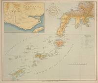
Ver a tamaño completo.
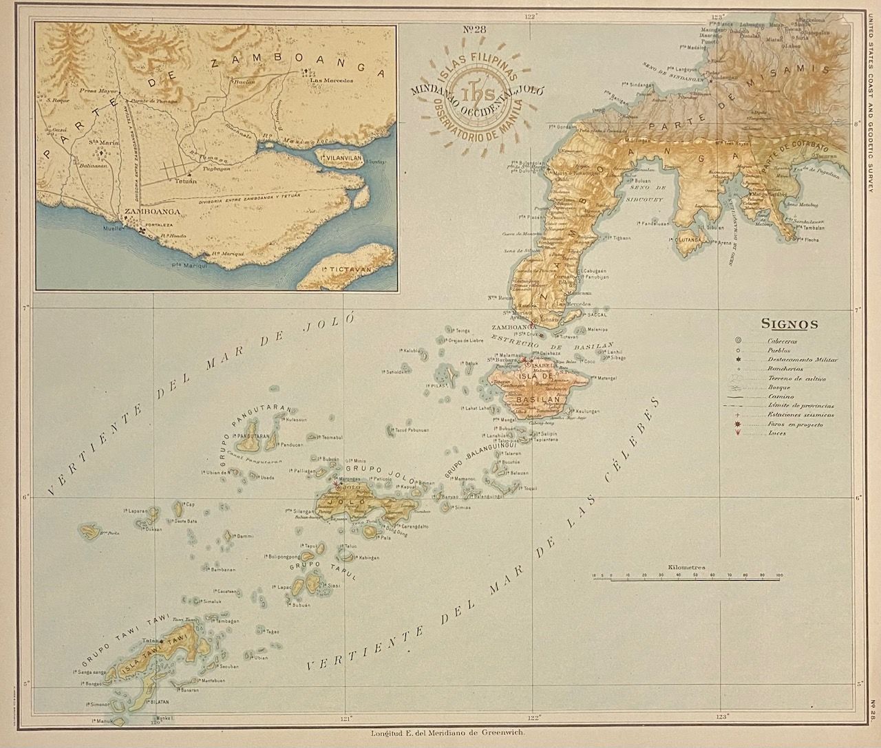
No. 28 Mindanao Occidental, Jolo. Islas Filipinas Observatorio de Manila
de ALGUE, P. Jose and U.S. COAST AND GEODETIC SURVEY
- Usado
- Estado
- Ver descripción
- Librería
-
New York, New York, United States
Formas de pago aceptadas
Sobre este artículo
Washington: Government Printing Office, 1900. Map. Color lithograph. Image measures 13 1/2" x 11 1/2"<br/> <br/> This map of the Sulu Archipelago and the western part of island of Mindanao was originally prepared as part of a series made by the Manila Observatory of the Jesuits in 1899. Led by director P. Jose Algue, the Observatory employed only native Philippine draftsmen to complete the technical work required for the project. Upon learning of the Jesuits' undertaking, the U.S. Coast and Geodetic Survey entered into cooperation with the Observatory to produce a comprehensive atlas of the Philippine archipelago. The 30 maps were then brought to the U.S., redrawn slightly with regards to scale and projection, and published by the Survey in 1900 as the "Atlas of the Philippine Islands," the third edition in a series of special publications. This unique combination of American command and a wholly Spaniard or Filipino staff made the Observatory a rare example of cooperation during the period of the Philippine-American War, which continued from 1898 to 1902. Furthermore, the project is significant in its own right given the historic difficulty of mapping the islands, owing in particular to constant disputes between the warring imperial powers of Spain and Portugal. As the superintendent of the Survey describes in the atlas's introduction, the Jesuits spared no pains in securing all available data, and verified them by consultation with members of other religious orders, as well as with old residents, travels, and explorers. <br> <br> The map depicts the western peninsula of Mindanao and the Sulu Archipelago, also known as Basulta, comprising the islands of Basilan, Balanguingui, Jolo, Pangutaran, and Tawi Tawi. Topography is artistically rendered, and rivers, cities, towns, highways, horse trails, footpaths, lighthouses, seismic stations, streetcars, and estates are labeled. An inset in the upper left shows the city of Zamboanga and the surrounding area. The map is in excellent condition with vibrant color. Small binding holes to top margin, not affecting the image. <br> The U.S. Coast and Geodetic Survey was first established in 1807. After the Civil War, the bureau took responsibility for mapping and conducting geodetic surveys of the the interior of the expanding country. The beautiful quality of this map of the Philippines, particularly with regard to geodetic detail, attests to the fascinating history and hard work that lay behind it.<br/> <br/>
Reseñas
(¡Iniciar sesión or Crear una cuenta primero!)
Detalles
- Librería
- Argosy Book Store
 (US)
(US)
- Inventario del vendedor #
- 310143
- Título
- No. 28 Mindanao Occidental, Jolo. Islas Filipinas Observatorio de Manila
- Autor
- ALGUE, P. Jose and U.S. COAST AND GEODETIC SURVEY
- Estado del libro
- Usado
- Cantidad disponible
- 1
- Editorial
- Government Printing Office
- Lugar de publicación
- Washington
- Fecha de publicación
- 1900
- Palabras clave
- philippine-american war, jesuit, sulu
Términos de venta
Argosy Book Store
All items are offered net, subject to prior sale. Returns accepted within 7 days of receipt--please contact us first. Payment by Visa , Mastercard & American Express. Appropriate sales tax will be added for all N.Y. State residents
Sobre el vendedor
Argosy Book Store
Miembro de Biblio desde 2004
New York, New York
Sobre Argosy Book Store
We are a large retail store, with 6 floors of out-of-print and rare books, (including, Americana, modern first editions, history of medicine and science), antique maps and prints, autograph manuscripts, letters & signatures.