Descripción:
London: Bloomsbury, 2015 Book. Very Good. Red Cloth Boards. First Edition, First Printing. 11.25" Square. Account of the development of urban mapping and the history of cities as seen by cartographers. 224pp with index, illustrated throughout with colour maps and reproductions. Gilt lettering to front board and spine. Minor rubbing to corners, otherwise very good copy with no inscriptions. Unclipped DJ has minor edgewear, otherwise very good. HEAVY BOOK, additional postage required for 1st class or overseas shipping..
Resultados de búsqueda: Geography from Washburn Books
Has buscado:
- Librería: Washburn Books
- Tema: Geography from Washburn Books
Resultados: 21 - 38 de 38

Metropolis - Mapping the City
de Jeremy Black, Christopher Westhop (Contributing editor)
- Usado
- Muy bueno
- Tapa dura
- First
- Estado
- Usado - Muy bueno
- Edición
- First Edition, First Printing
- Encuadernación
- Hardcover
- ISBN 10 / ISBN 13
- 9781844862207 / 1844862208
- Cantidad disponible
- 1
- Librería
-
Pateley Bridge, North Yorkshire, United Kingdom
- Precio
-
EUR 23.76EUR 20.79 enviando a USA
Mostrar detalles
Precio
EUR 23.76
EUR 20.79
enviando a USA

The Nature of the Environment
de Andrew Goudie
- Usado
- Muy bueno
- Tapa blanda
- Estado
- Usado - Muy bueno
- Edición
- Reprint of 2nd Edition
- Encuadernación
- Paperback
- ISBN 10 / ISBN 13
- 9780631161288 / 0631161287
- Cantidad disponible
- 1
- Librería
-
Pateley Bridge, North Yorkshire, United Kingdom
- Precio
-
EUR 8.91EUR 20.79 enviando a USA
Mostrar detalles
Descripción:
Oxford: Basil Blackwell, 1990 Book. Very Good. Soft cover. Reprint of 2nd Edition. 4to - over 9¾" - 12" tall. Revised and updated edition of an established introduction to physical geography adapted for student use. Covers new concerns re the hole in the ozone layer and exploitation of coral reefs etc. 370pp plus index, illustrated with black and white photographs, charts and diagrams. Minor rippling to page edges, otherwise very good copy with no inscriptions..
Precio
EUR 8.91
EUR 20.79
enviando a USA

Nelson's Encyclopaedia - Vol.XXIV - Reference Atlas
- Usado
- fair
- Tapa dura
- Estado
- Usado - Fair
- Encuadernación
- Hardcover
- Cantidad disponible
- 1
- Librería
-
Pateley Bridge, North Yorkshire, United Kingdom
- Precio
-
EUR 7.72EUR 20.79 enviando a USA
Mostrar detalles
Descripción:
Thomas Nelson & Sons Book. Fair. Brown Leather. 16mo - over 5¾" - 6¾" tall. Undated volume, circa 1911. (Last geographical discovery listed dated 1909 and population figures given for the British Empire, 1911) Soft brown leather binding with publisher's gilt design to front board and lettering to spine, 360pp, coloured maps, plus 190pp index to place-names. Rubbing to spine and corners, top edges dusty and pencil inscription to front endpaper, otherwise fair/good copy..
Precio
EUR 7.72
EUR 20.79
enviando a USA

New Worlds - Maps From the Age of Discovery
de Ashley and Miles Baynton-Williams
- Usado
- Aceptable
- Tapa dura
- First
- Estado
- Usado - Aceptable
- Edición
- First Edition
- Encuadernación
- Hardcover
- ISBN 10 / ISBN 13
- 9781848660182 / 1848660189
- Cantidad disponible
- 1
- Librería
-
Pateley Bridge, North Yorkshire, United Kingdom
- Precio
-
EUR 29.70EUR 20.79 enviando a USA
Mostrar detalles
Descripción:
London: Quercus, 2008 Book. Fine. Illustrated Boards. First Edition. 4to - over 9¾" - 12" tall. Collection of maps covering five centuries of exploration, recording the European discovery of the world, brought together by cartographers. 224pp illustrated throughout in colour. Fine unmarked copy in unclipped DJ with minimal shelfwear. HEAVY BOOK. Additional postage will be requested for 1st class or overseas shipping. UK 2nd class postage is covered by the standard charge..
Precio
EUR 29.70
EUR 20.79
enviando a USA

The Observer's Handbook on Maps, Charts and Projections
de William Alexander, W J D Allan
- Usado
- Bien
- Tapa dura
- Estado
- Usado - Bien
- Edición
- 5th Impression
- Encuadernación
- Hardcover
- Cantidad disponible
- 1
- Librería
-
Pateley Bridge, North Yorkshire, United Kingdom
- Precio
-
EUR 8.91EUR 20.79 enviando a USA
Mostrar detalles
Descripción:
London: George Allen & Unwin Ltd, 1941 Book. Good. Paper Covered Boards. 5th Impression. 12mo - over 6¾" - 7¾" tall. 91pp. illustrated with black and white diagrams. Boards somewhat bowed, foxing to page edges and endpapers, spine darkened, boards marked and bumping to spine and corners, otherwise good copy with no inscriptions. Contains wartime advertisements for uniforms..
Precio
EUR 8.91
EUR 20.79
enviando a USA

Ordnance Survey - Skipton & Bradford - Sheet 16
de Ordnance Survey
- Usado
- Muy bueno
- Tapa blanda
- Estado
- Usado - Muy bueno
- Edición
- Reprint
- Encuadernación
- Paperback
- Cantidad disponible
- 1
- Librería
-
Pateley Bridge, North Yorkshire, United Kingdom
- Precio
-
EUR 7.13EUR 20.79 enviando a USA
Mostrar detalles
Descripción:
Newton Abbot, Devon: David & Charles Book. Very Good. Soft cover. Reprint. 12mo - over 6¾ - 7¾" tall. Reprint of the first edition of the one-inch Ordnance Survey of England and Wales, Sheet 16, Skipton & Bradford. Fold-out map 41" x 30.5" , printed on one side only, contained in paper wallet. Small crease to corner of map and wallet has minor rubbing to corners and slight marking, otherwise in very good condition..
Precio
EUR 7.13
EUR 20.79
enviando a USA

Ordnance Survey New Popular Edition One-Inch Map of England & Wales - Sheet 90 Askrigg & Settle
de Ordnance Survey
- Usado
- Bien
- Tapa blanda
- Estado
- Usado - Bien
- Encuadernación
- Paperback
- Cantidad disponible
- 1
- Librería
-
Pateley Bridge, North Yorkshire, United Kingdom
- Precio
-
EUR 7.13EUR 20.79 enviando a USA
Mostrar detalles
Descripción:
Chessington: Ordnance Survey Office, 1947 Book. Good. Card Covers. 8" Tall x 4.9" wide. Undated fold-out map, first published in this edition in 1947, price marked five shillings. Measures approx 30 square inches unfolded. Colour sheet mounted on linen backing. Slight wear to folds and corners, and card covers somewhat marked and worn, otherwise good condition..
Precio
EUR 7.13
EUR 20.79
enviando a USA

Ordnance Survey - Newcastle & Sunderland - Sheet 6
de Ordnance Survey
- Usado
- Muy bueno
- Tapa blanda
- Estado
- Usado - Muy bueno
- Edición
- Reprint
- Encuadernación
- Paperback
- Cantidad disponible
- 1
- Librería
-
Pateley Bridge, North Yorkshire, United Kingdom
- Precio
-
EUR 7.13EUR 20.79 enviando a USA
Mostrar detalles
Descripción:
Newton Abbot, Devon: David & Charles, 1968 Book. Very Good. Soft cover. Reprint. 12mo - over 6¾ - 7¾" tall. Reprint of the first edition of the one-inch Ordnance Survey of England and Wales, Sheet 6, Newcastle & Sunderland. Fold-out map 41" x 30.5" , printed on one side only, contained in paper wallet. Minor rubbing to corners of wallet and some marks to front panel otherwise in very good condition..
Precio
EUR 7.13
EUR 20.79
enviando a USA

Philip's Concise World Atlas - Eighth Edition
de Keith Lye (Text)
- Usado
- Muy bueno
- Tapa blanda
- Estado
- Usado - Muy bueno
- Edición
- 8th Edition
- Encuadernación
- Paperback
- ISBN 10 / ISBN 13
- 9780540076314 / 0540076317
- Cantidad disponible
- 1
- Librería
-
Pateley Bridge, North Yorkshire, United Kingdom
- Precio
-
EUR 11.88EUR 20.79 enviando a USA
Mostrar detalles
Descripción:
London: George Philip Ltd in Association with The Royal Geographical Society, 1998 Book. Illus. by Stefan Chabluk, John Cox, Richard Monkhouse. Very Good. Soft cover. 8th Edition. Folio - over 12 - 15" tall. Excellent atlas, 224pp with index. 128 pages of colour maps. Minor edge and surface wear, otherwise very good copy with no inscriptions. HEAVY BOOK, additional postage may be required for Air Mail shipping..
Precio
EUR 11.88
EUR 20.79
enviando a USA

Pictorial Atlas of the World
de William R Mead (Foreword)
- Usado
- Muy bueno
- Tapa dura
- Estado
- Usado - Muy bueno
- Edición
- Revised Second Edition
- Encuadernación
- Hardcover
- ISBN 10 / ISBN 13
- 9780862839338 / 0862839335
- Cantidad disponible
- 1
- Librería
-
Pateley Bridge, North Yorkshire, United Kingdom
- Precio
-
EUR 14.85EUR 20.79 enviando a USA
Mostrar detalles
Descripción:
Godalming, Surrey: Colour Library Books, 1992 Book. Very Good. Illustrated Red Boards. Revised Second Edition. Folio - over 12" - 15" tall. Informative reference work with geographical and politcal maps plus information on the countries and continents of the world. 223pp with 80 page index comprising over 35,000 entries. Slight rubbing to lower corners, otherwise very good copy with no inscriptions. Unclipped DJ has edgewear and 2" closed tear to lower corner. HEAVY BOOK, extra postage required for 1st class or overseas shipping..
Precio
EUR 14.85
EUR 20.79
enviando a USA

A Regional Geography of Western Europe
de F J Monkhouse
- Usado
- Muy bueno
- Tapa dura
- First
- Estado
- Usado - Muy bueno
- Edición
- First Edition
- Encuadernación
- Hardcover
- Cantidad disponible
- 1
- Librería
-
Pateley Bridge, North Yorkshire, United Kingdom
- Precio
-
EUR 17.82EUR 20.79 enviando a USA
Mostrar detalles
Descripción:
London: Longmans Green & Co, 1959 Book. Very Good. Dark Blue Cloth Boards. First Edition. 8vo - over 7¾" - 9¾" tall. Geographies for Advanced Study Series. 726pp with index, illustrated throughout with black and white photographs, maps and diagrams. Gilt lettering to spine. Slight bumping to spine and corners, minor marking to edges and former owner's name to front endpaper, otherwise very good unannotated copy. Unclipped DJ edgeworn, with several small tears to edges and slightly darkened spine. HEAVY BOOK, additional postage may be requested..
Precio
EUR 17.82
EUR 20.79
enviando a USA
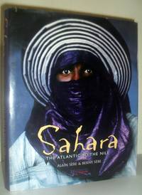
Sahara - The Atlantic to the Nile
de Alain Sebe and Berny Sebe
- Usado
- Muy bueno
- Tapa dura
- First
- Estado
- Usado - Muy bueno
- Edición
- First Thus
- Encuadernación
- Hardcover
- ISBN 10 / ISBN 13
- 9781844300266 / 1844300269
- Cantidad disponible
- 1
- Librería
-
Pateley Bridge, North Yorkshire, United Kingdom
- Precio
-
EUR 17.82EUR 20.79 enviando a USA
Mostrar detalles
Descripción:
London: Hschette Illustrated UK, 2001 Book. Very Good. Blue Cloth Boards. First Thus. Folio - over 12 - 15" tall. Collection of photographs that illustrate the beauty and diversity of the Sahara Desert. Includes studies of cave paintings from 6000 BC. 191pp with index, illustrated profusely throughout in colour. Silver lettering to spine. Minimal marking to edges and boards, otherwise very good plus copy with no inscriptions. Unclipped DJ has minor edgewear, with small internal tape repair to top edge, otherwise very good. HEAVY BOOK, additional postage may be required for Air Mail shipping..
Precio
EUR 17.82
EUR 20.79
enviando a USA

The Times Comprehensive Atlas of the World - Tenth Edition
de The Times
- Usado
- Muy bueno
- Tapa dura
- Estado
- Usado - Muy bueno
- Edición
- Tenth Edition
- Encuadernación
- Hardcover
- ISBN 10 / ISBN 13
- 9780723007920 / 0723007926
- Cantidad disponible
- 1
- Librería
-
Pateley Bridge, North Yorkshire, United Kingdom
- Precio
-
EUR 23.76EUR 20.79 enviando a USA
Mostrar detalles
Descripción:
London: Times Books, 2001 Book. Very Good. Black Cloth Boards. Tenth Edition. Elephant Folio - over 15 - 23" tall. Reprint of the 10th edition of the Times Atlas of the world. 220pp illustrated profusely throughout with colour maps. Silver lettering to top board and spine. Lovely copy with no marks of inscriptions in unclipped dustwrapper and very good slipcase. VERY HEAVY BOOK, additional postage will be requested..
Precio
EUR 23.76
EUR 20.79
enviando a USA

The Times Concise Atlas of the World
de Times Books
- Usado
- near fine
- Tapa dura
- Estado
- Usado - Near Fine
- Edición
- 5th Edition, Reprinted with Revisions
- Encuadernación
- Hardcover
- ISBN 10 / ISBN 13
- 9780723002789 / 0723002789
- Cantidad disponible
- 1
- Librería
-
Pateley Bridge, North Yorkshire, United Kingdom
- Precio
-
EUR 11.88EUR 20.79 enviando a USA
Mostrar detalles
Descripción:
London: Times Books Ltd, 1988 Book. Near Fine. Blue Cloth Boards. 5th Edition, Reprinted with Revisions. Folio - over 12" - 15" tall. Excellent reference work with maps, star charts, information on evolution, geology etc. 147 pages of maps with 96 page index. Gilt lettering to front board and spine. Complete with illustrated slipcase. Minimal bumping to corners, otherwise near fine copy with no inscriptions. Slipcase has some marking to edges and scuffing, otherwise very good. HEAVY BOOK, extra postage will be required..
Precio
EUR 11.88
EUR 20.79
enviando a USA

Twenty-first Century Leeds - Geographies of a Regional City
de Rachael Unsworrh & John Stillwell (Editors)
- Usado
- Bien
- Tapa dura
- First
- Estado
- Usado - Bien
- Edición
- 1st Edition
- Encuadernación
- Hardcover
- ISBN 10 / ISBN 13
- 9780853162421 / 0853162425
- Cantidad disponible
- 1
- Librería
-
Pateley Bridge, North Yorkshire, United Kingdom
- Precio
-
EUR 14.85EUR 20.79 enviando a USA
Mostrar detalles
Descripción:
Leeds: Leeds University Press, 2004 Book. Good. Black Cloth Boards. 1st Edition. Folio - over 12 - 15" tall. Results of research into key aspects of the contemporary city, its positive attributes and its inequalities, edited by two geographers at the University of Leeds. 393pp with index, illustrated throughout with colour photographs, diagrams and maps. Silver lettering to spine, black endpapers. Some bumping to spine and corners, small split to cloth on lower corner, and minor marking to rear endpaper, otherwise good copy with no inscriptions. Unclipped DJ edgeworn, with tears to lower edge and flyleaf and old sellotape repair, else good. VERY HEAVY BOOK, extra postage will be required..
Precio
EUR 14.85
EUR 20.79
enviando a USA

Wales: A Physical, Economic and Social Geography
de Margaret E Hughes & A J James
- Usado
- Muy bueno
- Tapa dura
- First
- Estado
- Usado - Muy bueno
- Edición
- First Edition
- Encuadernación
- Hardcover
- Cantidad disponible
- 1
- Librería
-
Pateley Bridge, North Yorkshire, United Kingdom
- Precio
-
EUR 7.13EUR 20.79 enviando a USA
Mostrar detalles
Descripción:
London: University of London Press Ltd, 1961 Book. Very Good. Green Cloth Boards. First Edition. 8vo - over 7¾" - 9¾" tall. Geography text and source book suitable for secondary school pupils. 240pp with index, illustrated with 103 black and white maps and diagrams. Gilt lettering to spine and gilt emblem to front board. Slight slant and bumping to spine and minor bend to boards, otherwise very good copy with no inscriptions..
Precio
EUR 7.13
EUR 20.79
enviando a USA

The World - New Regional Geographies Book IV
de Leonard Brooks
- Usado
- Muy bueno
- Tapa dura
- Estado
- Usado - Muy bueno
- Edición
- New & Revised Edition
- Encuadernación
- Hardcover
- Cantidad disponible
- 1
- Librería
-
Pateley Bridge, North Yorkshire, United Kingdom
- Precio
-
EUR 14.26EUR 20.79 enviando a USA
Mostrar detalles
Descripción:
University of London Press, 1944 Book. Very Good. Brown Cloth Boards. New & Revised Edition. 12mo - over 6¾" - 7¾" tall. 562pp with index, illustrated with 150 black and white maps and diagrams (entirely new maps in this edition) and double page map to front endpapers. Page 543 is creased due to being cut incorrectly. Slight bumping to spine and corners and former owner's name to front endpaper, otherwise very good copy, clean and tight..
Precio
EUR 14.26
EUR 20.79
enviando a USA

World Reference Atlas
de Dorling Kindersley
- Usado
- near fine
- Tapa dura
- Estado
- Usado - Near Fine
- Edición
- Revised Second Edition
- Encuadernación
- Hardcover
- ISBN 10 / ISBN 13
- 9780751303926 / 0751303925
- Cantidad disponible
- 1
- Librería
-
Pateley Bridge, North Yorkshire, United Kingdom
- Precio
-
EUR 8.91EUR 20.79 enviando a USA
Mostrar detalles
Descripción:
London: Dorling Kindersley Ltd, 1998 Book. Near Fine. Illustrated Boards. Revised Second Edition. 4to - over 9¾" - 12" tall. Authoritative atlas featuring over 600 maps, 5000 illustrations, charts and diagrams and A-Z factfile on the world's nations. 731pp. illustrated throughout in colour. Muinimal wear ro spine, otherwise near fine copy with no inscriptions. Unclipped DJ has minimal edge and surface wear, otherwise near fine. HEAVY BOOK, additional postage will be requested..
Precio
EUR 8.91
EUR 20.79
enviando a USA

¿No has encontrado lo que estabas buscando?
Prueba a añadir esta búsqueda a búsquedas guardadas Cada día se añaden millones de libros a Biblio. Cuando uno de ellos encaje con tu búsqueda, te enviaremos un correo para avisarte. Y lo mejor de todo, ¡es gratis!
Añadir a búsquedas guardadas

¿Eres un lector habitual o un coleccionista de libros?
Únete al Biblioclub y ahorra 10% en cada compra, ¡cada día! Hasta un máximo de 20$ en cada pedido

Responsabilidad social
¿Sabías que desde 2004 Biblio ha destinado sus beneficios a la construcción de 16 bibliotecas públicas en zonas rurales de Latinoamérica?
