Descripción:
Oxford: Bodleian Library, University of Oxford 2008. 4to. Scarce. 95 pp. Black hardback in a colour illustrated jacket. Minimal rubbing to jacket extremities. Board clean, internally clean. A study - with many colour illustrations - of early maps of Britain, particularly the Gough Map, a 650 year old medieval map that was arguably the first to depict a recognisable British coastline as well as road and river routes between towns. Includes a fold-out reproduction of the map at rear. 1851240225 . Near Fine. Hardcover. 2008.
Resultados de búsqueda: Maps and Atlases from Foster Books - Stephen Foster, ABA, ILAB, PBFA
Has buscado:
- Librería: Foster Books - Stephen Foster, ABA, ILAB, PBFA
- Tema: Maps and Atlases from Foster Books - Stephen Foster, ABA, ILAB, PBFA
Resultados: 21 - 40 de 59

Más fotos
The Gough Map: The earliest road map of Great Britain?
de Millea, Nick
- Usado
- near fine
- Tapa dura
- Estado
- Usado - Near Fine
- Encuadernación
- Hardcover
- ISBN 10 / ISBN 13
- 9781851240227 / 1851240225
- Cantidad disponible
- 1
- Librería
-
London, Greater London, United Kingdom
- Precio
-
EUR 150.34EUR 15.03 enviando a USA
Mostrar detalles
Precio
EUR 150.34
EUR 15.03
enviando a USA

Más fotos
The Harmsworth Universal Atlas and Gazetteer
de The Offices of the Amalgamated Press
- Usado
- Muy bueno
- Estado
- Usado - Very Good
- Cantidad disponible
- 1
- Librería
-
London, Greater London, United Kingdom
- Precio
-
EUR 210.47EUR 15.03 enviando a USA
Mostrar detalles
Descripción:
London: The Amalgamated Press circa 1907. Folio. pp, viii, iii, 210, 32, 284., Coloured maps (mostly double page), 32 pp on commerce maps and diagrams, followed by the gazetteer. Bound in a black half morocco binding. Binding rubbed at extremities, contents very good, bright and clean. This is a heavy item and may require additional postage if being shipped outside of Europe. . Very Good. Half Morocco. 1907.
Precio
EUR 210.47
EUR 15.03
enviando a USA

Más fotos
Histoire de la Guerre de Crimee : Atlas volume
de Rousset, Camille
- Usado
- Muy bueno
- Tapa dura
- Estado
- Usado - Very Good
- Encuadernación
- Hardcover
- Cantidad disponible
- 1
- Librería
-
London, Greater London, United Kingdom
- Precio
-
EUR 90.20EUR 15.03 enviando a USA
Mostrar detalles
Descripción:
Paris: Librairie Hachete et Cie. 1878. 8vo. Atlas volume only. Unpaginated. Original limp brown cloth with black lettering to front board. Faint darkening to cloth. Internally clean. Ten double-page colour maps. . Very Good. Limp Cloth. 1878.
Precio
EUR 90.20
EUR 15.03
enviando a USA

Más fotos
Italiae Antiquae et Novae : Pars Septentrionalis et Pars Australis. Two maps in slipcase
de Cramer, I. A.
- Usado
- Muy bueno
- Estado
- Usado - Very Good
- Cantidad disponible
- 1
- Librería
-
London, Greater London, United Kingdom
- Precio
-
EUR 300.68EUR 15.03 enviando a USA
Mostrar detalles
Descripción:
Oxford: Published as the Act directs, for the Author, by Joseph Parker 1825. Map. Two folding maps in case. Each measures 76cm x 65cm. Dissected and mounted on linen. In contemporary cardboard slipcase with paper title label to edge. Both maps hand-coloured. Slipcase edgeworn. Maps in Very Good condition. . Very Good. 1825.
Precio
EUR 300.68
EUR 15.03
enviando a USA

Más fotos
Japan: A Cartographic Vision. European Printed Maps from the Early 16th to the 19th Century
de Walter, Lutz [ed.]
- Usado
- near fine
- Tapa dura
- First
- Estado
- Usado - Near Fine
- Edición
- First Edition in English
- Encuadernación
- Hardcover
- ISBN 10 / ISBN 13
- 9783791313214 / 3791313215
- Cantidad disponible
- 1
- Librería
-
London, Greater London, United Kingdom
- Precio
-
EUR 42.09EUR 15.03 enviando a USA
Mostrar detalles
Descripción:
New York: Prestel 1994. 4to. 232 pp. Hardcover with illustrated jacket. Slight curled top edge of jacket. Clean and bright internally - near fine. With 265 illustrations, of which 182 are in colour, these mainly being early maps of Japan. Includes the 'List of Printed Maps of Japan before 1900', useful for a collector and map historian. 3791313215 . Near Fine. Hardcover. First Edition in English. 1994.
Precio
EUR 42.09
EUR 15.03
enviando a USA

Más fotos
Laurie and Whittle's New Survey of the Environs of London : Comprehending and Extent of Twenty Miles North and South, and Twenty-Six East and West, From St.Paul's Cathedral
de Coltman, Nathaniel
- Usado
- Bien
- Estado
- Usado - Good
- Cantidad disponible
- 1
- Librería
-
London, Greater London, United Kingdom
- Precio
-
EUR 601.35EUR 15.03 enviando a USA
Mostrar detalles
Descripción:
London: Laurie & Whittle 1809 [1807]. Map. An Improved Edition. Original linen-backed folding map in cardboard case. Measures approx. 68cm x 55cm. Case edgeworn. Staining to linen backing. Map clean with a couple of minor spots. Original colouring. 'The Extent of the Two Penny Post Delivery is Coloured Red'. In Good to Very Good condition. . Good. 1809.
Precio
EUR 601.35
EUR 15.03
enviando a USA

Más fotos
Look Up Your Atlas
de Bridges, T.C. and Alnwick, H.
- Usado
- Muy bueno
- Tapa dura
- Estado
- Usado - Very Good
- Encuadernación
- Hardcover
- Cantidad disponible
- 1
- Librería
-
London, Greater London, United Kingdom
- Precio
-
EUR 30.07EUR 15.03 enviando a USA
Mostrar detalles
Descripción:
London: George G. Harrap 1943. 4to. 62 pp, illustrated in colour and black and white, wear and marks to boards, a war economy standard book. . Very Good. Pictorial Boards. 1943.
Precio
EUR 30.07
EUR 15.03
enviando a USA

Más fotos
Map of England and Wales
de The Chart Publishing Company
- Usado
- Muy bueno
- Tapa dura
- Estado
- Usado - Very Good
- Encuadernación
- Hardcover
- Cantidad disponible
- 1
- Librería
-
London, Greater London, United Kingdom
- Precio
-
EUR 48.11EUR 15.03 enviando a USA
Mostrar detalles
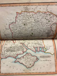
Descripción:
Oxford: The Chart Publishing Company N.d. [c. 1930's]. FolioMap. Two folding maps in a slipcase. One map measures 29" by 40," the other 24" x 40." Maps are linen-backed and folded with maroon cloth boards at covers. The two maps fit into a maroon cloth slipcase. Slight wear to extremities of slipcase. Maps reinforced in case edges with cellotape. Both maps in VG condition. . Very Good. Cloth. 1930.
Precio
EUR 48.11
EUR 15.03
enviando a USA

Más fotos
Map of the Siberian Railway : Stanford's Map of the Siberian Railway, The Great Land Route to China and Korea
de Edward Stanford
- Usado
- Muy bueno
- Tapa dura
- Estado
- Usado - Very Good
- Encuadernación
- Hardcover
- Cantidad disponible
- 1
- Librería
-
London, Greater London, United Kingdom
- Precio
-
EUR 902.03EUR 15.03 enviando a USA
Mostrar detalles
Descripción:
London: Edward Stanford 1907. 8vo.Map. Folding map. Dated March 20th, 1907. Original publisher's cloth case with paper title label onlay to front board. Minor rubbing to spine cloth. Endpaper adverts. Measures 115cm x 75cm open. Colour map sections on linen backing. Very clean. No spotting. Scarce lithographic colour map. . Very Good. Cloth. 1907.
Precio
EUR 902.03
EUR 15.03
enviando a USA

Más fotos
Map of the County of Surrey from an Actual Survey Made in the Years 1822 and 1823 By C. & I. Greenwood (Facsimile)
de GREENWOOD, C. & I.
- Usado
- Aceptable
- Estado
- Usado - Fine
- Edición
- Facsimile
- Cantidad disponible
- 1
- Librería
-
London, Greater London, United Kingdom
- Precio
-
EUR 132.30EUR 15.03 enviando a USA
Mostrar detalles
Descripción:
London: George Pringle 1823. FolioFolding Map. FACIMILE folding map disected in 8 sections and mounted on linen in a marbled paper covered slipcase. Map is 77 x 63.5 cms., and when folded in a case of 26 x 33 cms. A lovely facsimile of this scarce colour map, which has the 'View of Kew Palace ' engraved image in the top left hand corner. . Fine. Slipcase. Facsimile. 1823.
Precio
EUR 132.30
EUR 15.03
enviando a USA

Mapping London : Making Sense of the City
de Foxell, Simon
- Usado
- Muy bueno
- Tapa dura
- First
- Estado
- Usado - Very Good
- Edición
- First Edition
- Encuadernación
- Hardcover
- ISBN 10 / ISBN 13
- 9781906155070 / 1906155070
- Cantidad disponible
- 1
- Librería
-
London, Greater London, United Kingdom
- Precio
-
EUR 57.73EUR 15.03 enviando a USA
Mostrar detalles
Descripción:
London: Black Dog Publishing 2007. Oblong 4to. 279 pp., illustrated throughout 1906155070 . Very Good. Illustrated Boards. First Edition. 2007.
Precio
EUR 57.73
EUR 15.03
enviando a USA
Más fotos
Maps of the several counties and shires in England, with the Pricipality of Wales
de Darton and Baker (publishers)
- Usado
- Bien
- Tapa dura
- Estado
- Usado - Good
- Encuadernación
- Hardcover
- Cantidad disponible
- 1
- Librería
-
London, Greater London, United Kingdom
- Precio
-
EUR 2,405.40EUR 15.03 enviando a USA
Mostrar detalles
Descripción:
London: Darton and Baker 1804. 8vo.Map. Unpaginated with 46 double page maps. Recased with cloth spine and original card boards. Wear to the edges of the boards, particularly the corners, with fragment of original title label tipped to the front reading Atlas. Some pencil notes to the endpapers. Stain affecting the bottom edge of the leaves runs through the volume, particularly affecting maps 25-29 and 34-41. Very Scarce title containing 46 hand coloured maps engraved by B. Baker, OCLC records just a single copy at Cambridge. This copy lacks the Middlesex map, which looks to be inserted later in this copy so perhaps a binders error. Only one auction recorded 45 years ago and that was lacking several maps. . Good. Cloth Spine. 1804.
Precio
EUR 2,405.40
EUR 15.03
enviando a USA

Más fotos
Miniature Antique Maps: an illustrated guide for the collector
de King, Geoffrey L.
- Usado
- near fine
- Tapa dura
- Estado
- Usado - Near Fine
- Edición
- Second Edition, Revised
- Encuadernación
- Hardcover
- Cantidad disponible
- 1
- Librería
-
London, Greater London, United Kingdom
- Precio
-
EUR 150.34EUR 15.03 enviando a USA
Mostrar detalles
Descripción:
Oxford: Tooley Adams & Co. 2003. 8vo. Scarce. 223 pp. Purple hardcover with gilt lettering to spine inside illustrated jacket. In near fine condition. Illustrated throughout in black & white. A highly detailed complete chronology, bibliography and printing history of miniature maps, from in 1472 to 1900. A scarce book. . Near Fine. Hardcover. Second Edition, Revised. 2003.
Precio
EUR 150.34
EUR 15.03
enviando a USA

Más fotos
Neues Panorama des Rheins von Mainz bis Coln / Nouveau Panorama du Rhin depuis Mayence jusqu'a Cologne
de Delkeskamp, Frederick Wilhelm
- Usado
- Muy bueno
- Estado
- Usado - Very Good
- Cantidad disponible
- 1
- Librería
-
London, Greater London, United Kingdom
- Precio
-
EUR 300.68EUR 15.03 enviando a USA
Mostrar detalles
Descripción:
Frankfurt: Frederick Wilhelm Delkeskamp 1837. Small Oblong 4to.Map. 28, [4], fold-out panorama [17] pp. 32-page 'Notes to the new Panorama of the Rhine from Mentz to Cologne by Frederick William Delkeskamp' - 'Original edition entirely revised and augmented with 60 marginal views' 1838 bound to front pastedown, beneath which is the crest bookplate of Ivor A. B. Ferguson. Fold-out engraved panoroma map, featuring marginal views of sights to see along the course of the Rhine from Cologne to Mainz. Red morocco boards with later gilt lettering to spine over horizontal card titles to front and rear boards, in French and German respectively. Areas of loss at spine ends and some wear and bumping across binding. Patches of water staining, though map and notes otherwise quite clean. Notes are in English and include advice to travellers. 27 x 19 cms. The map in 25.5 x 276 cm long and is linen backed. . Very Good. Publisher's Morocco. 1837.
Precio
EUR 300.68
EUR 15.03
enviando a USA
![Neueste General Post & Strassen Karte des Konigreichs Boehmen [Bohemia Prague]](https://d3525k1ryd2155.cloudfront.net/h/099/128/1106128099.0.m.jpg)
Neueste General Post & Strassen Karte des Konigreichs Boehmen [Bohemia Prague]
de Map
- Usado
- Muy bueno
- Estado
- Usado - Very Good
- Cantidad disponible
- 1
- Librería
-
London, Greater London, United Kingdom
- Precio
-
EUR 180.41EUR 15.03 enviando a USA
Mostrar detalles
Descripción:
Prag: Marco Berra 1850. Map. Original folding map. Measures 63cm x 52cm. Finely engraved hand-coloured folding map backed on linen. A few minor stains. In VG condition. . Very Good. 1850.
Precio
EUR 180.41
EUR 15.03
enviando a USA

Más fotos
A New Map of the River Thames from Oxford to London, from entirely new surveys, taken during the Summer of 1871: with a Guide, giving every information required by the Tourist, the Oarsman, and the Angler
de Taunt, Henry W.
- Usado
- Muy bueno
- Tapa dura
- Estado
- Usado - Very Good
- Edición
- Second Edition
- Encuadernación
- Hardcover
- Cantidad disponible
- 1
- Librería
-
London, Greater London, United Kingdom
- Precio
-
EUR 300.68EUR 15.03 enviando a USA
Mostrar detalles
Descripción:
Oxford: Henry W. Taunt 1873. Oblong 12mo.Map. Second Edition. 79 pp. Green cloth with blind-stamped decorations and gilt lettering to boards; 25 x 16cm. Worn at edges and marked boards; internally yellowed and occasional smudges not affecting text. A detailed map of the Thames, along with relevant information for the river-goer, including fishing spots, shops and inns to stay at; with each map are 80 small pasted-down photographs. Ink owner's name and address to prelim. This copy has lots of small and very neat ink annotations with additional information (e.g. "take the left bank here - the right is very shallow"), that if anything complement the maps. Extensive advertisements throughout. . Very Good. Cloth. Second Edition. 1873.
Precio
EUR 300.68
EUR 15.03
enviando a USA

Más fotos
A New Map of the River Thames from Oxford to London, from entirely new surveys, taken during the Summer of 1871: with a Guide, giving every information required by the Tourist, the Oarsman, and the Angler
de Taunt, Henry W.
- Usado
- Muy bueno
- Tapa dura
- First
- Estado
- Usado - Very Good
- Edición
- First Edition
- Encuadernación
- Hardcover
- Cantidad disponible
- 1
- Librería
-
London, Greater London, United Kingdom
- Precio
-
EUR 541.22EUR 15.03 enviando a USA
Mostrar detalles
Descripción:
Oxford: Henry W. Taunt 1872. Oblong 8vo.Map. First Edition. 79 pp. Green cloth with blind-stamped decorations and gilt lettering to boards; 25 x 16 cm. Worn at corners, spine ends and a few marks to boards; internal scattered spotting and slight water-crinkling, but no ownership names. A detailed map of the Thames, along with relevant information for the river-goer, including fishing spots, shops and inns to stay at; with each map are 80 small pasted-down photographs. Extensive advertisements throughout. . Very Good. Cloth. First Edition. 1873.
Precio
EUR 541.22
EUR 15.03
enviando a USA

Más fotos
New and Improved Map of England and Wales : Including the Principal Part of Scotland, Wheron are Carefully Delineated all the Mail and Turnpike Roads Direct and Cross ...
de Map
- Usado
- Muy bueno
- Estado
- Usado - Very Good
- Cantidad disponible
- 1
- Librería
-
London, Greater London, United Kingdom
- Precio
-
EUR 150.34EUR 15.03 enviando a USA
Mostrar detalles
Descripción:
London: William Darton and Son N.d. [c. 1820's]. Map. Original linen-backed folding map measuring 66cm x 78cm. In original slipcase with paper title label to front panel. Slipcase worn. Early ink notations to linen on one panel. Hand-colouring to map. . Very Good. 1820.
Precio
EUR 150.34
EUR 15.03
enviando a USA

Más fotos
Nouvelle Geographie Moderne des Cinq Parties du Monde. Asie
de De Varigny, C.
- Usado
- Muy bueno
- Tapa dura
- Estado
- Usado - Very Good
- Encuadernación
- Hardcover
- Cantidad disponible
- 1
- Librería
-
London, Greater London, United Kingdom
- Precio
-
EUR 150.34EUR 15.03 enviando a USA
Mostrar detalles
Descripción:
Paris: La Librairie Illustree circa 1890s. 4to. FRENCH TEXT. 324 pp. Fully bound in a highly decorative red cloth. Gilded and blue painted lettering and decoration to the spine and boards. All edges gilt. Binding ever so slightly loose, some rubbing to corners and top of spine, and some small marks on the rear board, but otherwise in very good condition. Illustrated with engravings throughout. Colour maps and some tinted plates. The Asia volume from the 5 volume series. . Very Good. Decorative Cloth. 1890.
Precio
EUR 150.34
EUR 15.03
enviando a USA

Más fotos
Novus Atlas Sinensis 1655 : Faksimiles nach der Prachtausgabe der Herzog August Bibliothek Wolfenbuttel
de Blaeu, Joan and Hans Kauffmann & York Alexander Haase
- Usado
- near fine
- Tapa dura
- Estado
- Usado - Near Fine
- Encuadernación
- Hardcover
- Cantidad disponible
- 1
- Librería
-
London, Greater London, United Kingdom
- Precio
-
EUR 81.78EUR 15.03 enviando a USA
Mostrar detalles
Descripción:
Stuttgart: Muller und Schindler 1973. Facsimile. Facsimile. Large folio measuring 50cm x 35cm. Quarter red cloth over parchment-paper covered boards. In slipcase. Paperback text volume in German language. Double-page colour folding sheets, loose, as issued. A few marks to slipcase. Internally in Fine unused condition. . Near Fine. Parchment Paper Covered Boards. 1973.
Precio
EUR 81.78
EUR 15.03
enviando a USA

¿No has encontrado lo que estabas buscando?
Prueba a añadir esta búsqueda a búsquedas guardadas Cada día se añaden millones de libros a Biblio. Cuando uno de ellos encaje con tu búsqueda, te enviaremos un correo para avisarte. Y lo mejor de todo, ¡es gratis!
Añadir a búsquedas guardadas

¿Eres un lector habitual o un coleccionista de libros?
Únete al Biblioclub y ahorra 10% en cada compra, ¡cada día! Hasta un máximo de 20$ en cada pedido

Responsabilidad social
¿Sabías que desde 2004 Biblio ha destinado sus beneficios a la construcción de 16 bibliotecas públicas en zonas rurales de Latinoamérica?
