Descripción:
Philadelphia: E.H. Butler and Company, 1888 Original color map from "Geography of Pennsylvania." Measures 12 by 10 inches. Printed on back. Staple holes in right margin, some small edgetears, minor age toning. Good.
Resultados de búsqueda: Cartography and Maps from Ken Jackson
Has buscado:
- Librería: Ken Jackson
- Tema: Cartography and Maps from Ken Jackson
Resultados: 21 - 40 de 99

Antique Map. Central States - Eastern Section.
de Jacques W. Redway.
- Usado
- Bien
- Estado
- Usado - Bien
- Cantidad disponible
- 1
- Librería
-
Calgary, Alberta, Canada
- Precio
-
EUR 6.27EUR 9.29 enviando a USA
Mostrar detalles
Precio
EUR 6.27
EUR 9.29
enviando a USA

Antique Map - South America General Map.
- Usado
- Muy bueno
- Estado
- Usado - Muy bueno
- Cantidad disponible
- 1
- Librería
-
Calgary, Alberta, Canada
- Precio
-
EUR 17.47EUR 9.29 enviando a USA
Mostrar detalles
Descripción:
London: The Harmsworth Atlas and Gazetteer., 1900 Map measures 15.5 by 20 inches or 39 by 25 cm. Some age toning and light creasing. Vertical fold as issued. Very Good.
Precio
EUR 17.47
EUR 9.29
enviando a USA

Antique Map - Asiatic Russia and the Siberian Railway.
- Usado
- Muy bueno
- Estado
- Usado - Muy bueno
- Cantidad disponible
- 1
- Librería
-
Calgary, Alberta, Canada
- Precio
-
EUR 17.47EUR 9.29 enviando a USA
Mostrar detalles
Descripción:
London: The Harmsworth Atlas and Gazetteer., 1900 Map measures 15.5 by 20 inches or 39 by 25 cm. Some age toning and light creasing. Vertical fold as issued. Very Good.
Precio
EUR 17.47
EUR 9.29
enviando a USA

Antique Map. Middle Atlantic States - Northern Section.
de Jacques W. Redway.
- Usado
- Bien
- Estado
- Usado - Bien
- Cantidad disponible
- 1
- Librería
-
Calgary, Alberta, Canada
- Precio
-
EUR 6.27EUR 9.29 enviando a USA
Mostrar detalles
Descripción:
Philadelphia: E.H. Butler and Company, 1888 Original color map from "Geography of Pennsylvania." Measures 12 by 10 inches. Printed on back. Staple holes in right margin, some small edgetears, minor age toning. Good.
Precio
EUR 6.27
EUR 9.29
enviando a USA

Atlas Der Grossen Entdecker. 30 Abenteuerliche Reisen Von Der Antike Bis Heute
de Burton, Rosemary, Richard Cavendish And Bernard Stonehouse
- Usado
- Aceptable
- Tapa dura
- First
- Estado
- Usado - Aceptable
- Edición
- 1st Edition
- Encuadernación
- Hardcover
- Cantidad disponible
- 1
- Librería
-
Calgary, Alberta, Canada
- Precio
-
EUR 20.98EUR 9.29 enviando a USA
Mostrar detalles
Descripción:
Germany, 1993 First German edition in hardcover with dust jacket. 224 pp. Illustrations, maps. Jacket has very minor edgecreasing otherwise fine/fine.
Precio
EUR 20.98
EUR 9.29
enviando a USA

Foto de archivo: la portada puede ser diferente
Atlas of Maritime History
de Lloyd, Christopher
- Usado
- Tapa dura
- First
- Estado
- Usado - Very Good in Very Good jacket
- Edición
- First Edition
- Encuadernación
- Hardcover
- ISBN 10 / ISBN 13
- 9780668037792 / 0668037792
- Cantidad disponible
- 1
- Librería
-
Calgary, Alberta, Canada
- Precio
-
EUR 27.98EUR 9.29 enviando a USA
Mostrar detalles
Descripción:
New York, NY: Arco Publishing Company, Inc., 1975 First edition in hardcover with dust jacket. 144 pp. Colour maps, illustrated endpapers, figures, photographs, charts index. Minor spine lean, light wear to boards. Jacket has some short tears, small chips, rubbing to edges. Very Good/Very Good.
Precio
EUR 27.98
EUR 9.29
enviando a USA

Más fotos
Atlas of Landforms
de Scovel, Major James L., Lt. Colonel Emmer J. O'Brien, Major J.C. McCormack, And Major R.B. Chapman
- Usado
- Bien
- Tapa blanda
- Estado
- Usado - Bien
- Encuadernación
- Paperback
- Cantidad disponible
- 1
- Librería
-
Calgary, Alberta, Canada
- Precio
-
EUR 27.98EUR 9.29 enviando a USA
Mostrar detalles
Descripción:
New York: John Wiley and Sons, Inc., 1965 Paper covers with coil binding. Tidy ex-university library copy. 164 pp. Maps, bibliography, index. Good.
Precio
EUR 27.98
EUR 9.29
enviando a USA

Más fotos
Barnett's Bury St. Edmunds Steet Plan With Index
- Usado
- near fine
- Tapa blanda
- Estado
- Usado - Near Fine
- Encuadernación
- Paperback
- Cantidad disponible
- 1
- Librería
-
Calgary, Alberta, Canada
- Precio
-
EUR 9.07EUR 9.29 enviando a USA
Mostrar detalles
Descripción:
Barking, Essex.: A G. Barnett Publication. Fold-out map in paper covers. Hint of shelfwear to covers otherwise Fine.
Precio
EUR 9.07
EUR 9.29
enviando a USA

Más fotos
Blackfoot, Alberta, Canada. West of Fourth Meridian. Sectional Map No. 115
- Usado
- Bien
- Estado
- Usado - Bien
- Cantidad disponible
- 1
- Librería
-
Calgary, Alberta, Canada
- Precio
-
EUR 20.98EUR 9.29 enviando a USA
Mostrar detalles
Descripción:
Ottawa, Ontario: The Surveyor General's Office., 1948 Three color fold out map measuring 24" by 34" including margins. Scale is 1/190, 000 or three miles to one inch. Includes: Telegraph and telephone lines, Boundary of Indian Reservation, Churches, Schools, Elevators, Radio Broadcast Stations (with call letters), etc. Many of the folds have splits. Good only.
Precio
EUR 20.98
EUR 9.29
enviando a USA
Más fotos
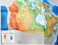
Canada-Relief. Large Fold-Out Colour Map
- Usado
- Muy bueno
- Tapa blanda
- Estado
- Usado - Muy bueno
- Encuadernación
- Paperback
- Cantidad disponible
- 1
- Librería
-
Calgary, Alberta, Canada
- Precio
-
EUR 20.98EUR 9.29 enviando a USA
Mostrar detalles
Descripción:
Ottawa: Energy, Mines and Resources Canada/Macmillan of Canada., 1976 Geographical Map Series No. 1. Measures 42" by 32". Scale 1" to 118 miles. There is a 4" tear to the middle fold at right edge otherwise fine. Very Good.
Precio
EUR 20.98
EUR 9.29
enviando a USA
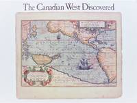
The Canadian West Discovered
de Javorski, Mary
- Usado
- near fine
- Tapa blanda
- First
- Estado
- Usado - Near Fine
- Edición
- 1st Edition.
- Encuadernación
- Paperback
- ISBN 10 / ISBN 13
- 9780919224339 / 0919224334
- Cantidad disponible
- 1
- Librería
-
Calgary, Alberta, Canada
- Precio
-
EUR 13.27EUR 9.29 enviando a USA
Mostrar detalles
Descripción:
Calgary, Alberta: Glenbow Museum., 1989 First printing in oblong trade paperback. Exhibition catalogue. 75 pp. Over 50 reproductions of old maps in both colour and black and white. Minor rubbing to covers. Near Fine.
Precio
EUR 13.27
EUR 9.29
enviando a USA
Carte Routiere Geologique Du Manitoba 1987
de Compilation De D.M. Lauhn-Jensen. Cartographie De T. Franceschet Et M. Timcoe
- Usado
- near fine
- Tapa blanda
- Estado
- Usado - Near Fine
- Encuadernación
- Paperback
- Cantidad disponible
- 1
- Librería
-
Calgary, Alberta, Canada
- Precio
-
EUR 10.47EUR 9.29 enviando a USA
Mostrar detalles
Descripción:
Commission Geologique Du Canada., 1987 Large fold-out colour map measuring 35" x 53". Rear of map has panels with colour photographs and smaller maps. Minor wear. Near Fine. Reduced postage on this item.
Precio
EUR 10.47
EUR 9.29
enviando a USA
Climatological Atlas of Africa. Commission for Technical Co-Operation in Africa South of the Sahara. Joint Project No. 1.
de Jackson, Stanley P. Signed Copy
- Usado
- Muy bueno
- Tapa dura
- Firmado
- Estado
- Usado - Muy bueno
- Encuadernación
- Hardcover
- Cantidad disponible
- 1
- Librería
-
Calgary, Alberta, Canada
- Precio
-
EUR 210.08EUR 9.29 enviando a USA
Mostrar detalles
Descripción:
Lagos, Nigeria: CCTA/CSA,, 1961 Large elephant folio in green cloth boards with peg binding. Measures 24 by 18 inches (60 by 45 cm). Signed by Mr. Jackson on the title page. There are 55 colour maps showing rainfall, temperatures, etc. Very Good. Extra postage will be required. Please email for photographs or more information.
Precio
EUR 210.08
EUR 9.29
enviando a USA

Conflict and Cooperation in Managing Maritime Space in Semi-enclosed Seas.
de Vivian Louis Forbes.
- Usado
- near fine
- Tapa blanda
- First
- Estado
- Usado - Near Fine
- Edición
- 1st Edition.
- Encuadernación
- Paperback
- ISBN 10 / ISBN 13
- 9789971692438 / 9971692430
- Cantidad disponible
- 1
- Librería
-
Calgary, Alberta, Canada
- Precio
-
EUR 20.98EUR 9.29 enviando a USA
Mostrar detalles
Descripción:
Singapore: Singapore University Press., 2001 First printing in tall paper covers. 384 pp. Maps, bibliography. Very minor shelfwear. Near Fine.
Precio
EUR 20.98
EUR 9.29
enviando a USA

Más fotos
Cyprus on the Table 1878-1920
de Gole, Susan
- Usado
- Muy bueno
- Tapa blanda
- First
- Estado
- Usado - Muy bueno
- Edición
- 1st Edition.
- Encuadernación
- Paperback
- ISBN 10 / ISBN 13
- 9789963420605 / 9963420605
- Cantidad disponible
- 1
- Librería
-
Calgary, Alberta, Canada
- Precio
-
EUR 48.99EUR 9.29 enviando a USA
Mostrar detalles
Descripción:
Nicosia, Cypress.: Bank of Cyprus Cultural Foundation., 1996 First printing in tall card covers 61 pp. Footnotes, colour plates, maps. Small bump to top edge of foredge has caused some light crimping, faint spine lean. otherwise fine. Very Good.
Precio
EUR 48.99
EUR 9.29
enviando a USA
Más fotos
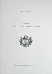
Cyprus. the Reliability of Early Maps
de Campbell, Tony
- Usado
- Aceptable
- Tapa blanda
- First
- Estado
- Usado - Aceptable
- Edición
- 1st Edition
- Encuadernación
- Paperback
- ISBN 10 / ISBN 13
- 9789963420469 / 996342046X
- Cantidad disponible
- 1
- Librería
-
Calgary, Alberta, Canada
- Precio
-
EUR 34.98EUR 9.29 enviando a USA
Mostrar detalles
Descripción:
Nicosia, Cypress.: Bank of Cyprus Cultural Foundation., 1994 First printing in stapled card covers. 39 pp. Colour plates, notes. Fine.
Precio
EUR 34.98
EUR 9.29
enviando a USA

Más fotos
Early Maps of the British Ilses A.D.1000 - A.D. 1579
de G.R. Crone, MA. Introduction and Notes.
- Usado
- Bien
- Estado
- Usado - Bien
- Cantidad disponible
- 1
- Librería
-
Calgary, Alberta, Canada
- Precio
-
EUR 56.00EUR 9.29 enviando a USA
Mostrar detalles
Descripción:
London: Royal Geographical Society, 1961 Includes 20 facsimile black and white maps on 14 sheets, and paperback book in a custom folder with foredge ties. Sheets measure 21 by 16 inches or 52 by 41 cm. The book has 32 pages and describes each individual map. It includes and bibilography and index. All of the maps have a small insignificant crease in one corer. The front panel of the folder has some discoloration/fading around edges and a 1 inch water stain at the bottom. The book is fine.
Precio
EUR 56.00
EUR 9.29
enviando a USA

Más fotos
Firenze. Plan of the City and Firenze Souvenir Booklet
- Usado
- Muy bueno
- Tapa blanda
- Estado
- Usado - Muy bueno
- Encuadernación
- Paperback
- Cantidad disponible
- 1
- Librería
-
Calgary, Alberta, Canada
- Precio
-
EUR 9.07EUR 9.29 enviando a USA
Mostrar detalles
Descripción:
E.N.I.T, Italian State Tourist Department, 1973 Fold-out plan in colour. Measures 20 by 28 inches. Minor creasing. Included is a small fold out souvenir book with colour illustrations. Very Good.
Precio
EUR 9.07
EUR 9.29
enviando a USA

Más fotos
Fold Out Illustration of Northbrook Island, Seen from de Bruyne sound from "On the Polar Star in the Arctic Sea."
- Usado
- Bien
- Estado
- Usado - Bien
- Cantidad disponible
- 1
- Librería
-
Calgary, Alberta, Canada
- Precio
-
EUR 6.97EUR 9.29 enviando a USA
Mostrar detalles
Descripción:
London: Hutchinson & Co., 1903 Salvaged from a deceased copy of Amedeo's book. Measures 24 by 9 inches (61 by 23 cm). Some creasing and soiling, an old Chicago Public Library stamp. Good.
Precio
EUR 6.97
EUR 9.29
enviando a USA

Más fotos
Fold Out Illustration of The Bay of Teplitz from "On the Polar Star in the Arctic Sea."
- Usado
- Bien
- Estado
- Usado - Bien
- Cantidad disponible
- 1
- Librería
-
Calgary, Alberta, Canada
- Precio
-
EUR 6.97EUR 9.29 enviando a USA
Mostrar detalles
Descripción:
London: Hutchinson & Co., 1903 Salvaged from a deceased copy of Amedeo's book. Measures 36 by 9 inches (81 by 23 cm). Some creasing and soiling, an old Chicago Public Library stamp. Good.
Precio
EUR 6.97
EUR 9.29
enviando a USA

¿No has encontrado lo que estabas buscando?
Prueba a añadir esta búsqueda a búsquedas guardadas Cada día se añaden millones de libros a Biblio. Cuando uno de ellos encaje con tu búsqueda, te enviaremos un correo para avisarte. Y lo mejor de todo, ¡es gratis!
Añadir a búsquedas guardadas

¿Eres un lector habitual o un coleccionista de libros?
Únete al Biblioclub y ahorra 10% en cada compra, ¡cada día! Hasta un máximo de 20$ en cada pedido

Responsabilidad social
¿Sabías que desde 2004 Biblio ha destinado sus beneficios a la construcción de 16 bibliotecas públicas en zonas rurales de Latinoamérica?
