Bartholomew's Reduced Ordnance Survey. Sheet 1. Northumberland. Scale 2 Miles To An Inch. Coloured For Tourists & Cyclists. -
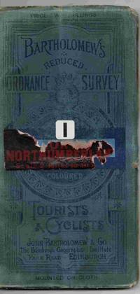
Bartholomew's Reduced Ordnance Survey. Sheet 1. Northumberland. Scale 2 Miles to an Inch. Coloured for Tourists & Cyclists.
- Usado
- good
- First
Edinburgh: John Bartholomew & Co. 1st Edition . Map. Good/No Jacket (as published). 4" x 7.5. A map mounted on cloth depicting an area of northern England, not dated but thought to be from around 1900. Some wear to the edges of the blue folded cover the map is clean an tidy and usable. Some damage to the title label on the front cover. All orders processed and shipped promptly from the UK.
-
Librería
Independent bookstores
 (GB)
(GB)
- Formato/Encuadernación Map
- Estado del libro Usado - Good
- Estado de la sobrecubierta No Jacket (as published)
- Cantidad disponible 1
- Edición 1st Edition
- Editorial John Bartholomew & Co
- Lugar de publicación Edinburgh
- Tamaño 4" x 7.5
- Palabras clave MAP ENGLAND TOPOGRAPHY TRAVEL
- Size 4" x 7.5
