Descripción:
Paris, Librairie Larousse, (1915-19).. 1st Edition . Hardcover. .. 41 issues bound in one volume. Thick royal quarto. Unpaginated. With hundreds of letterpress maps, many of which are in colour, printed on recto only on 246 leaves of plates. Some photo-plates. Explanatory text to each map. Introductions. HARDCOVER, bound in contemporary quarter cloth, bit rubbed and scuffed in places, paper-covered boards, cloth inner hinges, spine gilt. All 41 original yellow card wrappers, printed in red, are preserved and bound-in, few with old institutional stamp; expert paper repair to one leaf with minor loss. In about fine condition. Excellent copy, very well preserved. ~ FIRST EDITION. Very rare. F-3
CARTE DER TURKEY, FOLDING MAP OF TURKEY. de WEISS, Franz Von.: - 1829
de WEISS, Franz Von.:
Te mostramos ejemplares similares más abajo.
Te mostramos ejemplares similares a la derecha.

CARTE DER TURKEY, FOLDING MAP OF TURKEY.
de WEISS, Franz Von.:
- Usado
- Tapa dura
Vienna, 1829.. ELEVEN FOLDING MAPS ONLY OF TWENTY ONE. Approximately 660 x 440 mm, 26 x 17½ inches, all maps linen backed, small printed label with area covered and number, printed label with the importer's name and address (William & Norgate Importers of Foreign Books, 14 Henrietta Street, Covent Garden, London). Maps housed in a contemporary cloth slipcase with inner cloth chemise, gilt lettering to spine, paper label to upper cover with the maps listed in old ink, the chemise has a manuscript strip of distances, ( Englische Meilen..). Slight wear to slipcase otherwise case and maps in very good condition. Only half the complete map is present (11-21): Salonik; Constantinopel; Prevesa; Lepanto; Smyrna; Plane des Hellesponts und Bosphorus; Tripolitzsa; Rodos; Carte von Kleinasien; I. Candia (West); I. Candia (Ost). MORE IMAGES ATTACHED TO THIS LISTING, ALL ZOOMABLE, FURTHER IMAGES ON REQUEST. POSTAGE AT COST. A heavy item which may require extra postage.
-
Librería
Roger Middleton
 (GB)
(GB)
- Estado del libro Usado
- Cantidad disponible 1
- Encuadernación Tapa dura
- Lugar de publicación Vienna, 1829.
- Fecha de publicación 1829
- Palabras clave maps cartography turkey folding maps
Tenemos 1 ejemplares disponibles a partir de EUR 1,052.34.

Más fotos
Cartes Larousse: Atlas de la Guerre. With Directions in English, I-XLI [41 ISSUES WITH 206 PLATES. COMPLETE].
de (Cartes Larousse).
- Usado
- Tapa dura
- First
- Estado
- Usado - .
- Edición
- 1st Edition
- Encuadernación
- Hardcover
- Cantidad disponible
- 1
- Librería
-
, Netherlands
- Precio
-
EUR 600.00
Mostrar detalles
Precio
EUR 600.00
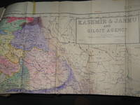
Survey of Pakistan Kashmir
- Usado
- very good
- Tapa blanda
- First
- Estado
- Usado - Very Good
- Edición
- 1st Edition
- Encuadernación
- Paperback
- Cantidad disponible
- 1
- Librería
-
Bath, Maine, United States
- Precio
-
EUR 926.30
Mostrar detalles
Descripción:
Jammer & Gilgit Agency, 1940 Government of Pakistan Full color Map 1 Inch = 16 miles. Extremely RARE OCLC locates 0 copies. 0 copies LOC. Oblong, no tears, or markings.. Oblong. 1st Edition. Soft cover. Very Good.
Precio
EUR 926.30

Más fotos
GEOGRAPHIA CLASSICA Geography of the Ancients 1723: Described as it is Contained in the Greek and Latin Classics in Twenty-nine Maps of the Old World
de Herman Moll (See note)
- Usado
- Tapa dura
- Estado
- Usado - Light discolour all prelims,initials front pastedown, ffep. Few maps minor defects,Condition Good
- Edición
- Fourth edition
- Encuadernación
- Hardcover
- Cantidad disponible
- 1
- Librería
-
VICTOR HARBOR, South Australia, Australia
- Precio
-
EUR 589.76
Mostrar detalles
Descripción:
London: Christopher Brown, 1723. Fourth edition. Original Papered board covers.Front cover detached (present). Back attached.. Light discolour all prelims,initials front pastedown, ffep. Few maps minor defects,Condition Good.. Title, Preface, Advert.,Table of Maps, Twenty-nine uncoloured, copper engraved maps laid down hand made paper. (Complete as called for title page) Overalll clean, minor faults (edges, marks, folds, couple with edge tide marks, etc) Above average. Maps: World (folding - includes part of northern Australia)), Trojan War, Ulysses, Voyage of Aeneas (2), 3 world maps single page, Roman Empire (infancy, Youthful, maturity, Julius Caesar) Hannibal, Gallia Vetus (incl part of GB), Baetica, Africa, Europe/Asia/Africa, Ancient Greece, Mediterranean (Lybia), Egypt, Pyrrhus, Demetrius, Sparta, Defeat 10,000 Greeks, Syria/Assyria, Scriptual Geography, Ecclesiastical History, Cyrus the Great, Persia, Alexander. Rare cartographic publication. National Library Australia lists similar item by…
Leer más Precio
EUR 589.76

Más fotos
FL
de Wolff, Stephanie and Dorothy Simpson Krause.
- Usado
- Firmado
- Estado
- Usado
- Edición
- Edition of 10 variants
- Encuadernación
- Unknown
- Cantidad disponible
- 1
- Librería
-
Hoover, Alabama, United States
- Precio
-
EUR 756.16
Mostrar detalles
Descripción:
[Boca Raton, Florida]:: Jaffe Center for the Book Arts,, 2015.. Edition of 10 variants. 7.25 x 3.5"; 12 pages. Flutter book. Letterpress printed. Colophon with a map of Florida laser-printed. Cover and pages incorporate letterpress printing on a Vandercook 4 proof press using wood type, metal and collagraph plates. Blind printing of an area map. Printed on Arches 88 paper. Plant inclusion endpapers. Laid in handmade paper wrapper with slit-and-slot closure. Signed and numbered by the artists. Statement: "During Stephanie Wolff's residency at the Jaffe Center for Book Arts, she and Dorothy Krause, the first resident artist, collaborated on this brief ode to Florida. A variety of Pigment prints of vintage documents, maps, photographs and botanicals were transferred onto the pages of this edition of 10 variable copies.
Precio
EUR 756.16
![A Geographicall [sic. Geographical ] Description Of All The Countries In The Known World. RARE...](https://d3525k1ryd2155.cloudfront.net/h/705/080/1090080705.0.m.jpg)
Más fotos
A Geographicall [sic. Geographical ] Description Of All The Countries In The Known World. RARE 1657 geography
de Clarke, Samuel
- Usado
- good
- Tapa dura
- First
- Estado
- Usado - Good
- Estado de la sobrecubierta
- No Jacket
- Edición
- 1st Edition
- Encuadernación
- Hardcover
- Cantidad disponible
- 1
- Librería
-
Portland, Oregon, United States
- Precio
-
EUR 803.42
Mostrar detalles
Descripción:
London: Thomas Newberry, 1657. 1st Edition . Hardcover. Good/No Jacket. 1657 FIRST EDITION, no illustrations, no maps, 278mm tall (covers), 272mm tall (pages). Full title: A Geographical Description Of All The Countries In The Known World. As Also Of the greatest and famousest Cities and Fabricks which have been, or are now remaining: Together with The greatest Rivers, the Strangest Fountains, the various Minerals, Stones, Trees, Hearbs, Plants, Fruits, Gums, &c. which are to bee found in every Country. Unto which is added, a Description of The rarest Beasts, Fowls, Birds, Fishes, and Serpents which are least known amongst us. Collected out of the most approved Authors, and from such as were eye-witnesses of most of the things contained herein. Vellum boards with calf title patch on spine lettered in gilt. Title page + 225 pages + 6 unnumbered pages of index + 7 pages of manuscript index. Soiled covers, some flaking on rear cover, solid binding, occasional page soiling but nothing major, wrinkle to…
Leer más Precio
EUR 803.42

Más fotos
Méthode Pour Etudier L'Histoire Avec Un Catalogue des principaux Historiens
de DUFRESNOY, Nicolas Lenglet
- Usado
- near fine
- Tapa dura
- Estado
- Usado - Near Fine
- Encuadernación
- Hardcover
- Cantidad disponible
- 1
- Librería
-
COLUMBIA, Missouri, United States
- Precio
-
EUR 708.90
Mostrar detalles
Descripción:
1737 Fresnoy History & Geography MAPS Ancient Greece Rome Egypt Italy 5v SETNicolas du Fresnoy was an 18th-century French scholar known for his vast portfolio of works on philosophy, history, and geography. One of his most important works was his 'Methods of Studying History' – a thorough and detailed collection of articles on ancient kingdoms, rulers and emperors, and history of social classes from the Bible times through the 18th-century. Fresnoy covers ancient Egypt, early French empires, Greek and Romans, and much, much more.
It even includes sections devoted to the history of the church and the influence of the church on the history of Europe. Note the inclusion of impressive, folding maps in this five-volume 1737 edition.
Item number: #14566
Price: $750
DUFRESNOY, Nicolas Lenglet
Méthode Pour Etudier L'Histoire Avec Un Catalogue des principaux Historiens
Amsterdam: Aux Depens De La Compagnie, 1737.
Details:
·
Collation: Complete with all pages; 5 volumes
o
Vol. I – [4],… Leer más
Precio
EUR 708.90

Más fotos
MEXICO ILLUSTRATED WITH DESCRIPTIVE LETTER-PRESS IN ENGLISH AND SPANISH
de Philips, John
- Usado
- near fine
- Tapa dura
- Estado
- Usado - Near Fine
- Edición
- 1st Facsimile Edition
- Encuadernación
- Hardcover
- Cantidad disponible
- 1
- Librería
-
Salisbury, Connecticut, United States
- Precio
-
EUR 590.75
Mostrar detalles
Descripción:
Manuel Quesada Brfandi, 1964. 1st Facsimile Edition. Hardcover. Near Fine. Facsimile of 1848 edition, folio, full tan leather gilt-ruled and titles stamped in brown front cover and spine. #306 of 1000 copies. The original edition published in 1848 by E. Atchley, Library of Fine Arts, London. 26 plates each with polished tissue guard, the original lithographs by Messrs Rider and Walker from drawings by John Phillips and printed by Day & Son, lithographer to the Queen. Minor scuffing to corners and spine tips, internals as new. A superior copy.
Precio
EUR 590.75

Más fotos
Country Map of Counties Kunigōri zenzu 国郡全図(くにごうりぜんしゅ
de ICHIKAWA, Toukei
- Usado
- near fine
- First
- Estado
- Usado - Near Fine
- Edición
- First
- Cantidad disponible
- 1
- Librería
-
COLUMBIA, Missouri, United States
- Precio
-
EUR 897.94
Mostrar detalles
Descripción:
1837 Japanese ATLAS MAPS Hand Painted COLOR Illustrated Japan Kunigori ZenzuAn interesting 19th century Edo woodblock-print of 'Country Maps of Counties.' This is a rare collection of hand-colored illustrated maps is an Atlas from different counties in Japan from Kinai to Tokaido and Tosan-do. This rare 1837 first edition has 34 double pages of illustrations throughout!
Item number: #15945
Price: $950
市川 東谿
ICHIKAWA, Toukei
Country Map of Counties (Kunigōri zenzu) 国郡全図(くにごうりぜんしゅ)
(Honshirogane) Edo: Nagakaya Toshiro, Tenpo 8 [1837]. First Edition.
Details:
·
Collation: Complete with all pages
o
Illustrated throughout
·
Language: Japanese
·
Binding: Softcover; tight & secure
·
Size: ~11in X 7.75in (28cm x 19.5cm)
·
Very rare and desirable with auctions records and price comparisons at $2500
Our Guarantee:
Very Fast. Very Safe. Free Shipping Worldwide.
Customer satisfaction is our priority! Notify us with 7 days of receiving,… Leer más
Precio
EUR 897.94

Más fotos
Atlas of Indiana County, Pennsylvania
de BEERS, D.G.
- Usado
- near fine
- Tapa dura
- Estado
- Usado - Near Fine
- Encuadernación
- Hardcover
- Cantidad disponible
- 1
- Librería
-
COLUMBIA, Missouri, United States
- Precio
-
EUR 708.90
Mostrar detalles
Descripción:
1871 HUGE ATLAS Indiana County Pennsylvania Pittsburgh Color City MAPS DG BeersA rare 19th-century atlas of Indiana County, Pennsylvania. Collected by D.G. Beers, this atlas features 40 colored maps of the towns in west-central Pennsylvania. Beers atlases are considered to highly accurate and very popular, even to today.
Item number: #15253
Price: $750
BEERS, D.G.
Atlas of Indiana County, Pennsylvania
Philadelphia : D.G. Beers, 1871.
Details:
· Collation: Complete with all pages
o 40 maps
· Provenance: Handwritten
o James P. George
o J. Cal. George
o David George
· Language: English
· Binding: Leather; tight and secure
·
Size: ~16in X 13.25in (40.5cm x 33.5cm)
Our Guarantee:
Very Fast. Very Safe. Free Shipping Worldwide.
Customer satisfaction is our priority! Notify us with 7 days of receiving, and we will offer a full refund without reservation!
15253Photos available upon request.
Precio
EUR 708.90

Más fotos
CARTE DER TURKEY, FOLDING MAP OF TURKEY.
de WEISS, Franz Von.:
- Usado
- Tapa dura
- Estado
- Usado
- Encuadernación
- Hardcover
- Cantidad disponible
- 1
- Librería
-
Oxford, Oxfordshire, United Kingdom
- Precio
-
EUR 1,052.34
Mostrar detalles
Descripción:
Vienna, 1829.. ELEVEN FOLDING MAPS ONLY OF TWENTY ONE. Approximately 660 x 440 mm, 26 x 17½ inches, all maps linen backed, small printed label with area covered and number, printed label with the importer's name and address (William & Norgate Importers of Foreign Books, 14 Henrietta Street, Covent Garden, London). Maps housed in a contemporary cloth slipcase with inner cloth chemise, gilt lettering to spine, paper label to upper cover with the maps listed in old ink, the chemise has a manuscript strip of distances, ( Englische Meilen..). Slight wear to slipcase otherwise case and maps in very good condition. Only half the complete map is present (11-21): Salonik; Constantinopel; Prevesa; Lepanto; Smyrna; Plane des Hellesponts und Bosphorus; Tripolitzsa; Rodos; Carte von Kleinasien; I. Candia (West); I. Candia (Ost). MORE IMAGES ATTACHED TO THIS LISTING, ALL ZOOMABLE, FURTHER IMAGES ON REQUEST. POSTAGE AT COST. A heavy item which may require extra postage.
Precio
EUR 1,052.34

Más fotos
The Sky and the Forest
de Forester, C.S
- Usado
- very good
- Tapa dura
- First
- Estado
- Usado - Very Good
- Estado de la sobrecubierta
- Very Good
- Edición
- First Edition
- Encuadernación
- Hardcover
- Cantidad disponible
- 1
- Librería
-
Salem, Oregon, United States
- Precio
-
EUR 32.98EUR 19.78¡Ahorra EUR 13.96!
Mostrar detalles
Descripción:
C.S. Forester: The Sky and the Forest. Little, Brown and Company, Boston. Stated First Edition First Printing Thus August, 1948. Cover price $2.75. Used. VG BOOK/VG UNCLIPPED DUST JACKET. A story of a central Africa. By C.S. Forester, author of the Admiral Hornblower series.
Precio
EUR 32.98EUR 19.78
¡Ahorra EUR 13.96
!
![Alaska and Klondike Region; [With inset of Klondike Region on the Upper Yukon detail] [From an...](https://d3525k1ryd2155.cloudfront.net/h/062/537/1339537062.0.m.jpg)
Alaska and Klondike Region; [With inset of Klondike Region on the Upper Yukon detail] [From an atlas, "Gazetteer of Alaska and Yukon Region " pp. 105 and 106]
de Miller, J. Martin
- Usado
- very good
- Estado
- Usado - Very Good
- Edición
- Unknown
- Cantidad disponible
- 1
- Librería
-
Sebastopol, California, United States
- Precio
-
EUR 36.86
Mostrar detalles
Descripción:
Chicago: J. Martin Miller, 1899. Unknown. Map. Very Good. [Map copyright 1899, printing date of Atlas later] [19.875x15.125in]; Colored map of Alaska with steamer routes from Portland and Seattle, insets of the Klondike Region on the Upper Yukon and Western portion of Aleutian Islands; On verso index of places and names with two large black and white images; Age toning to all edges, water stain marks on bottom, slight printing offset of colors, small chips and closed tears to lower edge;.
Precio
EUR 36.86

Zemepis Sveta - Monsunova Asie
de De La Blache, P. Vidal; Gallois, L
- Usado
- Tapa dura
- Estado
- Usado - Very Good Condition
- Estado de la sobrecubierta
- No Dust Jacket
- Encuadernación
- Hardcover
- Cantidad disponible
- 1
- Librería
-
Oak Point, Texas, United States
- Precio
-
EUR 56.71
Mostrar detalles
Descripción:
Aventinum, Prague, Czechoslovakia, 1930. Hardcover. Very Good Condition/No Dust Jacket. Text entirely in Czech. Geography book on Asia with numerous photographs and maps. 1931 edition also available. Size: 4mo - over 9 3/4" - 12" tall. 400 pp. Pages are yellowed, but are tight and clean. Moderate shelfwear along the spine. Corners are lightly bumped. Quantity Available: 1. Shipped Weight: 3-5 pounds. Category: Travel & Places; Non-English Language::Czech; Pictures of this item not already displayed here available upon request. Inventory No: 001227. . Additional shipping charges may apply.
Precio
EUR 56.71

Zemepis Sveta - Monsunova Asie
de De La Blache, P. Vidal; Gallois, L
- Usado
- Tapa dura
- Estado
- Usado - Very Good Condition
- Estado de la sobrecubierta
- No Dust Jacket
- Encuadernación
- Hardcover
- Cantidad disponible
- 1
- Librería
-
Oak Point, Texas, United States
- Precio
-
EUR 56.71
Mostrar detalles
Descripción:
Aventinum, Prague, Czechoslovakia, 1931. Hardcover. Very Good Condition/No Dust Jacket. Text entirely in Czech. Geography book on Asia with numerous photographs and maps. 1930 edition also available. Size: 4mo - over 9 3/4" - 12" tall. 400 pp. Pages are yellowed, but are tight and clean. Moderate shelfwear along the spine. Corners are lightly bumped. Quantity Available: 1. Shipped Weight: 3-5 pounds. Category: Travel & Places; Non-English Language::Czech; Pictures of this item not already displayed here available upon request. Inventory No: 001228. . Additional shipping charges may apply.
Precio
EUR 56.71

Asia from the Best Authorities, Russell, ca.1800
de Russell
- Usado
- Estado
- Usado
- Cantidad disponible
- 1
- Librería
-
Plymouth, Devon, United Kingdom
- Precio
-
EUR 23.65
Mostrar detalles
Descripción:
Russell, J. : Asia from the Best Authorities. Nd but ca.1800. From "A New Geographical, Historical and Commercial Grammar and Present State of Several Kingdoms of the World". Copper engraving. Size approx 200 x 230mm. Two neat folds. Some age colouring to edges, otherwise clean and bright. Includes Arabia, India, Borneo, Japan, China and eastern Russia.
Precio
EUR 23.65

North America from the Best Authorities, Russell, ca.1800
de Russell
- Usado
- Estado
- Usado
- Cantidad disponible
- 1
- Librería
-
Plymouth, Devon, United Kingdom
- Precio
-
EUR 23.65
Mostrar detalles
Descripción:
Russell, J. : A General Map of North America from the Best Authorities. Nd but ca.1800. From "A New Geographical, Historical and Commercial Grammar and Present State of Several Kingdoms of the World." Copper engraving. Size approx 200 x 230mm. Two neat folds. Some age colouring to edges, otherwise very clean and bright.
Precio
EUR 23.65
![MAP OF UTAH [Territory]](https://d3525k1ryd2155.cloudfront.net/h/836/461/1485461836.0.m.jpg)
Más fotos
MAP OF UTAH [Territory]
- Usado
- Estado
- Usado - Very Good-
- Edición
- Original
- Cantidad disponible
- 1
- Librería
-
Williamsburg, Virginia, United States
- Precio
-
EUR 61.44
Mostrar detalles
Descripción:
New York, Richmond, Chicago, & Toledo: H. H. Hardesty, 1885. Original color lithographed map printed by Rand, McNally & Company, Engravers and published in HARDESTY'S HISTORICAL AND GEOGRAPHICAL ENCYCLOPEDIA: SPECIAL VIRGINIA EDITION. 19 3/8 inches by 13 1/4 inches on a 21" X 14 1/2" sheet. The map depicts the Territory of Utah in its final form--large areas had been removed and ceded to Nevada, Colorado, Wyoming, and Nebraska since Utah became a U. S. Territory in 1850. The issue of polygamy prevented statehood until it was finally granted in 1896. This map features railroads and topography and uses color to set off counties from each other. Unlike most atlas maps of the period, this map identifies most small towns. The map is guaranteed to be moe than 135 years old. The map is in about very good condition: generally clean and bright, with slight toning of paper and one faint water stain near the center-left edge of the map.. Original. Single Sheet. Very Good-. Elephant…
Leer más Precio
EUR 61.44

Philips Special Map of the Nile, The Advance on Khartum and the Environs of Omdurman. Cc1900
de George Philips and Son,
- Usado
- Estado
- Usado
- Cantidad disponible
- 1
- Librería
-
Plymouth, Devon, United Kingdom
- Precio
-
EUR 30.74
Mostrar detalles
Descripción:
Philips Special map of the Nile illustrating the Advance on Khartum [Khartoum] with an enlargement of the environs of Omdurman [Omdur]. George Philips and Son, London and Liverpool Ca 1900. 580mm x 900mm folded map. Front title wrapper has come loose, not affecting map area. Three maps are displayed within the sheet. Map1. Map of the Nile Valley 520mm x 300mm showing the approaches of Khartum. Scale 1inch to 100 Geographical miles. Coloured indicating Possessions and Protectorates of European Powers. Map 2. Special map of the Nile from Dongola to Khartum. Scale 16 miles to the inch. Coloured. In set in this map is Map3. Environs of Omdurman, Scale 5 statute miles to the inch. Some small breaks at some folds, not affecting imagery or use of map. Title label is damaged, the map is clean and bright, probably unused. A very interesting record.
Precio
EUR 30.74

Last Tales
de Dinesen, Isak
- Usado
- very good
- Tapa dura
- First
- Estado
- Usado - Very Good
- Estado de la sobrecubierta
- Good+
- Edición
- First Edition
- Encuadernación
- Hardcover
- Cantidad disponible
- 1
- Librería
-
Salem, Oregon, United States
- Precio
-
EUR 113.42EUR 68.05¡Ahorra EUR 48.00!
Mostrar detalles
Descripción:
Dinesen, Isak: Last Tales, A Collection of Twelve New Tales of Compelling Beauty 1957, Random House. First Edition. Stated First Printing Thus. Used. Very Good/Good+ original red dust jacket, price-clipped. Jacket states 11/57 on front flap. 5 3/4 X
Precio
EUR 113.42EUR 68.05
¡Ahorra EUR 48.00
!

The Adventure of Wrangel Island
de Vilhjalmur Stefansson
- Usado
- good
- Tapa dura
- First
- Estado
- Usado - Good
- Estado de la sobrecubierta
- No DJ Included
- Edición
- First Edition
- Encuadernación
- Hardcover
- Cantidad disponible
- 1
- Librería
-
Salem, Oregon, United States
- Precio
-
EUR 118.05EUR 70.82¡Ahorra EUR 49.96!
Mostrar detalles
Descripción:
The Adventure of Wrangel Island, Alaska (1925 Macmillan 1st Edition) HISTORY OF ALASKA. EXLIB. Good Condition/ No DJ included. Fold-out map affixed to binding at the back of the book has never been opened. The story of the (unsuccessful) attempted colonization of Wrangel Island Alaska. 413 pages plus appendix, Index. Titling is still bright. A clean, solid copy. Scarce.
Precio
EUR 118.05EUR 70.82
¡Ahorra EUR 49.96
!
