
COMPENDIOUS GEOGRAPHICAL AND HISTORICAL GRAMMAR exhibiting a brief survey of the terraqueous globe : and shewing, the situation, extent, boundaries, and divisions of the various countries, their chief towns, mountains, rivers, climates, and productions; their governments, revenues, commerce, and their sea and land forces; likewise, the religion, language, literature, customs, and manners of the respective inhabitants of the different nations: and also, a concise view of the political history of the several empires, kingdoms, and states. Embellished with maps.
- Usado
- good
- Tapa dura
- Estado
- Good
- Librería
-
Blockley, Gloucestershire, United Kingdom
Formas de pago aceptadas
Sobre este artículo
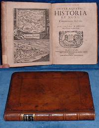
London: W.Peacock, 1795. Hardcover. Good. Hand colored in outline Folding Maps (12 + frontis) by Russell. Duodecimo red roan gilt (spine quite chipped down at head/foot & heavily rubbed/tips worn) All Edges Gilt xxii+404pp +(4p index) 2 leaves nearly loose but clean and square. Nice 19th century inscription on FEP. All folding maps crisp and untorn with outline coloring. Maps: Chart of the world - East Indies - Spain and Portugal - France - Italy - Netherlands - United Provinces - German Empire and Switzerland - Prussia and Poland - Dominions of Russia - Sweden, Denmark and Norway - Great Britain and Ireland - States of America.
Reseñas
(¡Iniciar sesión or Crear una cuenta primero!)
Detalles
- Librería
- Abbey Antiquarian Books
 (GB)
(GB)
- Inventario del vendedor #
- V68561
- Título
- COMPENDIOUS GEOGRAPHICAL AND HISTORICAL GRAMMAR exhibiting a brief survey of the terraqueous globe : and shewing, the situation, extent, boundaries, and divisions of the various countries, their chief towns, mountains, rivers, climates, and productions; their governments, revenues, commerce, and their sea and land forces; likewise, the religion, language, literature, customs, and manners of the respective inhabitants of the different nations: and also, a concise view of the political history of the several empires, kingdoms, and states. Embellished with maps.
- Ilustrador
- Hand colored in outline Folding Maps (12 + frontis) by Russell
- Formato/Encuadernación
- Tapa dura
- Estado del libro
- Usado - Good
- Cantidad disponible
- 1
- Editorial
- W.Peacock
- Lugar de publicación
- London
- Fecha de publicación
- 1795
- Palabras clave
- geography maps
- Catálogos del vendedor
- Antiquarian;
Términos de venta
Abbey Antiquarian Books
We accept Mastercard or Visa, PayPal, bank transfer (EU) and checks in USD or GBP. Shipping cost is additional to the book price. If your book order is heavy or large, we may contact you to ask for more money for shipping. Books may be returned for refund if not as described in our catalogue entry.
Sobre el vendedor
Abbey Antiquarian Books
Miembro de Biblio desde 2005
Blockley, Gloucestershire
Sobre Abbey Antiquarian Books
We are antiquarian booksellers established in Gloucestershire, England for over twenty years. We have general stock and specialise in early illustrated and children's books and pop-ups. We are members of PBFA.
Glosario
Algunos términos que podrían usarse en esta descripción incluyen:
- Leaves
- Very generally, "leaves" refers to the pages of a book, as in the common phrase, "loose-leaf pages." A leaf is a single sheet...
- Crisp
- A term often used to indicate a book's new-like condition. Indicates that the hinges are not loosened. A book described as crisp...
- Gilt
- The decorative application of gold or gold coloring to a portion of a book on the spine, edges of the text block, or an inlay in...
- Edges
- The collective of the top, fore and bottom edges of the text block of the book, being that part of the edges of the pages of a...
Categorías de este libro
Also Recommended
-

-

-
-

-

¡Ahorra un 10% en cada compra!
Únete al Biblioclub y empieza a ahorrar un 10% enn todas tus compras.
$29.95 / Año
