Descripción:
1969: United States, Defense Mapping Agency . Visual and Radio Communication regulations for the Hydrographic/Topographic Center. Very good. . 27 x 20 cm. 156 pp.
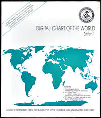
Digital Chart of the World, Version 1 de United States. Defense Mapping Agency - July 1992
de United States. Defense Mapping Agency
Digital Chart of the World, Version 1
de United States. Defense Mapping Agency
- Usado
- near fine
- First
Washington, DC: United States Defense Mapping Agency, July 1992. 3.5" and 5.25 Diskettes for MS-DOS 3.1 and higher. Near Fine. Not from a library. Based on the Defense Mapping Agency's 1:1,000,000-scale Operational navigation chart base maps; organized into 17 thematic layers; allows you to change the colors and symbols used in the display; gives you full zoom capability; allows you to print hard copy or save data to a hard disk.
Government doc no.: D 5.358:992/PACK.
GPO item no.: 0378-E-36
Geographic class no.: 3200
Other system no.: (OCoLC)26783779
Type of material: Map
Government doc no.: D 5.358:992/PACK.
GPO item no.: 0378-E-36
Geographic class no.: 3200
Other system no.: (OCoLC)26783779
Type of material: Map
-
Librería
Books of the World
 (US)
(US)
- Estado del libro Usado - Near Fine
- Edición Version 1
- Editorial United States. Defense Mapping Agency.
- Lugar de publicación Washington, DC
- Fecha de publicación July 1992
- Palabras clave map, atlas, digital

International Code of Signals. 1969.
de United States Defense Mapping Agency
- Usado
- Estado
- Usado - Visual and Radio Communication regulations for the Hydrographic/Topographic Center. Very good.
- Cantidad disponible
- 1
- Librería
-
Gloucester, Massachusetts, United States
- Precio
-
EUR 18.79
Mostrar detalles
Precio
EUR 18.79

International Code of Signals. 1969.
de United States Defense Mapping Agency
- Usado
- Estado
- Usado - Visual and Radio Communication regulations for the Hydrographic/Topographic Center. Very good.
- Cantidad disponible
- 1
- Librería
-
Gloucester, Massachusetts, United States
- Precio
-
EUR 18.79
Mostrar detalles
Descripción:
1969: United States, Defense Mapping Agency . Visual and Radio Communication regulations for the Hydrographic/Topographic Center. Very good. . 27 x 20 cm. 156 pp.
Precio
EUR 18.79

Sight Reduction Tables for Air Navigation (Selected Stars) Epoch 1980.0
de U.S. Defense Mapping Agency, Hydrographic Center
- Usado
- good
- Estado
- Usado - good
- Cantidad disponible
- 1
- Librería
-
Silver Spring, Maryland, United States
- Precio
-
EUR 28.19
Mostrar detalles
Descripción:
Washington, DC: GPO, 1977. good. 29 cm, 324, v.1 only of the 3-vol. set, spiralbound, tables, Table 5--Refraction laid in (4 pages) DMA Stock No. NVPUB248V1. Volume I contains tables for selected stars for all latitudes, calculated for the epoch of 1980.0 and is intended for use for about 5 years. Pub. No. 249 has been designed for use with the Air Almanac. This is an important reference work, well organized for manual review.
Precio
EUR 28.19
Handbook of Magnetic Compass Adjustment
de (US Defense Mapping Agency)
- Usado
- Aceptable
- Tapa dura
- Estado
- Usado - Fine
- Edición
- 4th edition
- Encuadernación
- Hardcover
- Cantidad disponible
- 1
- Librería
-
MELBOURNE, Victoria, Australia
- Precio
-
EUR 38.90
Mostrar detalles
Descripción:
Washington: Defense Mapping Agency, 1980. 4th edition. Fine. octavo. orig. cloth v + 96pp., text ills., index, Name obscured on end paper o/w fine copy
Precio
EUR 38.90

Distances Between Ports 1976 Pub. 151
de Defense Mapping Agency, Hydrographic Center, United States
- Usado
- Tapa blanda
- Estado
- Usado
- Encuadernación
- Paperback
- Cantidad disponible
- 1
- Librería
-
San Francisco, California, United States
- Precio
-
EUR 70.48
Mostrar detalles
Descripción:
Washington, DC: Defense Mapping Agency, 1976.. 4to, Soft Covers, 218 pp., Good with creasing from damp stains, toning to covers, else VG. Fold-out color map inside cover.
Precio
EUR 70.48
Proceedings of the Second Geodetic Symposium on Satelllite Doppler Positioning, hosted by Applied Research Laboratories, Held at The University of Texas at Austin: Volume 2
de United States. Defense Mapping Agency and National Ocean Survey
- Usado
- Tapa dura
- First
- Estado
- Usado - Very good. No dust jacket.
- Edición
- Presumed first edition/first printing
- Encuadernación
- Hardcover
- Cantidad disponible
- 1
- Librería
-
Silver Spring, Maryland, United States
- Precio
-
EUR 234.92
Mostrar detalles
Descripción:
United States, 1979. Presumed first edition/first printing. Hardcover. Very good. No dust jacket.. viii, 801-1333 p. Includes: illustrations, diagrams. Volume 2 ONLY. This sumposium was cosponsored by the Defense Mapping Agency and the National Ocean Survey. It was hosted by the Aplied Research Laboratories and held at the University of Texas at Austin. Volume II includes Session IV on Terrestrial Adjustments, Session V on Advanced Systems, the Closing Session and the Symposium Scrapbook of photographs, countries representated and the list of attendees.
Precio
EUR 234.92