Ver a tamaño completo.

Map of North Wales. From The Ordnance Surveys. (with Names of Railway Stations.)
de BACON & CO., G. W.:
- Usado
- Tapa dura
- Estado
- Ver descripción
- Librería
-
Dorchester, Dorset, United Kingdom
Formas de pago aceptadas
Sobre este artículo
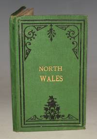
Edinburgh, G.W. Bacon & Co., n.d. ca1890. Hardback, 7 x 4 inches. Green cloth with gilt lettering and black border decoration to front. In very good condition. Some rubbing to edges a couple of minor handling marks to cloth, boards have slight curl. Inner endpapers tanned and cracked along inner of spine. Some minor darkening and small chips to edge of key map on endpaper. Some minor tanning to bottom corner of map else overall clean and bright with nice colouring. Else a very good clean and tight copy. Full-Colour fold-out map printed on paper and mounted on cloth. Map size 19 x 19.5 inches.
Reseñas
(¡Iniciar sesión or Crear una cuenta primero!)
Detalles
- Librería
- The Antique Map & Bookshop
 (GB)
(GB)
- Inventario del vendedor #
- 91066
- Título
- Map of North Wales. From The Ordnance Surveys. (with Names of Railway Stations.)
- Autor
- BACON & CO., G. W.:
- Estado del libro
- Usado
- Encuadernación
- Tapa dura
- Editorial
- Edinburgh, G.W. Bacon & Co., n.d. ca1890
- Palabras clave
- MAPS BACON & CO., G. W.: Bacon’s, Map of North Wales, Ordnance survey, ca1890, fold out, colour, canvas, wales, county maps, tourist, railways,
Términos de venta
The Antique Map & Bookshop
30 day return guarantee, with full refund including original shipping costs for up to 30 days after delivery if an item arrives misdescribed or damaged.
Sobre el vendedor
The Antique Map & Bookshop
Miembro de Biblio desde 2016
Dorchester, Dorset
Sobre The Antique Map & Bookshop
The Antique Map & Bookshop was established in 1976 and has been in Puddletown since 1978. PUDDLETOWN is situated just outside DORCHESTER in the county of DORSET, on the A35 to BOURNEMOUTH. The village has a by-pass now which means there is easy access to the village and ample space for parking. Our shop is directly on the main road through the village.
Glosario
Algunos términos que podrían usarse en esta descripción incluyen:
- Cracked
- In reference to a hinge or a book's binding, means that the glue which holds the opposing leaves has allowed them to separate,...
- Tight
- Used to mean that the binding of a book has not been overly loosened by frequent use.
- G
- Good describes the average used and worn book that has all pages or leaves present. Any defects must be noted. (as defined by AB...
- Edges
- The collective of the top, fore and bottom edges of the text block of the book, being that part of the edges of the pages of a...
- Gilt
- The decorative application of gold or gold coloring to a portion of a book on the spine, edges of the text block, or an inlay in...
- Rubbing
- Abrasion or wear to the surface. Usually used in reference to a book's boards or dust-jacket.
- Spine
- The outer portion of a book which covers the actual binding. The spine usually faces outward when a book is placed on a shelf....
- Cloth
- "Cloth-bound" generally refers to a hardcover book with cloth covering the outside of the book covers. The cloth is stretched...
