
Ver a tamaño completo.


Report on the United States and Mexican Boundary Survey: made under the direction of the Secretary of the Interior
de William Hemsley Emory (1811-1887)
- Usado
- Muy bueno
- Tapa dura
- Estado
- Muy bueno
- Librería
-
Fort Worth, Texas, United States
Formas de pago aceptadas
Sobre este artículo
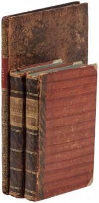
2 volumes in 3. Volume I, parts I and II: xvi+258 pages with frontispiece, 72 maps (1 folding) and illustrations engraved on steel, map and meteorological engraved on copper diagram, 12 engravings on stone, 20 wood cuts and errata; vii+174+[21 plates] with folding map in color, 26 maps and illustrations and errata. Volume 2, part I: 270+[75 plate] pages with index; Volume II, part II: 62+[27 plates] pages with index, 33+[25 plate] pages with index, 35+[41 plate] pages with index, 85+[ii]+[41 plate] pages with index. U S Geological Survey Bulletin 194 map (40" x 26 1/4"). Quarto (11" x 9") bound in red cloth with gilt lettering to spine. House of Representatives, 34th Congress, 1st Session, Senate Ex. Doc 108. (Howes E146; Wagner-Camp 291; Wheat, Transmississippi West III, 822 and pages 242-4.) First edition with this set includes three plates not recorded in Wagner-Camp and not found in all copies: a colorful "Map Illustrating the General Geological Features of the Country West of the Mississippi River" (facing page I:258); "View of Monument Mountain" facing page I:96; and "View Along the Gila (Cereus Giganteus)" facing the last text leaf in the second volume.
The folding map in volume one is one of the foundation maps for the western United States and represents the culmination of fifty years of government explorations. Starting with Lewis and Clark, there were numerous official and unofficial surveys and explorations, all adding to the pool of knowledge presented here. While large sections are still labeled "unexplored territory," Emory fitted these fragments together with the information gathered during his surveys into a reasonably correct cartographic picture of the West. This map shows large, transitional territories of Nebraska, Kansas, New Mexico, Utah, Oregon, Washington and Minnesota. It was drawn by Thomas Jekyll under the supervision of Lt. Nathaniel Michler of the Topographical Engineers. Lt. Michler worked with his counterpart representing Mexico, Captain Francisco Jimenez, to survey between Nogales and Yuma including the area south of Arivaca.
The U S Geological survey Bulletin 194 was drawn by J.E. Weyss, circa 1860. The map features the survey lines between Texas and New Mexico with good topographical detail. Information includes forts, Raton Pass, the Santa Fe, and Albuquerque trails, numerous explorers' routes, Indian trails, and more. The map is an interesting historical curiosity because it was not published when the survey was finished due to the outbreak of the Civil War. In 1902 the map was belatedly included in a Geological Survey Bulletin by Marcus Baker. Printed by the Norris Peters Co., Photo-Lithograph. It is a large and extremely detailed chart by J.H. Clark, U.S. Commissioner.
Report on the United States and Mexican Boundary Survey has been called "one of the masterworks of Western and American history." Published in the years 1857 to 1859, it was the official report of the U.S. Boundary Commission upon completing its work of surveying and mapping the United States-Mexico boundary. The boundary survey was a consequence of the U.S.-Mexican War and the Treaty of Guadalupe Hidalgo, which concluded the war on February 2, 1848. The treaty transferred to the United States nearly half of the territory of Mexico and delimited the boundary. Some of the land was settled by Mexican ranchers and farmers, but much of the territory was unexplored and to Americans, it was an unknown land. Commissions from both the U.S. and Mexico began the survey and demarcation of the line in 1849. In 1853, through negotiation of the Gadsden Treaty, the United States purchased additional territory that now forms the southern parts of Arizona and New Mexico. The boundary survey was completed in 1855, and the U.S. and Mexican commissions finished their maps in 1857, while work on the U.S. final Report continued for another two years. The U.S.-Mexico boundary Report was published in two massive volumes, sometimes in three, and its contents make up an encyclopedia of the Southwest. It presents not only the results of the boundary survey, but also the results of the scientific investigations connected with the survey. Major William H. Emory, a Topographical Engineer, Chief Astronomer, and fourth U.S. Boundary Commissioner, oversaw production of the Report on the United States and Mexican Boundary Survey. Although the title page bears his name, the Report is the work of many contributors. In all of the essays, the illustrations are closely tied to the text. The geological reports in Volume I, Part II contain twenty-two drawings and diagrams that illustrate the features discussed. The authors of the geological chapters are Charles C. Parry and Arthur C. V. Schott, who both participated in the field survey, and James Hall, the influential state geologist of New York. The geological reports include a catalog of fossils collected during the survey. Most of the fossils are shells, and they were collected mainly by Schott and Emory. Timothy A. Conrad, a paleontologist at the Smithsonian Institution, identified and described the fossils. Twenty-one full-page, black-and-white plates were drawn by paleontologist Fielding B. Meek and engraved by John E. Gavit to illustrate the descriptions. The main chapter, "Botany of the Boundary," is by Princeton University botanist John Torrey, who identified and classified the plants of the borderlands, naming and describing many new genera and species. St. Louis physician and botanist George Engelmann was dedicated to one group of plants, the cacti. Similar to Torrey's chapter, it lists and describes the cacti of the borderlands and names many new species. The chapter on fishes by Smithsonian zoologist Charles F. Girard contains forty-one full-page, black-and-white plates. Some of the plates indicate that they were drawn by John H. Richard of the Smithsonian Institution and engraved by William H. Dougal of Georgetown, D.C. They depict specimens that were collected by boundary survey naturalists. Spencer F. Baird, assistant secretary of the Smithsonian Institution, prepared the chapter on "Reptiles of the Boundary." It is illustrated with forty-one full-page, black-and-white plates, some of which are signed by Richard and Dougal. The report on "Mammals of the Boundary" was also written by Baird, with illustrations drawn by J. H. Richard and R. Metzeroth and engraved by Dougal and Metzeroth. There are twenty-seven full-page, black-and-white plates showing the mammals. The chapter on birds, also by Baird, contains some of the most appealing illustrations in the Report. There are twenty-five full-page plates, all in color, drawn by Baird and lithographed by Bowen & Company of Philadelphia. The pictures of Indians have often been reproduced. They are full-page, color illustrations, nine of them altogether. All are by Schott, engraved on stone by Sarony, Major & Knapp of New York. The nine drawings complement the discussions of Indian culture in the chapters on geography. Views of cities and forts built by Spanish and Anglo settlers further reveal border life. Ten of these illustrations appear in Emory's geographical essays. Most of them have no artist's signatures but at least two are by Schott and one is by boundary commission draftsman Augustus de Vaudricourt. The remaining ninety-seven illustrations are topographical drawings or landscapes, the largest subject category. They appear throughout the geographical and geological reports. Most were drawn by Schott or by John E. Weyss, although many are unsigned. They were reproduced by a variety of techniques, including engraving on steel, engraving on stone, and woodcut. Several different individuals or firms were responsible for the reproductions. Made while the surveys were in progress, the views by Weyss and Schott and the final boundary maps are correlated. They offer parallel representations of the topography, the boundary monuments, and the location of the line. Trained as scientists and engineers, the officers of the Topographical Corps regarded scientific observation as an important purpose of their work. Exploration of the new lands acquired in the U.S.-Mexican War and discovery of their resources were goals as important as marking the boundary. Scientific discovery was the first step in the process of incorporating the region into the United States.
Condition:
Modern cloth; intermittent offsetting and minor foxing, a few paper clip marks, one extraneous leaf bound in to second volume, a few leaves worn with tape repairs else very good.
Reseñas
(¡Iniciar sesión or Crear una cuenta primero!)
Detalles
- Librería
- The Book Collector ABAA, ILAB, TBA
 (US)
(US)
- Inventario del vendedor #
- E0830
- Título
- Report on the United States and Mexican Boundary Survey: made under the direction of the Secretary of the Interior
- Autor
- William Hemsley Emory (1811-1887)
- Estado del libro
- Usado - Muy bueno
- Cantidad disponible
- 1
- Edición
- First
- Encuadernación
- Tapa dura
- Editorial
- A O P Nicholson
- Lugar de publicación
- Washington, DC
- Fecha de publicación
- 1857-1859
- Páginas
- 3 volumes
- Tamaño
- Quarto
- Peso
- 0.00 libras
- Palabras clave
- Borderlands
- Catálogos del vendedor
- Exploration;
- Atención
- Puede que se trate de un conjunto de varios volúmenes y requiera de gastos de envío adicionales.
Términos de venta
The Book Collector ABAA, ILAB, TBA
All items are guaranteed as described. If an item is
not as described, it is returnable within seven days
of receipt, unless other arrangements are made.
Full refunds given only when items are received in
the same condition in which they were sent.
We require new customers to send payment with
their order. Customers known to us will be invoiced
with payment due in thirty days, unless prior
arrangements are made. Institutions will be billed
to meet their requirements. All items subject to prior
sale.
We accept Visa, Mastercard, and American Express
Please be advised that we can only ship to your billing address.
We accept checks, but may require that the check clears before we ship an order.
Prices of books do not include shipping.
We use UPS domestically and internationally. Other shipping arrangements can be made. Shipping is always charged at cost.
Texas residents must add 8.25% sales tax.
Sobre el vendedor
The Book Collector ABAA, ILAB, TBA
Miembro de Biblio desde 2005
Fort Worth, Texas
Sobre The Book Collector ABAA, ILAB, TBA
The Book Collector specializes in the finest collections of Chess, Anthropology, Americana and American Literature. Visit our website at www.bookcollectorshop.com
Glosario
Algunos términos que podrían usarse en esta descripción incluyen:
- First Edition
- In book collecting, the first edition is the earliest published form of a book. A book may have more than one first edition in...
- Gilt
- The decorative application of gold or gold coloring to a portion of a book on the spine, edges of the text block, or an inlay in...
- Leaves
- Very generally, "leaves" refers to the pages of a book, as in the common phrase, "loose-leaf pages." A leaf is a single sheet...
- Title Page
- A page at the front of a book which may contain the title of the book, any subtitles, the authors, contributors, editors, the...
- New
- A new book is a book previously not circulated to a buyer. Although a new book is typically free of any faults or defects, "new"...
- Spine
- The outer portion of a book which covers the actual binding. The spine usually faces outward when a book is placed on a shelf....
- Errata
- Errata: aka Errata Slip A piece of paper either laid in to the book correcting errors found in the printed text after being...
- Quarto
- The term quarto is used to describe a page or book size. A printed sheet is made with four pages of text on each side, and the...
- Cloth
- "Cloth-bound" generally refers to a hardcover book with cloth covering the outside of the book covers. The cloth is stretched...


![Relación Del Último Viage Al Estrecho De Magdallanes De La Fragata De S. M. Santa María De La Cabeza En Los Años De 1785 Y 1786. [WITH:] .Apendice A La Relación Del Viage Al Magallanes De La Fragata De Guerra Santa María De La Cabeza, Que Contiene](https://d3525k1ryd2155.cloudfront.net/h/605/922/932922605.0.m.0.jpg)
