Descripción:
Pitt, Moses and Swart, Stephaman. Duynckercke, [Dunkirk]. Ca 1683. Hand coloured, copper engraved sea-chart. Chart size 440 x 505 mm, sheet size 580mm x 690mm. Two charts on one sheet showing the Dunkirk approaches. The larger chart from that of Blaeu's Pourtraict de la fameuse ville et havre de Duynckercke. With Rhumb lines, compass rose and scales. Townships and sandbanks indicated. Decorated with fleets of galleons off shore. With an inset panorama of Duynckercke [Dunkirk] after Jan Van Loon and a smaller coastal profile of Cales. The smaller chart showing the coast of Flanders, from Walchren [ Walcheren ] to Boloigne. Early hand coloured charts with later red ruled border on wide blank margins. Small tear without loss to lower blank margin, otherwise in bright and clean condition. Rare and attractive Sea Charts.
Tabula Asiae III - 1548 map of area surrounding the Black Sea and the Caspian Sea de Gastaldi, Giacomo - 1548
de Gastaldi, Giacomo

Tabula Asiae III - 1548 map of area surrounding the Black Sea and the Caspian Sea
de Gastaldi, Giacomo
- Usado
- near fine
Venice, 1548. No Binding. Near Fine/No Jacket. Single page woodcut map. 5" x 6 1/2". Hand tinted. Mounted on acid-free backing board with matte. Central vertical fold has been reinforced with archival tape applied to back surface. Depicts the land area between the Black Sea and the Caspian Sea. Two birds in lower right, a monkey and a camel in left margin, and a curiously house-like Noah's Ark floating in the Caspian. Removed (not by me!) from Gastaldi's "Geografia," a highly influential 16th century atlas. Please see photos for best description.
-
Librería
Alan Foljambe, Bookseller [ABAC/ILAB]
 (CA)
(CA)
- Formato/Encuadernación No Binding
- Estado del libro Usado - Near Fine
- Estado de la sobrecubierta No Jacket
- Cantidad disponible 1
- Lugar de publicación Venice
- Fecha de publicación 1548
- Palabras clave MAP, ANTIQUE
- Product_type Map
![Sea Chart. Duynckercke [Dunkirk].](https://d3525k1ryd2155.cloudfront.net/h/721/019/192019721.0.m.jpg)
Sea Chart. Duynckercke [Dunkirk].: Original Antique Hand coloured, copper engraved sea-chart.
de Pitt, Moses and Swart, Stephaman
- Usado
- Muy bueno
- First
- Estado
- Usado - Muy bueno
- Cantidad disponible
- 1
- Librería
-
Plymouth, Devon, United Kingdom
- Precio
-
EUR 237.80
Mostrar detalles
Precio
EUR 237.80
Más fotos
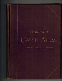
Standard Classic Atlas for Schools and Colleges with an Alphabetical Index Giving the Latitudes and Longitudes of Nearly 10,000 Places
- Usado
- near fine
- Tapa dura
- First
- Estado
- Usado - Near Fine
- Estado de la sobrecubierta
- No Jacket, As Issued
- Edición
- First Edition
- Encuadernación
- Hardcover
- Cantidad disponible
- 1
- Librería
-
Bloomington, Indiana, United States
- Precio
-
EUR 374.00
Mostrar detalles
Descripción:
New York and Chicago: Ivison, Blakeman, Taylor & Company, 1885. RARE, Worldcat lists only one institutional holding . Contains 22 two-page maps of ancient countries and empires plus 30 pp. Index with latitudes and longitudes of nearly 10,000 places. Near Fine, small number in ink top corner front paste down, light rubbing to cloth at tips. Maps include Orbis Veteribus Notus, Romanum Imperium, Hispania, Gallia, Asia Minor, Syria, Aegyptus, Africa et Libya, etc. . First Edition. Cloth. Near Fine/No Jacket, As Issued. 8vo - over 7¾" - 9¾" tall.
Precio
EUR 374.00

Más fotos
Arab navigation in the Indian Ocean before the coming of the Portuguese
de Ahmad ibn Majid al-Sadi , G.R. Tibbetts
- Usado
- Tapa dura
- First
- Estado
- Nuevo
- Edición
- First Edition
- Encuadernación
- Hardcover
- ISBN 10 / ISBN 13
- 9780718909000 / 0718909003
- Cantidad disponible
- 1
- Librería
-
Berg en dal, Netherlands
- Precio
-
EUR 240.00
Mostrar detalles
Descripción:
Ahmad ibn Majid al-Sadi, G.R. Tibbetts - Arab Navigation in the Indian Ocean before the coming of the Portuguese - London, The Royal Asiatic Society of Great Britain and Ireland; Luzac and Company Ltd, 1971 - First Edition - Hardcover - 614pp + 4 maps (out of 7)- 22x14 cmCondition Very Good: Cover some light shelf wear, inside as new. Four out of seven maps present: Chart of the Arabian Sea, India and the Bay of Bengal, Red Sea and Gulf of Eden, East African CoastIf you have any questions or want to see more pictures, feel free to ask.Your book will be securely packed and shipped with tracking number, signed & insured.
Precio
EUR 240.00

Más fotos
1875 ILLINOIS CENTRAL MAP.: Map of the Illinois Central Railroad and its Connections.
- Usado
- Estado
- Usado
- Cantidad disponible
- 1
- Librería
-
Houston, Texas, United States
- Precio
-
EUR 275.82
Mostrar detalles
Descripción:
[Railroad] Map of the Illinois Central Railroad and its Connections. Chicago: Rand McNally and Company Map Engravers. 1875. Map printed on green paper. 33 x 25 on sheet 40 x 38 cm folded to 9 x 19 cm. Added text printed in green in margins around map. One three inch fold split, else very good.OCLC shows one holding (Newberry Lib.) Relief shown by hachures. Timetables on verso "corrected to June 20th, 1875." Text describing routes and connections on 5 panels on verso: Illinois Central Railroad principal connections -- Illinois Central Railroad Dubuque and Sioux City Line! -- Illinois Central Railroad, the direct route from Chicago to Springfield, Farmer City, Clinton and Mt. Pulaski -- Illinois Central Railroad St. Louis through line -- Illinois Central Railroad New Orleans through line.
Precio
EUR 275.82

Mother of all life: A prophetic illumination
de Judith Pearl
- Usado
- Tapa blanda
- Firmado
- Estado
- Usado - v
- Estado de la sobrecubierta
- 966579283
- Edición
- R1998
- Encuadernación
- Paperback
- Cantidad disponible
- 1
- Librería
-
Forbes Road, Pennsylvania, United States
- Precio
-
EUR 369.33
Mostrar detalles
Descripción:
Chalet Magnificat, n. R1998. 966579283. Very Good. Includes short not to previous owner and Signed by Author
Precio
EUR 369.33

(Map of Pennsylvania): Geographical, Statistical, and Historical Map of Pennsylvania
de Carey & Lea (engr.by Young & Delleker)
- Usado
- Tapa dura
- First
- Estado
- Usado
- Encuadernación
- Hardcover
- Cantidad disponible
- 1
- Librería
-
Crozet, Virginia, United States
- Precio
-
EUR 374.00
Mostrar detalles
Descripción:
Philadelphia (Chestnut Street), 1822: HC Carey and I Lea, 1822. VG due to some minimal dampstaining most evident left upper corner, and minimally crossing neatline. The color portion of the map shows no significant visual effects from the stains. The original hand-colored image is clear and bright, with the surrounding letterpre ss text detailing aspects of population, climate, commerce, religion, government. There is a nice general historical sketch (in a separate page of original text, included here-- "Appendix to No. 18") in the letterpress. From the first edition "A Complete Historical, Chronological, and Geographical American Atlas...", which was also the first American atlas with letterpress printing on the map. This is a nice map, but for the defects described. The map image is 45x31cm; the entire image is 52.5x42cm..
Precio
EUR 374.00

Más fotos
MAP OF PHILADELPHIA, CAMDEN AND VICINITY Compiled from City Plans & Personal Surveys
de Smith, Elvino V.
- Usado
- Tapa dura
- Estado
- Usado - Good+
- Encuadernación
- Hardcover
- Cantidad disponible
- 1
- Librería
-
Fairfield, New Jersey, United States
- Precio
-
EUR 280.50
Mostrar detalles
Descripción:
Philadelphia: Elvino V. Smith. Good+. 1912. Hardcover. A very large folding map (56" x 43") mounted in a light blue, lightly faded, hardcover cloth folder with gilt lettering on front. Map in nice condition except for a few tears along the folds. Folder has paper tears along interior hinges. Condition--Folder: G+, Map: VG. Pennsylvania ; Fold out Map; Thin 12mo 7" - 7½" tall .
Precio
EUR 280.50

Más fotos
Digging the Old West: How Dams and Ditches Sculpted an American Landscape
de Franklin, Karmen Lee
- Usado
- Tapa blanda
- Estado
- Used- Fine
- Encuadernación
- Paperback
- ISBN 10 / ISBN 13
- 9780615531489 / 0615531482
- Cantidad disponible
- 1
- Librería
-
Longmont, Colorado, United States
- Precio
-
EUR 257.12
Mostrar detalles
Descripción:
Franklin Design Bureau, 2011. Paperback. Used- Fine condition. Book is clean and tight. Book shows light shelf wear. Light bumping on the top and bottom of the spine. No markings on the inside of the book. Photos are of the book we have here at Barbed Wire Books."It is one of the few works that attempts fully to explain Colorado's water history. It is unusually well-written, with vivid descriptions of people, processes, events, and landscape features." Mark Fiege
Precio
EUR 257.12

Más fotos
Atlas to Accompany Monograph XXXII on the Geology of the Yellowstone National Park
de Hague, Arnold
- Usado
- Bien
- Tapa dura
- Estado
- Usado - Bien
- Encuadernación
- Hardcover
- Cantidad disponible
- 1
- Librería
-
Lansdowne, Pennsylvania, United States
- Precio
-
EUR 409.53
Mostrar detalles
Descripción:
Washington, D.C.: United States Geological Survey, 1904. Hardcover. Good. 34 leaves: 24 color maps (7 double-leaf); 56 cm. Dark brown cloth with gilt-stamped cover title. Monographs of the United States Geological Survey, v. 32. In Good Condition: cloth is soiled and rubbed; corners are frayed; minor loss at ends of spine; blank leaf preceding title page is torn from fore-edge to gutter; faint dampstain along fore-edges and lower corners throughout, not impacting maps; closed 2-cm. tear from fore-edge of 2 maps; otherwise, clean and tight.
Precio
EUR 409.53

VEUE DE LA VILLE ET DU COLOSSE DE RHODES (View of the City and Colossus of Rhodes)
de RHODES - RHODOS - Original Antique etching
- Usado
- near fine
- Estado
- Usado - Near Fine
- Cantidad disponible
- 1
- Librería
-
Tel-Aviv, Israel
- Precio
-
EUR 233.75
Mostrar detalles
Descripción:
1730. No Binding. Near Fine. ORIGINAL ANTIQUE ETCHING (copper plate) dated 1727, depicting attractively the ancient harbour of Rhodes with the statue of the Colossus at its entrance. The statue, representing the sun god Helios, was considered one of the Seven Wonders of the Ancient World. Size in cm 43,5 x 28,8 (in inch 17,3 x 11,25 plus margin with title. Original centerfold.Strong impression. Very good paper quality
Precio
EUR 233.75

Foto de archivo: la portada puede ser diferente
Le Carte D'America di Giacomo Gastaldi: Contributo Alla Storia Della Cartografic del Secolo XVI
de Giacomo Gastaldi Stefano Grande
- Nuevo
- Tapa blanda
- Estado
- Nuevo
- Encuadernación
- Paperback
- ISBN 10 / ISBN 13
- 9781018282527 / 1018282521
- Cantidad disponible
- 10
- Librería
-
Southport, Merseyside, United Kingdom
- Precio
-
EUR 23.24
Mostrar detalles
Descripción:
Paperback / softback. New.
Precio
EUR 23.24
Foto de archivo: la portada puede ser diferente
Le Carte D'America di Giacomo Gastaldi: Contributo Alla Storia Della Cartografic del Secolo XVI
de Grande, Giacomo Gastaldi Stefano
- Usado
- Bien
- Tapa blanda
- Estado
- Usado - Bien
- Encuadernación
- Paperback
- ISBN 10 / ISBN 13
- 9781018282527 / 1018282521
- Cantidad disponible
- 1
- Librería
-
Newport Coast, California, United States
- Precio
-
EUR 46.29
Mostrar detalles
Descripción:
paperback. Good. Access codes and supplements are not guaranteed with used items. May be an ex-library book.
Precio
EUR 46.29

Foto de archivo: la portada puede ser diferente
Le Carte D'America di Giacomo Gastaldi: Contributo Alla Storia Della Cartografic del Secolo XVI
de Giacomo Gastaldi Stefano Grande
- Nuevo
- Tapa dura
- Estado
- Nuevo
- Encuadernación
- Hardcover
- ISBN 10 / ISBN 13
- 9781018277158 / 1018277153
- Cantidad disponible
- 10
- Librería
-
Southport, Merseyside, United Kingdom
- Precio
-
EUR 36.75
Mostrar detalles
Descripción:
Hardback. New.
Precio
EUR 36.75
Foto de archivo: la portada puede ser diferente
Le Carte D'America di Giacomo Gastaldi: Contributo Alla Storia Della Cartografic del Secolo XVI
de Grande, Giacomo Gastaldi Stefano
- Usado
- Bien
- Tapa dura
- Estado
- Usado - Bien
- Encuadernación
- Hardcover
- ISBN 10 / ISBN 13
- 9781018277158 / 1018277153
- Cantidad disponible
- 1
- Librería
-
Newport Coast, California, United States
- Precio
-
EUR 63.60
Mostrar detalles
Descripción:
hardcover. Good. Access codes and supplements are not guaranteed with used items. May be an ex-library book.
Precio
EUR 63.60

Natolia Nvova Tavola
de Gastaldi, Giacomo
- Usado
- Estado
- Usado - Very Good; slightly faded towards the center of the map
- Cantidad disponible
- 1
- Librería
-
Toronto, Ontario, Canada
- Precio
-
EUR 420.75
Mostrar detalles
Descripción:
Venice, 1566. Very Good; slightly faded towards the center of the map. Size : 190x262 (mm), 7.5x10.25 (Inches), Coloring: Hand Colored, Category: ; Maps Asia Near East Turkey
Precio
EUR 420.75

Tierra Nveva.
Title on verso: Tiera Nveva, De Los Bacalaos Tavola Prima Del Mondo Nvovo.
de Gastaldi, Giacomo - Ruscelli, Girolamo
- Usado
- Muy bueno
- Estado
- Usado - Muy bueno
- Cantidad disponible
- 1
- Librería
-
Toronto, Ontario, Canada
- Precio
-
EUR 1,776.50
Mostrar detalles
Descripción:
Venice, 1574. Very Good. Notes: First State, Italian edition of 1574. Published in La Geografia di Clavdio Tolomeo. Text on verso. Unusually elongated projection of the East Coast of North America, stretching from Florida to the Labrador., Size : 187x260 (mm), 7.36x10.24 (Inches), Coloring: Black & White, Reference: Burden, The Mapping of North America, #30. Kershaw #18b., Category: Maps Canada East; Maps United States East (States);
Precio
EUR 1,776.50

Universale della parte del mondo nuovamente ritrovata.: Gastaldi's hemispherical map of the Americas
de RAMUSIO, Giovanni Battista and GASTALDI, Giacomo
- Usado
- First
- Estado
- Usado
- Cantidad disponible
- 1
- Librería
-
London, United Kingdom
- Precio
-
EUR 7,134.00
Mostrar detalles
Descripción:
[Venice,: stamperia dei Giunta,, 1565].. 302 by 378mm (12 by 15 inches).. Double-page woodcut map. Second state of Gastaldi's map of the Western Hemisphere, originally published in the third volume of Ramusio's compendium of voyages, 'Delle Navigationi et Viaggi', 1556. With the page numbers '455' and '456' appearing in the top left and top right of the map, respectively. Printed from the second of three woodblocks, the first was destroyed in a fire at the Giunta premises in November of 1557. This hemispherical map depicts both American continents, extends to show the Molucca islands in the west, and Africa, Spain, and Ireland in the east, large and incomplete landmasses in the north and south, extending beyong the 'Circolo Artico' and 'Circolo Antartico'. The northernmost reaches of North America are left blank, thereby avoiding making a statement about contemporary speculation of a land bridge to Asia and depicts Japan with two islands. Notably, this is the first printed map bearing place names…
Leer más Precio
EUR 7,134.00
![Seconda tavola.[Venice], Ferrando Bertelli, 1565 [printed ca. 1570]. Engraved map of the Indian...](https://d3525k1ryd2155.cloudfront.net/h/320/987/1352987320.0.m.jpg)
Seconda tavola.[Venice], Ferrando Bertelli, 1565 [printed ca. 1570]. Engraved map of the Indian Ocean, Indian subcontinent and most of the Gulf region (28 x 39 cm; margins extended to 50 x 66.5 cm), at a scale of about 1:13,500,000 with north at the foot, with 3 sea monsters, a spouting whale and 3 ships in the ocean; and on the land elephants, lions and 2 people on horseback carrying spears. Although printed from a single copper plate, the present map image is divided into two parts, with a 7 mm gap between the right and left halves, so that nothing would be lost if the map were bound as a double-page plate.
de [GASTALDI, Giacomo]
- Usado
- Estado
- Usado
- Cantidad disponible
- 1
- Librería
-
t Goy, Netherlands
- Precio
-
EUR 18,000.00
Mostrar detalles
Descripción:
Rare very early engraved map showing the Indian subcontinent, the Strait of Hormuz, the eastern half of the Gulf, and the Indian Ocean, including the islands of Ceylon (Sri Lanka), the Maldives, Seychelles, the western tip of Sumatra and what must be the eastern tip of Somalia. Many topographic names appear in forms used in early Portuguese accounts of voyages, but most can be identified. In India and Ceylon we find Goa, Mangalor (Mangalore), Cochin (Kochi), Calinapata (Calcutta?), Besinagar (Bangalore), Colmucho (Colombo) and many others; in the Gulf region Cor. Dulfar (Dhofar), the island Macira (Masirah), C. Resalgate (Ras el Had?), Galatia (the ancient site Qalhat), Mazcate (Muscat), the island Quexumo (Qeshm) and Ormus (Hormuz). There is even an unlabelled city close to present-day Abu Dhabi. Two of the ships are labelled with their destinations: Calicut (Kozhikode) on the Malabar Coast and Molucche (the Moluccas) in the East Indies.Gastaldi first published a similar map as one of a set of three…
Leer más Precio
EUR 18,000.00
![La descrittione della prima parte dell'Asia. [and] Il disegno della seconda parte dell'Asia.](https://d3525k1ryd2155.cloudfront.net/h/985/506/1391506985.0.m.jpg)
La descrittione della prima parte dell'Asia. [and] Il disegno della seconda parte dell'Asia.: The most important maps of the Middle East and Arabia published in the sixteenth century
de GASTALDI, Giacomo & LAFRERI, Antonio
- Usado
- Estado
- Usado
- Cantidad disponible
- 1
- Librería
-
London, United Kingdom
- Precio
-
EUR 148,625.00
Mostrar detalles
Descripción:
[Rome and Venice respectively,, 1561].. 495 by 795mm. (19.5 by 31.25 inches). 450 by 780mm (17.75 by 30.75 inches). Pair of engraved maps, each on two sheets joined, watermark of ladder in shield under six-pointed star (Woodward 253), to all four sheets. Fine examples of the most influential sixteenth century maps of Central Asia and the Middle East, by Giacomo Gastaldi, the greatest cartographer of his era. Not only are these works the most accurate depiction of the area to date, but would go on to dominate the European view of the area for the rest of the sixteenth century. Giacomo Gastaldi (c1500-1567), originally from Piedmont, established himself as a cartographer in Venice, where he was given the notable title of 'Cosmographer to the Republic'. He was a prolific mapmaker, with a body of work numbering at least 109 pieces, including contributions to the 1548 Venice edition of Ptolemy's 'Geogra a', and Ramusio's 'Navigationi et viaggi'. Gastaldi's maps of Asia are considered amongst the most…
Leer más Precio
EUR 148,625.00

Il disegno della terza parte dell'Asia.: Gastaldi's seminal map of Southeast Asia
de GASTALDI, Giacomo, FORLANI, Paolo & BERTELLI, Ferrando
- Usado
- Estado
- Usado
- Cantidad disponible
- 1
- Librería
-
London, United Kingdom
- Precio
-
EUR 148,625.00
Mostrar detalles
Descripción:
[Venice,, 1562 and c1568].. 680 by 775mm. (26.75 by 30.5 inches).. Engraved map on three sheets joined, bearing three watermarks, upper left sheet with ladder in shield under cross pommy B (Woodward 256), upper right with lamb, paschal with straight standard C (Woodward 48), lower sheet, only lower half of ladder in shield under six-pointed star K (Woodward 253). A fine example of Gastaldi's map Southeast Asia, the most influential map of the region published in the sixteenth century, and the first map to name Singapore; here present with the rare southern extension sheet, incorporating the Java and the lucrative Spice Islands. Giacomo Gastaldi (c1500-1567), originally from Piedmont, established himself as a cartographer in Venice, where he was given the notable title of 'Cosmographer to the Republic'. He was a prolific mapmaker, with a body of work numbering at least 109 pieces, including contributions to the 1548 Venice edition of Ptolemy's 'Geogra a', and Ramusio's 'Navigationi et viaggi'.…
Leer más Precio
EUR 148,625.00

Más fotos
The Sky and the Forest
de Forester, C.S
- Usado
- Muy bueno
- Tapa dura
- First
- Estado
- Usado - Muy bueno
- Estado de la sobrecubierta
- Very Good
- Edición
- First Edition
- Encuadernación
- Hardcover
- Cantidad disponible
- 1
- Librería
-
Salem, Oregon, United States
- Precio
-
EUR 32.62EUR 16.32¡Ahorra EUR 17.44!
Mostrar detalles
Descripción:
C.S. Forester: The Sky and the Forest. Little, Brown and Company, Boston. Stated First Edition First Printing Thus August, 1948. Cover price $2.75. Used. VG BOOK/VG UNCLIPPED DUST JACKET. A story of a central Africa. By C.S. Forester, author of the Admiral Hornblower series.
Precio
EUR 32.62EUR 16.32
¡Ahorra EUR 17.44
!

Más fotos
Plat Book: Pierce County, Wisconsin
de Rhame, A. E
- Usado
- Aceptable
- Tapa blanda
- Estado
- Usado - Aceptable
- Encuadernación
- Paperback
- Cantidad disponible
- 1
- Librería
-
Woodruff, Wisconsin, United States
- Precio
-
EUR 43.63
Mostrar detalles
Descripción:
1930. Soft Cover. Fine. Unpaginated. Tan colored book is in Fine condition, no sign of wear.
Precio
EUR 43.63
![Alaska and Klondike Region; [With inset of Klondike Region on the Upper Yukon detail] [From an...](https://d3525k1ryd2155.cloudfront.net/h/062/537/1339537062.0.m.jpg)
Alaska and Klondike Region; [With inset of Klondike Region on the Upper Yukon detail] [From an atlas, "Gazetteer of Alaska and Yukon Region " pp. 105 and 106]
de Miller, J. Martin
- Usado
- Muy bueno
- Estado
- Usado - Muy bueno
- Edición
- Unknown
- Cantidad disponible
- 1
- Librería
-
Sebastopol, California, United States
- Precio
-
EUR 36.46
Mostrar detalles
Descripción:
Chicago: J. Martin Miller, 1899. Unknown. Map. Very Good. [Map copyright 1899, printing date of Atlas later] [19.875x15.125in]; Colored map of Alaska with steamer routes from Portland and Seattle, insets of the Klondike Region on the Upper Yukon and Western portion of Aleutian Islands; On verso index of places and names with two large black and white images; Age toning to all edges, water stain marks on bottom, slight printing offset of colors, small chips and closed tears to lower edge;.
Precio
EUR 36.46

Zemepis Sveta - Monsunova Asie
de De La Blache, P. Vidal; Gallois, L
- Usado
- Tapa dura
- Estado
- Usado - Very Good Condition
- Estado de la sobrecubierta
- No Dust Jacket
- Encuadernación
- Hardcover
- Cantidad disponible
- 1
- Librería
-
Oak Point, Texas, United States
- Precio
-
EUR 56.10
Mostrar detalles
Descripción:
Aventinum, Prague, Czechoslovakia, 1931. Hardcover. Very Good Condition/No Dust Jacket. Text entirely in Czech. Geography book on Asia with numerous photographs and maps. 1930 edition also available. Size: 4mo - over 9 3/4" - 12" tall. 400 pp. Pages are yellowed, but are tight and clean. Moderate shelfwear along the spine. Corners are lightly bumped. Quantity Available: 1. Shipped Weight: 3-5 pounds. Category: Travel & Places; Non-English Language::Czech; Pictures of this item not already displayed here available upon request. Inventory No: 001228. . Additional shipping charges may apply.
Precio
EUR 56.10

Last Tales
de Dinesen, Isak
- Usado
- Muy bueno
- Tapa dura
- First
- Estado
- Usado - Muy bueno
- Estado de la sobrecubierta
- Good+
- Edición
- First Edition
- Encuadernación
- Hardcover
- Cantidad disponible
- 1
- Librería
-
Salem, Oregon, United States
- Precio
-
EUR 112.20EUR 56.10¡Ahorra EUR 60.00!
Mostrar detalles
Descripción:
Dinesen, Isak: Last Tales, A Collection of Twelve New Tales of Compelling Beauty 1957, Random House. First Edition. Stated First Printing Thus. Used. Very Good/Good+ original red dust jacket, price-clipped. Jacket states 11/57 on front flap. 5 3/4 X
Precio
EUR 112.20EUR 56.10
¡Ahorra EUR 60.00
!

Zemepis Sveta - Monsunova Asie
de De La Blache, P. Vidal; Gallois, L
- Usado
- Tapa dura
- Estado
- Usado - Very Good Condition
- Estado de la sobrecubierta
- No Dust Jacket
- Encuadernación
- Hardcover
- Cantidad disponible
- 1
- Librería
-
Oak Point, Texas, United States
- Precio
-
EUR 56.10
Mostrar detalles
Descripción:
Aventinum, Prague, Czechoslovakia, 1930. Hardcover. Very Good Condition/No Dust Jacket. Text entirely in Czech. Geography book on Asia with numerous photographs and maps. 1931 edition also available. Size: 4mo - over 9 3/4" - 12" tall. 400 pp. Pages are yellowed, but are tight and clean. Moderate shelfwear along the spine. Corners are lightly bumped. Quantity Available: 1. Shipped Weight: 3-5 pounds. Category: Travel & Places; Non-English Language::Czech; Pictures of this item not already displayed here available upon request. Inventory No: 001227. . Additional shipping charges may apply.
Precio
EUR 56.10

The Adventure of Wrangel Island
de Vilhjalmur Stefansson
- Usado
- Bien
- Tapa dura
- First
- Estado
- Usado - Bien
- Estado de la sobrecubierta
- No DJ Included
- Edición
- First Edition
- Encuadernación
- Hardcover
- Cantidad disponible
- 1
- Librería
-
Salem, Oregon, United States
- Precio
-
EUR 116.77EUR 58.39¡Ahorra EUR 62.44!
Mostrar detalles
Descripción:
The Adventure of Wrangel Island, Alaska (1925 Macmillan 1st Edition) HISTORY OF ALASKA. EXLIB. Good Condition/ No DJ included. Fold-out map affixed to binding at the back of the book has never been opened. The story of the (unsuccessful) attempted colonization of Wrangel Island Alaska. 413 pages plus appendix, Index. Titling is still bright. A clean, solid copy. Scarce.
Precio
EUR 116.77EUR 58.39
¡Ahorra EUR 62.44
!

Seven Pillars Of Wisdom, A Triumph
de Lawrence, T.E
- Usado
- Bien
- Tapa dura
- First
- Estado
- Usado - Bien
- Estado de la sobrecubierta
- No DJ Included
- Edición
- First American Edition
- Encuadernación
- Hardcover
- Cantidad disponible
- 1
- Librería
-
Salem, Oregon, United States
- Precio
-
EUR 116.83EUR 58.42¡Ahorra EUR 62.47!
Mostrar detalles
Descripción:
T.E. Lawrence. SEVEN PILLARS OF WISDOM, A TRIUMPH. AUTOBIOGRAPHY. Privately Printed, 1926. First Published for general circulation 1935. First American Edition. States MCMXXXVI on the title page. Doubleday, Doran & Company, Inc. Garden City, NY. GOOD CONDITION/ NO DUST JACKET IS INCLUDED. 672 pages, indexed. Beige buckram boards. Spine has darkened a bit. 6 7/8 X 9 ½.
Precio
EUR 116.83EUR 58.42
¡Ahorra EUR 62.47
!

North America from the Best Authorities, Russell, ca.1800
de Russell
- Usado
- Estado
- Usado
- Cantidad disponible
- 1
- Librería
-
Plymouth, Devon, United Kingdom
- Precio
-
EUR 23.78
Mostrar detalles
Descripción:
Russell, J. : A General Map of North America from the Best Authorities. Nd but ca.1800. From "A New Geographical, Historical and Commercial Grammar and Present State of Several Kingdoms of the World." Copper engraving. Size approx 200 x 230mm. Two neat folds. Some age colouring to edges, otherwise very clean and bright.
Precio
EUR 23.78

Asia from the Best Authorities, Russell, ca.1800
de Russell
- Usado
- Estado
- Usado
- Cantidad disponible
- 1
- Librería
-
Plymouth, Devon, United Kingdom
- Precio
-
EUR 23.78
Mostrar detalles
Descripción:
Russell, J. : Asia from the Best Authorities. Nd but ca.1800. From "A New Geographical, Historical and Commercial Grammar and Present State of Several Kingdoms of the World". Copper engraving. Size approx 200 x 230mm. Two neat folds. Some age colouring to edges, otherwise clean and bright. Includes Arabia, India, Borneo, Japan, China and eastern Russia.
Precio
EUR 23.78
