
Ver a tamaño completo.
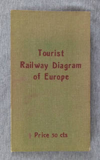
Tourist Railway Diagram of Europe Showing the Fares-Times-Distances Between Principal Cities Usually Visited By Americans
de Peters, Al
- Usado
- Bien
- Tapa dura
- Estado
- Bien/no jacket
- Librería
-
Spring Green, Wisconsin, United States
Formas de pago aceptadas
Sobre este artículo
Berlin: Hobbing & Co., 1910?. Hardcover. Good/no jacket. Green cloth over flexible card with red title, 7.5 in tall, folded map of Europe affixed to inside of rear cover. No date of publication given, the map configuration showing Bohemia as part of Austria indicates a pre-World War I date. The map, 22x23 in., shows the railway fares, times, and distances between cities. Also, transatlantic steamer ports are underlined in red, giving the name of steamship lines calling there. More detailed fare information for each country on reverse side. A clean map with 3 short tears at fold lines. Covers with brown tone at edges.
Reseñas
(¡Iniciar sesión or Crear una cuenta primero!)
Detalles
- Librería
- Sandhill Books
 (US)
(US)
- Inventario del vendedor #
- 002299
- Título
- Tourist Railway Diagram of Europe Showing the Fares-Times-Distances Between Principal Cities Usually Visited By Americans
- Autor
- Peters, Al
- Formato/Encuadernación
- Tapa dura
- Estado del libro
- Usado - Bien
- Estado de la sobrecubierta
- no jacket
- Cantidad disponible
- 1
- Editorial
- Hobbing & Co.
- Lugar de publicación
- Berlin
- Fecha de publicación
- 1910?
- Peso
- 0.00 libras
- Palabras clave
- railraod; railway; europe; map; trains
- Catálogos del vendedor
- Travel;
Términos de venta
Sandhill Books
Our book descriptions are guaranteed. If a book is not as described please send an email before returning the book. The full purchase price plus 2-way shipping will be refunded upon receipt of the book.
Sobre el vendedor
Sandhill Books
Miembro de Biblio desde 2006
Spring Green, Wisconsin
Sobre Sandhill Books
Browse our book shelves to find quality vintage and contemporary titles for your reading pleasure, academic interests, or to add to your collection. Please let me know if you want to see a photo. For any book that interests you, I can quickly email a photo or upload it to my Biblio.com listing.
Glosario
Algunos términos que podrían usarse en esta descripción incluyen:
- Jacket
- Sometimes used as another term for dust jacket, a protective and often decorative wrapper, usually made of paper which wraps...
- Edges
- The collective of the top, fore and bottom edges of the text block of the book, being that part of the edges of the pages of a...
- Cloth
- "Cloth-bound" generally refers to a hardcover book with cloth covering the outside of the book covers. The cloth is stretched...