Descripción:
Washington, D.C.: War Department, Office of the Chief of Engineers [Lithographed by Julius Bien, New York], 1869. First Edition. Prepared under the direction of Bvt. Brig. Gen. N. Michler, Major of Engineers, and Bvt. Lieut. Col. P.S. Michie, Capt. of Engineers. 16 maps on 17 sheets. All but one double-page. Folio (23-5/8 x 18-1/2 inches). Unbound sheets. Light stains at top edges of several maps, title with tape repair. First Edition. Prepared under the direction of Bvt. Brig. Gen. N. Michler, Major of Engineers, and Bvt. Lieut. Col. P.S. Michie, Capt. of Engineers. 16 maps on 17 sheets. All but one double-page. Folio (23-5/8 x 18-1/2 inches). The topographic maps comprise: 1A. Gettsburg to Appomattox Court House (northern) 1B Gettysburg to Appomattox Court House (southern) 2. Fredericksburg 3. Chancellorville, 4. The Wilderness 5. Spottsylvania 6. North Anna (single page) 7. Totopotomoy 8. Cold Harbor 9.. Richmond, 10. Bermuda Hundred 11. Petersburg and Five Forks 12. Jetersville and Sailor's…
Leer más Resultados de búsqueda: military maps illustrating the operations of
Has buscado:
- Título: military maps illustrating the operations of
- Autor: civil war
Resultados: 1 - 1 de 1
Más fotos
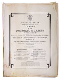
Military Maps Illustrating the Operations of the Armies of the Potomac & James, May 4th, 1864, to April 9th, 1865, Including Battlefields of the Wilderness, Spottsylvania, North Anna, Totopotomoy, Cold Harbor, the Siege of Petersburg and Richmond, Battlefield of Five Forks, Jetersville & Sailor's Creek, Highbridge, Farmville & Appomattox Court-House
de (Civil War) United States, War Department
- Usado
- First
- Estado
- Usado - Unbound sheets. Light stains at top edges of several maps, title with tape repair
- Edición
- First Edition
- Cantidad disponible
- 1
- Librería
-
New York, New York, United States
- Precio
-
EUR 2,361.50EUR 11.34 enviando a USA
Mostrar detalles
Precio
EUR 2,361.50
EUR 11.34
enviando a USA

¿No has encontrado lo que estabas buscando?
Prueba a añadir esta búsqueda a búsquedas guardadas Cada día se añaden millones de libros a Biblio. Cuando uno de ellos encaje con tu búsqueda, te enviaremos un correo para avisarte. Y lo mejor de todo, ¡es gratis!
Añadir a búsquedas guardadas

¿Eres un lector habitual o un coleccionista de libros?
Únete al Biblioclub y ahorra 10% en cada compra, ¡cada día! Hasta un máximo de 20$ en cada pedido

Responsabilidad social
¿Sabías que desde 2004 Biblio ha destinado sus beneficios a la construcción de 16 bibliotecas públicas en zonas rurales de Latinoamérica?
