Descripción:
Ordnance Survey, 1920. Paperback. Acceptable. 1920. Unpaginated. Orange and white pictorial paper cover. Cloth backed map is bright and clear, with light foxing and tanning. Slight creases to corners. Paper cover is moderately rub worn and thumbed with noticeable shelf wear to edges and corners.
Resultados de búsqueda: ordnance survey contoured road map of
Has buscado:
- Título: ordnance survey contoured road map of
- Autor: ordnance survey
Resultados: 1 - 20 de 83

Ordnance Survey Contoured Road Map of Windsor No 114
de Ordnance Survey
- Usado
- Aceptable
- Tapa blanda
- Estado
- Usado - Aceptable
- Encuadernación
- Paperback
- Cantidad disponible
- 1
- Librería
-
Goring-by-Sea, West Sussex, United Kingdom
- Precio
-
EUR 6.17EUR 7.19 enviando a USA
Mostrar detalles
Precio
EUR 6.17
EUR 7.19
enviando a USA

Ordnance Survey Contoured Road Map Of Pembroke And Tenby, Sheet 99
de Ordnance Survey
- Usado
- Bien
- Tapa blanda
- Estado
- Usado - Bien
- Encuadernación
- Paperback
- Cantidad disponible
- 1
- Librería
-
Goring-by-Sea, West Sussex, United Kingdom
- Precio
-
EUR 6.20EUR 7.19 enviando a USA
Mostrar detalles
Descripción:
Ordnance Survey, 1922. Paperback. Good. 1922. Popular Edition. Unpaginated. Card covers, paper map, without cloth backing. Map is clean with minimal wear at folds. Covers are clean with minimal rubbing and one slightly bent corner.
Precio
EUR 6.20
EUR 7.19
enviando a USA

Ordnance Survey Contoured Road Map of River Torridge and Disctrict Sheet 127
de Ordnance Survey
- Usado
- Aceptable
- Tapa blanda
- Estado
- Usado - Aceptable
- Encuadernación
- Paperback
- Cantidad disponible
- 1
- Librería
-
Goring-by-Sea, West Sussex, United Kingdom
- Precio
-
EUR 6.97EUR 7.19 enviando a USA
Mostrar detalles
Descripción:
Ordnance Survey, 1926. Paperback. Acceptable. 1926. No Edition Remarks. Unpaginated. Colour cloth bound map with pictorial paper covers. Map has light tanning and foxing overall. Paper cover has mild edgewear with curling to corners and reading creases. Pencil inscription to rear cover. Light tanning overall.
Precio
EUR 6.97
EUR 7.19
enviando a USA

Ordnance Survey Contoured Road Map of Blackburn, Sheet 32
de Ordnance Survey
- Usado
- Bien
- Tapa blanda
- Estado
- Usado - Bien
- Encuadernación
- Paperback
- Cantidad disponible
- 1
- Librería
-
Goring-by-Sea, West Sussex, United Kingdom
- Precio
-
EUR 8.50EUR 7.19 enviando a USA
Mostrar detalles
Descripción:
Ordnance Survey, 1929. Paperback. Good. 1929. No Edition Remarks. Unpaginated. Paper covered wraps and cloth back map panels. Splits and wear between panels. General wear to panels. Covers are rubbed and worn all over.
Precio
EUR 8.50
EUR 7.19
enviando a USA

Ordnance Survey Contoured Road Map of Watford
de Ordnance Survey
- Usado
- Bien
- Tapa blanda
- Estado
- Usado - Bien
- Encuadernación
- Paperback
- Cantidad disponible
- 1
- Librería
-
Goring-by-Sea, West Sussex, United Kingdom
- Precio
-
EUR 8.57EUR 7.19 enviando a USA
Mostrar detalles
Descripción:
Ordnance Survey, 1920. Paperback. Good. 1920. Unpaginated. Orange and white pictorial paperback. Cloth backed map is bright and clear, with light foxing and tanning. Slight creases to corners.
Precio
EUR 8.57
EUR 7.19
enviando a USA

Ordnance Survey Contoured Road Map Of Stow- On- The- Wold And District (Sheet 93)
de Ordnance Survey
- Usado
- Bien
- Tapa blanda
- Estado
- Usado - Bien
- Encuadernación
- Paperback
- Cantidad disponible
- 1
- Librería
-
Goring-by-Sea, West Sussex, United Kingdom
- Precio
-
EUR 8.60EUR 7.19 enviando a USA
Mostrar detalles
Descripción:
Ordnance Survey, 1919. Paperback. Good. 1919. Sheet 93. Unpaginated. Orange and white pictorial paperback. Cloth backed map is bright and clear, with light foxing and tanning. Slight creases to corners.
Precio
EUR 8.60
EUR 7.19
enviando a USA

Ordnance Survey Contoured Road Map Of Weald Of Kent Sheet 126
de Ordnance Survey
- Usado
- Aceptable
- Tapa blanda
- Estado
- Usado - Aceptable
- Encuadernación
- Paperback
- Cantidad disponible
- 1
- Librería
-
Goring-by-Sea, West Sussex, United Kingdom
- Precio
-
EUR 9.71EUR 7.19 enviando a USA
Mostrar detalles
Descripción:
Ordnance Survey, 1921. Paperback. Acceptable. 1921. No Edition Remarks. Unpaginated. Colour cloth bound map with pictorial paper covers. Map has light tanning overall. Paper cover has moderate edgewear with small tears and creasing. Slight curling to corners. Medium tanning overall.
Precio
EUR 9.71
EUR 7.19
enviando a USA

Ordnance Survey Contoured Road Map of Land's End and Lizard. Popular Edition. Sheet 146;
de Ordnance Survey
- Usado
- Tapa blanda
- Estado
- Usado
- Encuadernación
- Paperback
- Cantidad disponible
- 1
- Librería
-
Selkirk, United Kingdom
- Precio
-
EUR 11.99EUR 11.93 enviando a USA
Mostrar detalles
Descripción:
Southampton Ordnance Survey, nd ( c 1926);. Softcover. Good+ condition. Linen-backed folded map in pictorial card covers. Scale 1 mile to the inch. Full colour road map with contours. Map is clean, lightly rubbed at folds. .
Precio
EUR 11.99
EUR 11.93
enviando a USA

ORDNANCE SURVEY CONTOURED ROAD MAP OF SIDMOUTH AND BRIDPORT Popular edition Scale 1 inch to 1 mile- Sheet # 139
de Ordnance Survey
- Usado
- Muy bueno
- Estado
- Usado - Muy bueno
- Cantidad disponible
- 1
- Librería
-
Blue Hill, Maine, United States
- Precio
-
EUR 18.78EUR 5.63 enviando a USA
Mostrar detalles
Descripción:
Southampton: Ordnance Survey Office/ Charles Close Dir., 1924. Map. Very Good. 4 X 7 in. high. unfolds to 30 X 21 inches. Condition of the book is VERY GOOD; Map is very clean, lightly rubbed at folds, but no splits or tears. Geography Ephemera
Precio
EUR 18.78
EUR 5.63
enviando a USA
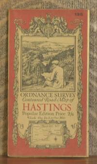
ORDNANCE SURVEY CONTOURED ROAD MAP OF HASTINGS Popular edition Scale 1 inch to 1 mile- Sheet # 135
de Ordnance Survey
- Usado
- Muy bueno
- Estado
- Usado - Muy bueno
- Edición
- Third revised edition
- Cantidad disponible
- 1
- Librería
-
Blue Hill, Maine, United States
- Precio
-
EUR 18.78EUR 5.63 enviando a USA
Mostrar detalles
Descripción:
Southampton: Ordnance Survey Office/ Charles Close Dir., 1921. Third revised edition. Map. Very Good. 4 X 7 in. high. unfolds to 30 X 21 inches. Condition of the book is VERY GOOD; Map is very clean, lightly rubbed at folds, but no splits or tears. Geography Ephemera
Precio
EUR 18.78
EUR 5.63
enviando a USA
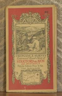
ORDNANCE SURVEY CONTOURED ROAD MAP OF STRATFORD-on-AVON AND DISTRICT Popular edition Scale 1 inch to 1 mile- Sheet # 82
de Ordnance Survey
- Usado
- Muy bueno
- Estado
- Usado - Muy bueno
- Edición
- Third revised edition
- Cantidad disponible
- 1
- Librería
-
Blue Hill, Maine, United States
- Precio
-
EUR 18.78EUR 5.63 enviando a USA
Mostrar detalles
Descripción:
Southampton: Ordnance Survey Office/ Charles Close Dir., 1930. Third revised edition. Map. Very Good. 4 X 7 in. high. unfolds to 29 1/2 X 22 inches. Condition of the book is VERY GOOD; Map is very clean, lightly rubbed at folds, but no splits or tears. Geography Ephemera
Precio
EUR 18.78
EUR 5.63
enviando a USA
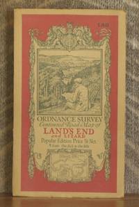
ORDNANCE SURVEY CONTOURED ROAD MAP OF LAND'S END AND LIZARD Popular edition Scale 1 inch to 1 mile- Sheet # 146
de Ordnance Survey
- Usado
- Muy bueno
- Estado
- Usado - Muy bueno
- Edición
- Third revised edition
- Cantidad disponible
- 1
- Librería
-
Blue Hill, Maine, United States
- Precio
-
EUR 18.78EUR 5.63 enviando a USA
Mostrar detalles
Descripción:
Southampton: Ordnance Survey Office/ Charles Close Dir., 1931. Third revised edition. Map. Very Good. 4 X 7 in. high. unfolds to 34 1/2 X 28 inches. Condition of the book is VERY GOOD; Map is very clean, lightly rubbed at folds, but no splits or tears. Geography Ephemera
Precio
EUR 18.78
EUR 5.63
enviando a USA

ORDNANCE SURVEY CONTOURED ROAD MAP OF PEMBROKE AND TENBY Popular edition Scale 1 inch to 1 mile- Sheet # 99
de Ordnance Survey
- Usado
- Muy bueno
- Estado
- Usado - Muy bueno
- Edición
- Third revised edition
- Cantidad disponible
- 1
- Librería
-
Blue Hill, Maine, United States
- Precio
-
EUR 18.78EUR 5.63 enviando a USA
Mostrar detalles
Descripción:
Southampton: Ordnance Survey Office/ Charles Close Dir., 1930. Third revised edition. Map. Very Good. 4 X 7 in. high. unfolds to 38 X 24 1/2 inches. Condition of the book is VERY GOOD; Map is very clean, lightly rubbed at folds, but no splits or tears. Geography Ephemera
Precio
EUR 18.78
EUR 5.63
enviando a USA
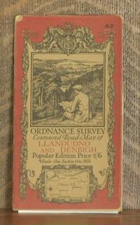
ORDNANCE SURVEY CONTOURED ROAD MAP OF LLANDUDNO AND DENBIGH Popular edition Scale 1 inch to 1 mile- Sheet # 42
de Ordnance Survey
- Usado
- Muy bueno
- Estado
- Usado - Muy bueno
- Edición
- Third revised edition
- Cantidad disponible
- 1
- Librería
-
Blue Hill, Maine, United States
- Precio
-
EUR 18.78EUR 5.63 enviando a USA
Mostrar detalles
Descripción:
Southampton: Ordnance Survey Office/ Charles Close Dir., 1928. Third revised edition. Map. Very Good. 4 X 7 in. high. unfolds to 30 X 25 inches. Condition of the book is VERY GOOD; Map is very clean, lightly rubbed at folds, but no splits or tears. Geography Ephemera
Precio
EUR 18.78
EUR 5.63
enviando a USA
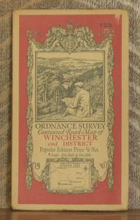
ORDNANCE SURVEY CONTOURED ROAD MAP OF WINCHESTER AND DISTRICT Popular edition Scale 1 inch to 1 mile- Sheet # 123
de Ordnance Survey
- Usado
- Muy bueno
- Estado
- Usado - Muy bueno
- Edición
- Third revised edition
- Cantidad disponible
- 1
- Librería
-
Blue Hill, Maine, United States
- Precio
-
EUR 18.78EUR 5.63 enviando a USA
Mostrar detalles
Descripción:
Southampton: Ordnance Survey Office/ Charles Close Dir., 1931. Third revised edition. Map. Very Good. 4 X 7 in. high. unfolds to 29 1/2 X 22 inches. Condition of the book is VERY GOOD; Map is very clean, lightly rubbed at folds, but no splits or tears. Geography Ephemera
Precio
EUR 18.78
EUR 5.63
enviando a USA
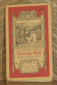
ORDNANCE SURVEY CONTOURED ROAD MAP OF TUNBRIDGE WELLS Popular edition Scale 1 inch to 1 mile- Sheet # 125
de Ordnance Survey
- Usado
- Muy bueno
- Estado
- Usado - Muy bueno
- Edición
- Third revised edition
- Cantidad disponible
- 1
- Librería
-
Blue Hill, Maine, United States
- Precio
-
EUR 18.78EUR 5.63 enviando a USA
Mostrar detalles
Descripción:
Southampton: Ordnance Survey Office/ Charles Close Dir., 1930. Third revised edition. Map. Very Good. 4 X 7 in. high. unfolds to 29 1/2 X 22 inches. Condition of the book is VERY GOOD; Map is very clean, lightly rubbed at folds, but no splits or tears. Geography Ephemera
Precio
EUR 18.78
EUR 5.63
enviando a USA
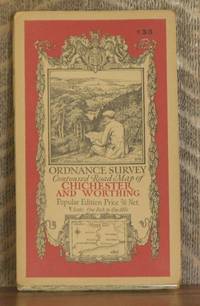
ORDNANCE SURVEY CONTOURED ROAD MAP OF CHICHESTER AND WORTHING Popular edition Scale 1 inch to 1 mile- Sheet # 133
de Ordnance Survey
- Usado
- Muy bueno
- Estado
- Usado - Muy bueno
- Edición
- Third revised edition
- Cantidad disponible
- 1
- Librería
-
Blue Hill, Maine, United States
- Precio
-
EUR 18.78EUR 5.63 enviando a USA
Mostrar detalles
Descripción:
Southampton: Ordnance Survey Office/ Charles Close Dir., 1929. Third revised edition. Map. Very Good. 4 X 7 in. high. unfolds to 29 1/2 X 22 inches. Condition of the book is VERY GOOD; Map is very clean, lightly rubbed at folds, but no splits or tears. Geography Ephemera
Precio
EUR 18.78
EUR 5.63
enviando a USA
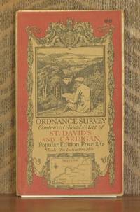
ORDNANCE SURVEY CONTOURED ROAD MAP OF ST. DAVID'S AND CARDIGAN Popular edition Scale 1 inch to 1 mile- Sheet # 88
de Ordnance Survey
- Usado
- Muy bueno
- Estado
- Usado - Muy bueno
- Cantidad disponible
- 1
- Librería
-
Blue Hill, Maine, United States
- Precio
-
EUR 18.78EUR 5.63 enviando a USA
Mostrar detalles
Descripción:
Southampton: Ordnance Survey Office/ E.M. Jack Dir., 1923. Map. Very Good. 4 X 7 in. high. unfolds to 36 X 23 1/2 inches. Condition of the book is VERY GOOD; Map is very clean, lightly rubbed at folds, but no splits or tears. Geography Ephemera
Precio
EUR 18.78
EUR 5.63
enviando a USA

ORDNANCE SURVEY CONTOURED ROAD MAP OF BISHOP'S CASTLE POPULAR EDITION , MOUNTED IN SECTIONS
de DIRECTOR GENERAL ORDNANCE SURVEY
- Usado
- Muy bueno
- Tapa blanda
- First
- Estado
- Usado - Muy bueno
- Encuadernación
- Paperback
- Cantidad disponible
- 1
- Librería
-
Brighton, East Sussex, United Kingdom
- Precio
-
EUR 10.79EUR 14.15 enviando a USA
Mostrar detalles
Descripción:
SOUTHAMPTON: Ordnance Survey Office, 1920 First printed in 1920, this is a reprint from 1935 (print code 2000/35) .price 4/-. Sheet 70.Scale 1 inch to 1 mile.Mounted in sections on linen and folded in the original covers, with a front cover illustration by Ellis Martin. VG (Covers- Light chafing to the edges of the covers and previous owner's initials in ink to top margin of front. No notable soiling. Face of map clean with no notable wear or soiling. cloth backing, Covers Montgomery, Newtown, Church Stretton, Clun, Knighton, Craven Arms and Ludlow. Please see our image of the actual map offered for sale. We are pleased to be able to offer the option of card payment at our website where additional images of the item may also be available.
Precio
EUR 10.79
EUR 14.15
enviando a USA

Ordnance Survey Contoured One Inch to One Mile Road Map of Pickering and Thirsk, Sheet 22
de The Ordnance Survey
- Usado
- Bien
- Tapa blanda
- Estado
- Usado - Bien
- Encuadernación
- Paperback
- Cantidad disponible
- 1
- Librería
-
Goring-by-Sea, West Sussex, United Kingdom
- Precio
-
EUR 18.46EUR 7.19 enviando a USA
Mostrar detalles
Descripción:
The Ordnance Survey, 1924. Paperback. Good. 1924. No edition remarks. Unpaginated. Pictorial paper cover enclosing colour map on cloth. Pages remain bright and clean with minimal tanning and foxing. Paper cover has mild edge-wear with light rubbing and creasing. Some mild marking and tanning. Previous owner's name on front.
Precio
EUR 18.46
EUR 7.19
enviando a USA

¿No has encontrado lo que estabas buscando?
Prueba a añadir esta búsqueda a búsquedas guardadas Cada día se añaden millones de libros a Biblio. Cuando uno de ellos encaje con tu búsqueda, te enviaremos un correo para avisarte. Y lo mejor de todo, ¡es gratis!
Añadir a búsquedas guardadas

¿Eres un lector habitual o un coleccionista de libros?
Únete al Biblioclub y ahorra 10% en cada compra, ¡cada día! Hasta un máximo de 20$ en cada pedido

Responsabilidad social
¿Sabías que desde 2004 Biblio ha destinado sus beneficios a la construcción de 16 bibliotecas públicas en zonas rurales de Latinoamérica?
