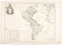
South America from Donald Heald Rare Books
Novedades

Más fotos
A Map of the British Empire in America, with the French and Spanish Settlements Adjacent Thereto
de POPPLE, Henry (1695-1743, Cartographer). TOMS, William Henry (c.1700-1765, Engraver), BARON, Bernard (c.1700-1766, Engraver), SEARLE, Richard William (1732-1785, Engraver)
- Estado
- Usado
- Published
- 1734
- Encuadernación
- Folio
- Cantidad disponible
- 1
- Librería
-
New York, New York, USA
- Precio
-
EUR 155,017.50
Mostrar detalles
Descripción:
London: Sold by the Proprietors S[amuel] Harding on the Pavement in St. Martins Lane, and W[illiam] H[enry] Toms, Engraver in Union Court near Hatton Garden Holborn, 1734. Folio. (21 x 15 inches). Engraved folding key map in Babinski State 4, showing the track line of Spanish Galleons. Large engraved wall map on 15 double-page and 5 full-page map sheets,… Saber más sobre este artículo Precio
EUR 155,017.50

Más fotos
Isla de Cuba Pintoresca. Collection de Vistas Generales
de BARANANO, Leonardo (1837-1858) and LAPLANTE, Edouardo (1818-1860)
- Estado
- Usado
- Published
- 1856
- Cantidad disponible
- 1
- Librería
-
New York, New York, USA
- Precio
-
EUR 42,277.50
Mostrar detalles
Descripción:
Havana: Santiago Martín, 1856. 8 lithographs, printed in colour and finished by hand, within ruled borders. Sheet size: 20 5/8 x 31 7/8 inches. Very rare series of large coloured lithographs of colonial Cuban towns and harbours.
The sought-after collection of Cuban prints, the majority drawn by Barañano, and lithographed by Laplante, comprises the following topographical views, with… Saber más sobre este artículo Precio
EUR 42,277.50
![Brasilia et Peruvia. Ad Strenuu et Magnificu Dnm. D. Theodoricu Echter a Mesthelbru, Sac. Caes. Maiesti. & Reverediss. Principi, Episc. Herbipolesi, primu a confilijs. &c. [Brazil and Peru. To the vigorous and magnificent Theodoricus Echter of Mespelbrunn, Sacred, Caesar, Majestic and Most Revered Prince Bishop of Herbipolis [Würzburg], first among advisers, &c.]](https://d3525k1ryd2155.cloudfront.net/h/763/335/1297335763.1.m.jpg)
Brasilia et Peruvia. Ad Strenuu et Magnificu Dnm. D. Theodoricu Echter a Mesthelbru, Sac. Caes. Maiesti. & Reverediss. Principi, Episc. Herbipolesi, primu a confilijs. &c. [Brazil and Peru. To the vigorous and magnificent Theodoricus Echter of Mespelbrunn, Sacred, Caesar, Majestic and Most Revered Prince Bishop of Herbipolis [Würzburg], first among advisers, &c.]
de DE JODE, Cornelis (1568-1600, Cartographer)
- Estado
- Usado
- Published
- 1593
- Encuadernación
- Map
- Cantidad disponible
- 1
- Librería
-
New York, New York, USA
- Precio
-
EUR 8,925.25
Mostrar detalles
Descripción:
Antwerp, 1593. Map. Hand-colored copperplate engraved map. Provenance: The Goodyear Collection
Hand-colored example of De Jode's important early map of South America, based on Petrus Plancius's wall map of the world, published in 1592.
De Jode's map of South America is one of the earliest maps to focus on the continent of South America, and is the… Saber más sobre este artículo Precio
EUR 8,925.25

America sive India Nova ad magnae Gerardi Mercatoris avi Universalis imitationem in compendium redacta
de MERCATOR, Michael (1565/70-1614)
- Estado
- Usado
- Published
- 1628
- Cantidad disponible
- 1
- Librería
-
New York, New York, USA
- Precio
-
EUR 4,462.62
Mostrar detalles
Descripción:
[Amsterdam: Hondius, circa, 1628. Copper-engraved map, early hand-colouring. French text on verso. Roundels at each corner with inset maps of the Gulf of Mexico, Cuba and Hispaniola, the remaining containing the cartouche. (Expert restoration at sheet edges). A fine example of one of the most celebrated maps of the Americas, the only printed map by Gerard Mercator's grandson Michael.
… Saber más sobre este artículo Precio
EUR 4,462.62

Venezuela, cum parte Australi Nova Andalusiae
de BLAEU, Willem (1571-1638) and Jan BLAEU (1596-1673)
- Estado
- Usado
- Published
- 1640
- Cantidad disponible
- 1
- Librería
-
New York, New York, USA
- Precio
-
EUR 798.58
Mostrar detalles
Descripción:
Amsterdam, 1640. Engraved map, period hand-colouring in outline. French text on verso. Sheet size: 19 5/8 x 23 1/4 inches. A fine 17th century map of Venezuela and the Lesser Antilles.
In the seventeenth century, the Dutch hegemony in ship building and navigation engendered their dominance in mapmaking. At the lead of this field was the Blaeu family.… Saber más sobre este artículo Precio
EUR 798.58

L'Amerique ou Le Nouveau Continent dressee sur les Memoires les plus nouveaux et sur les Relations les plus recentes, rectifiez sur les dernieres observations. Dediée et Presentée a Monseigneur Law
de NOLIN II, Jean-Baptiste (1686-1762)
- Estado
- Usado
- Published
- 1742
- Cantidad disponible
- 1
- Librería
-
New York, New York, USA
- Precio
-
EUR 2,113.88
Mostrar detalles
Descripción:
Paris: chés l'Auteur rue St. Jacques à l'Enseigne de la Place des Victoires, 1742. Copper-engraved map, period hand colouring in outline. A rare depiction of the mythical Sea of the West.
This unusual mapping of North and South America, dedicated to John Law of Mississippi Bubble infamy, includes several mythical elements, including the Sea of the West, Florida… Saber más sobre este artículo Precio
EUR 2,113.88

Más fotos
Carte de l'Amerique corrigee et augmentee dessus Toutes les aultres cy devant faictes par P. Bertius
de TAVERNIER, Melchior (1564-1641)
- Estado
- Usado
- Published
- 1627
- Cantidad disponible
- 1
- Librería
-
New York, New York, USA
- Precio
-
EUR 2,348.75
Mostrar detalles
Descripción:
[Paris, 1627. Copper-engraved map, insets of polar regions. Scarce first state of Tavernier's separately-issued map of North America, including insets of the Arctic and Antarctic regions.
In 1627, Tavernier, the most important mapseller and publisher in France, published a set of the four continents after Bertius, though possibly without his permission. Although crediting Bertius, the map more closely… Saber más sobre este artículo Precio
EUR 2,348.75
Más fotos
L'Amerique suivant le R. P. Charlevoix J.te, Mr. De La Condamine, et plusiers autres nouv.le observations
de LE ROUGE, Georges Louis (1712-90)
- Estado
- Usado
- Published
- 1746
- Cantidad disponible
- 1
- Librería
-
New York, New York, USA
- Precio
-
EUR 1,691.10
Mostrar detalles
Descripción:
Paris, 1746. Copper-engraved map, period hand-colouring in outline. Table at the bottom left. Mid-18th century French map of North and South America showing the latest Russian and English discoveries in the Arctic: one of the earliest depictions of the discoveries of Bering's second expedition.
This decorative map by Le Rouge shows North and South America, with the discoveries… Saber más sobre este artículo Precio
EUR 1,691.10

Más fotos
America Aurea Pars Alter Mundi Auctoribus
de VALK, Gerard (c.1650-1726) & Leonard VALK (1675-1755)
- Estado
- Usado
- Published
- 1700
- Cantidad disponible
- 1
- Librería
-
New York, New York, USA
- Precio
-
EUR 2,583.62
Mostrar detalles
Descripción:
Amsterdam, 1700. Copper-engraved map, full period hand-colouring. Highly decorative map of North and South America showing California as an island and here with full period hand colouring.
This decorative map by the Valk brothers is after a similar map by Carol Allard, first published circa 1696. Cartographically, both Allard and the Valks borrow heavily from the De Wit… Saber más sobre este artículo Precio
EUR 2,583.62

Más fotos
Recentissima Novi Orbis, Sive Americae Septentrionalis et Meridionalis Tabula
de ALLARD, Carol (1648-1709)
- Estado
- Usado
- Published
- 1697
- Cantidad disponible
- 1
- Librería
-
New York, New York, USA
- Precio
-
EUR 1,691.10
Mostrar detalles
Descripción:
Amsterdam, 1697. Copper-engraved map. Small inset of New Zealand within the cartouche. Rare issue of Allard's map of North and South America, the first to show important corrections to the mapping of the Great Lakes and the Mississippi River Valley.
"The map of America by Allard is derived from that of Frederick de Wit, c. 1675" (Burden). Significantly,… Saber más sobre este artículo Precio
EUR 1,691.10

Más fotos
Carte Générale de L'Amérique
de PALAIRET, Jean (1697-1774)
- Estado
- Usado
- Published
- 1754
- Cantidad disponible
- 1
- Librería
-
New York, New York, USA
- Precio
-
EUR 563.70
Mostrar detalles
Descripción:
London: Nourse, Vaillant, Millar, Rocque & Sayer, 1754. Copper-engraved map, with full original colour, in very good condition. A highly decorative map of the Americas, evincing Palairet's uniquely elegant aesthetic style
This artistically virtuous map embraces the entirety of North and South America, and also takes in the western extremities of Europe and Africa. South America is very… Saber más sobre este artículo Precio
EUR 563.70

Más fotos
Carte D'Amerique Dressée pour l'Usage du Roy...1739. America Accurate in Imperia, Regna, Status & Populos Divisa, ad Usum Ludovici XV, Galliarum Regis
de DE L'ISLE, Guillaume and Covens & Mortier
- Estado
- Usado
- Published
- 1742
- Cantidad disponible
- 1
- Librería
-
New York, New York, USA
- Precio
-
EUR 751.60
Mostrar detalles
Descripción:
Amsterdam: Covens & Mortier, 1742. Engraving with period outline colour. Some mild soiling. Discolouration at centerfold. An elegant map of North and South America, the most accurate to date, produced for the "usage du Roy," Louis XV.
Guillaume de l'Isle (1675-1726) was the son of a cartographer and pupil of Jean Dominique Cassini, who, among other important contributions,… Saber más sobre este artículo Precio
EUR 751.60
