Cartography from Leopolis Volodymyr Dmyterko
Novedades

Imago Lithuaniae. Lietuvos Didžiosios Kunigaiǩstystès žemèlapiai ir dokumentai iš Tomaszo Niewodniczańskio rinkiniu
de Niewodniczański,Tomasz; Braziūnienė, Alma; Linka, Kazys
- Estado
- Usado - Fine
- Published
- 2002
- Encuadernación
- Soft cover
- ISBN
- 9789986092445
- Cantidad disponible
- 1
- Librería
-
Kraków, POL
- Precio
-
EUR 222.49
Mostrar detalles
Descripción:
Vilnius: Magi Raštai, 2002 4to (25.5 cm), 224 pp. Laminated wrappers with flaps. In Lithuanian, Polish, and English. This publication features maps and documents from the Grand Duchy of Lithuania, sourced from the collections of Tomasz Niewodczański (1933-2010), a Polish physicist, entrepreneur, collector, and bibliophile. He assembled one of the world's largest private cartographic collections. Precio
EUR 222.49

Imago Mundi The Journal of the International Society for the History of Cartography Volume 44
- Estado
- Usado - Very Good
- Published
- 1992
- Encuadernación
- Hardcover
- ISBN
- 9780905776170
- Cantidad disponible
- 1
- Librería
-
Kraków, POL
- Precio
-
EUR 56.21
Mostrar detalles
Descripción:
London: Imago Mundi, Ltd., 1992 4to (30.5 cm), frontispiece in color, 178 pp. Publisher's cloth, gilt-lettered spine and front board (binding slightly rubbed and stained, bookplate tipped in verso of the title page). Contents include articles: "A Tibetan map of lHo-kha in the South-Eastern Himalayan borderlands of Tibet" by Toni Huber; "The Aslake world map" by Peter M. Barber &… Saber más sobre este artículo Precio
EUR 56.21

Materiały do słownika kartografów i geodetów polskich. Archiwalia z dawnej Pracowni Historii Geografii i Kartografii Bolesława Olszewicza
- Estado
- Usado - Very Good
- Published
- 1999
- Encuadernación
- Soft cover
- ISBN
- 9788390897387
- Cantidad disponible
- 1
- Librería
-
Kraków, POL
- Precio
-
EUR 9.37
Mostrar detalles
Descripción:
Warsaw: Retro-Art, 1999 8vo (23.5 cm), 201, [1] pp. Laminated wrappers. In Polish. Materials for the dictionary of Polish cartographers and surveyors. Archives from the former Workshop of the History of Geography and Cartography of Bolesław Olszewicz edited by Jan Szeliga and Wiesława Wernerowa == Przygotowali do druku Jan Szeliga i Wiesława Wernerowa. Instytut Historii Nauki PAN. Zespół Historii Kartografii,… Saber más sobre este artículo Precio
EUR 9.37

Más fotos
Dorobek polskiej historii kartografii
- Estado
- Usado - Good
- Published
- 1993
- Encuadernación
- Soft cover
- Cantidad disponible
- 1
- Librería
-
Kraków, POL
- Precio
-
EUR 7.03
Mostrar detalles
Descripción:
Warsaw: Polska Akademia Nauk; Instytut Historii Nauki, Oświaty i Techniki, 1993 8vo (24 cm), 137, [1] pp. Printed wrappers and dust jacket (dj slightly rubbed, 3 articles at the beginning loose and each stapled at the top). In Polish with abstracts and contents in English. For contents see scan == Zawiera 7 rozpraw: Edward Schnayder, Profesor dr Karol Buczek (1902-1983)… Saber más sobre este artículo Precio
EUR 7.03

Ukraine on old maps: The end of 15th - first half of 17th c.
de Vavrychyn, Mariya
- Estado
- New
- Published
- 2006
- Encuadernación
- Hardcover
- ISBN
- 9789666315260
- Cantidad disponible
- 1
- Librería
-
Kraków, POL
- Precio
-
EUR 140.52
Mostrar detalles
Descripción:
Kyyiv: Kartohrafiya, 2006 4to (32 cm), 208 pp. Publisher's laminated boards. Text in English and Ukrainian. The publication includes descriptions and reproductions of 80 maps of Ukraine dating from the 15th to the first half of the 17th century, sourced from collections held in Lviv libraries. Precio
EUR 140.52

Ukraine on old maps: From the mid-17th to second half of 18th c.
de Vavrychyn, Mariya
- Estado
- New
- Published
- 2009
- Encuadernación
- Hardcover
- ISBN
- 9789664754443
- Cantidad disponible
- 1
- Librería
-
Kraków, POL
- Precio
-
EUR 140.52
Mostrar detalles
Descripción:
Kyiv: Kartohrafiya, 2009 4to (32 cm), 224 pp. Publisher's laminated boards. Text in English and Ukrainian. Descriptions and reproductions of 86 maps of Ukraine dating from the middle of the 17th to the 18th century are featured in this publication, drawn from the collections of libraries in Lviv. Precio
EUR 140.52

Atlas Antoniusa Milla: Geographicae tabulae in charta pergamena z 1583 roku
de Bykuc, Ewelina; Szaniawska, Lucyna; Wozniak, Maria
- Estado
- New
- Published
- 2015
- Encuadernación
- Hardcover
- Cantidad disponible
- 1
- Librería
-
Kraków, POL
- Precio
-
EUR 56.21
Mostrar detalles
Descripción:
Warsaw: Biblioteka Narodowa, 2015 4to (33.5 cm), 88 pp, 8 folding charts. In Polish. A facsimile reprint with extensive commentaries of a portolan atlas produced in 1583 by Antonio Millo (da Millo, or from Milos), a Greek cartographer active in Venice in the second half of 16th century. The manuscript is preserved in the Polish National Library. Precio
EUR 56.21

Cartography in France, 1660-1848: Science, Engineering, and Statecraft
de Konvitz, Josef
- Estado
- Usado - Near Fine
- Published
- 1987
- Encuadernación
- Hardcover
- ISBN
- 9780226450940
- Cantidad disponible
- 1
- Librería
-
Kraków, POL
- Precio
-
EUR 105.39
Mostrar detalles
Descripción:
University Of Chicago Press, 1987 4to (25.5 cm), XX, 194 pp, 5 plates. Publisher's cloth and dust jacket (minor shelf-wear, bookplate pasted on the front pastdown, collector's blind stamp on the title page). "French scientists, engineers, and public officials were responsible for the most important and distinctive innovations in cartography in eighteenth-century Europe. By expanding the analytical uses of maps,… Saber más sobre este artículo Precio
EUR 105.39

Collecting Antique Maps: An Introduction to the History of Cartography
de Potter, Jonathan
- Estado
- Usado - Fine
- Estado de la sobrecubierta
- Good
- Edición
- 4th Edition
- Published
- 2001
- Encuadernación
- Hardcover
- ISBN
- 9780951157763
- Cantidad disponible
- 1
- Librería
-
Kraków, POL
- Precio
-
EUR 28.10
Mostrar detalles
Descripción:
London: Jonathan Potter Limited, 2001 4to (30 cm), 220 pp. Publisher's cloth and dust jacket. One of the best introduction to the map collecting and the history of cartography. Precio
EUR 28.10

A Renaissance Globemaker's Toolbox: Johannes Schöner and the Revolution of Modern Science 1475-1550
de Hessler, John W.
- Estado
- Usado - Fine
- Published
- 2013
- Encuadernación
- Hardcover
- ISBN
- 9781907804168
- Cantidad disponible
- 1
- Librería
-
Kraków, POL
- Precio
-
EUR 22.25
Mostrar detalles
Descripción:
D Giles, 2013 Oblong 8vo (20 x 23.5 cm), 176 pp. Publisher's cloth and dust jacket (minor shelf-wear). The first full study in the English language to give context to the extraordinary life and seminal work of the Nuremburg mathematician, cartographer and scientist Johannes Schöner (d. 1543). Schöner's collection of maps and notes offers an unprecedented insight into cartographic development… Saber más sobre este artículo Precio
EUR 22.25
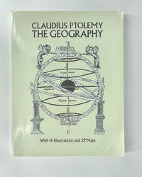
The Geography
de Ptolemy, Claudius
- Estado
- Usado - Very Good
- Published
- 1991
- Encuadernación
- Soft cover
- ISBN
- 9780486268965
- Cantidad disponible
- 1
- Librería
-
Kraków, POL
- Precio
-
EUR 46.84
Mostrar detalles
Descripción:
Dover Publications, 1991 4to (31 cm), XVI, 288 pp. Laminated wrappers (corners slightly bumped, collector's stamps on half-title and title). Unabridged Dover republication of Geography of Claudius Ptolemy, published in a limited edition of 250 copies by the New York Public Library in 1932. Precio
EUR 46.84

Mapping the Silk Road and Beyond
de Nebenzahl, Kenneth
- Estado
- Usado - Near Fine
- Published
- 2004
- Encuadernación
- Hardcover
- ISBN
- 9780714844091
- Cantidad disponible
- 1
- Librería
-
Kraków, POL
- Precio
-
EUR 81.97
Mostrar detalles
Descripción:
Phaidon Press, 2004 Oblomg 4to (30 x 26 cm), 176 pp. Publisher's boards and dust jacket (dj slightly rubbed at extremities). "Mapping Asia presents an authoritative selection of the most important antique maps of Asia representing time periods from the age of Alexander the Great to the early nineteenth century, and spanning the area from the Middle East to Japan.… Saber más sobre este artículo Precio
EUR 81.97
![Magyar várak, városok, falvak metszeteken. 1515 - 1800 [3 volumes, complete set]](https://d3525k1ryd2155.cloudfront.net/h/141/385/1525385141.0.m.jpg)
Magyar várak, városok, falvak metszeteken. 1515 - 1800 [3 volumes, complete set]
de Szalai, Bela; Szantai, Lajos
- Estado
- As New
- Published
- 2006
- Encuadernación
- Hardcover
- ISBN
- 9789638734631
- Cantidad disponible
- 1
- Librería
-
Kraków, POL
- Precio
-
EUR 409.85
Mostrar detalles
Descripción:
Budapest, 2006 3 volumes 4to (33.5 cm), 156 pp, 334 plates; 164 pp, 341 plates; 184 pp, 99 plates. Publisher's cloth and dust jackets (minor shelf-wear). A comprehensive bibliography of views depicting Hungarian castles, towns, and villages up to the year 1800. Volume 1 encompasses 2,200 views capturing 94 towns within the present-day borders of Hungary. Volume 2 presents 1,986… Saber más sobre este artículo Precio
EUR 409.85

Lithuania on the Map
- Estado
- Usado - Fine
- Published
- 2002
- Encuadernación
- Hardcover
- ISBN
- 9789955415244
- Cantidad disponible
- 1
- Librería
-
Kraków, POL
- Precio
-
EUR 81.97
Mostrar detalles
Descripción:
Vilnus: Nathional Museum of Lithuania, 2002 4to (31 cm), 220 pp. Publisher's cloth and dust jacket. With this publications an attempt has been made to reflect, through cartographic images, the historical development of Lithuania from the first map to mention Baltic tribes to the restoration of Lithuanian state at the end of the 20th century. Precio
EUR 81.97
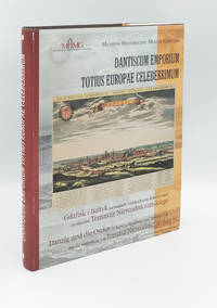
Dantiscum Emporium Totius Europae Celeberrimum. Danzig und die Ostsee in Karten, Ansichten und Dokumenten aus der Sammlung von Tomasz Niewodniczanski
de Kozica K.; Pezda J.
- Estado
- Usado - Fine
- Estado de la sobrecubierta
- Near Fine
- Published
- 2005
- Encuadernación
- Hardcover
- ISBN
- 9788391861080
- Cantidad disponible
- 1
- Librería
-
Kraków, POL
- Precio
-
EUR 105.39
Mostrar detalles
Descripción:
Gdańsk: Muzeum Historyczne Miasta Gdańska, 2005 4to (31.5 cm), 490 pp. Publisher's cloth and dust jacket (minor shelf-wear). Catalogue of an exhibition held in Gdansk in October, 2004 - January, 2005. In German and Polish. Maps, views and documents from a collection of Polish physicist, entrepreneur, collector and bibliophile Tomasz Niewodczański (1933-2010), relating to Gdańsk and the Baltic Sea. Precio
EUR 105.39

Metro Maps of the World
de Ovenden, Mark
- Estado
- Usado - Fine
- Published
- 2003
- Encuadernación
- Hardcover
- ISBN
- 9781854142726
- Cantidad disponible
- 1
- Librería
-
Kraków, POL
- Precio
-
EUR 18.74
Mostrar detalles
Descripción:
Capital Transport Publishing, 2003 Oblong 4to (28.5 x 25 cm), 136 pp. Laminated boards. Precio
EUR 18.74
![Imago Poloniae. Dawna Rzeczpospolita na mapach, dokumentach i starodrukach w zbiorach Tomasza Niewodniczańskiego = Das Polnisch-Litauische Reich in Karten, Dokumenten und alten Drucken. 2 vol. [complete set]](https://d3525k1ryd2155.cloudfront.net/h/947/384/1525384947.0.m.jpg)
Más fotos
Imago Poloniae. Dawna Rzeczpospolita na mapach, dokumentach i starodrukach w zbiorach Tomasza Niewodniczańskiego = Das Polnisch-Litauische Reich in Karten, Dokumenten und alten Drucken. 2 vol. [complete set]
- Estado
- Usado - Fine
- Published
- 2002
- Encuadernación
- Hardcover
- Cantidad disponible
- 1
- Librería
-
Kraków, POL
- Precio
-
EUR 339.59
Mostrar detalles
Descripción:
Warsaw: Agencja Reklamowo-Wydawnicza Arkadiusz Grzegorczyk, 2002 2 volumes 4to (33.5 cm), 388 pp; 324 pp. Laminated boards (minor shelf-wear). Tomasz Niewodczański (1933-2010), a Polish physicist, entrepreneur, collector, and bibliophile, assembled one of the world's largest private cartographic collections. "Imago Poloniae" serves as a catalog for the Polish-Lithuanian segment of the collection, now housed in the library of the Royal Castle… Saber más sobre este artículo Precio
EUR 339.59
![Atlas Hungaricus, 1528-1850: Magyarorszag nyomtatott terkepei = Hungary in printed maps. Volume 1-2 [complete set]](https://d3525k1ryd2155.cloudfront.net/h/923/384/1525384923.0.m.jpg)
Atlas Hungaricus, 1528-1850: Magyarorszag nyomtatott terkepei = Hungary in printed maps. Volume 1-2 [complete set]
de Szantai, Lajos
- Estado
- Usado - Near Fine
- Estado de la sobrecubierta
- Near Fine
- Published
- 1997
- Encuadernación
- Hardcover
- Cantidad disponible
- 1
- Librería
-
Kraków, POL
- Precio
-
EUR 456.69
Mostrar detalles
Descripción:
Budapest: Akademiai Kiado, 1997 2 volumes folio (36 cm), 424 pp; PP 425-776. Publisher's cloth and dust jacket (minor shelf-wear). A bibliography of printed maps of Hungary 1528-1850. The text is in Hungarian with descriptions of maps provided in English. Precio
EUR 456.69

The Map Book
de Barber, Peter
- Estado
- Usado - Fine
- Published
- 2005
- Encuadernación
- Hardcover
- ISBN
- 9780802714749
- Cantidad disponible
- 1
- Librería
-
Kraków, POL
- Precio
-
EUR 35.13
Mostrar detalles
Descripción:
Walker Books, 2005 4to (30 x 26 cm), 360 pp. Publisher's boards and dust jacket (dj slightly rubbed at extremities). "Head of Map Collections at the British Library, Peter Barber has here compiled an historic and lavish atlas, charting the progress of civilization as our knowledge of the world expanded. Simply organized as a progression through time, The Map Book… Saber más sobre este artículo Precio
EUR 35.13
![The Wardington Library: Important Atlases & Geographies. Part One: A-K - Part Two: L-Z. [2 vols, complete set]](https://d3525k1ryd2155.cloudfront.net/h/045/952/1517952045.0.m.jpg)
Más fotos
The Wardington Library: Important Atlases & Geographies. Part One: A-K - Part Two: L-Z. [2 vols, complete set]
de Sotheby's
- Estado
- Usado - Fine
- Published
- 2005
- Encuadernación
- Hardcover
- Cantidad disponible
- 1
- Librería
-
Kraków, POL
- Precio
-
EUR 140.52
Mostrar detalles
Descripción:
London: Sotheby's, 2005 2 volumes, 4to (27.5 cm), 344 pp; 368 pp. Publisher's cloth (minor shelf-wear). These auction catalogues document sales held in London on 18 October 2005 and 10 October 2006. The library assembled by Lord Wardington was acclaimed as one of the finest cartographic collections of its time. The catalogues comprise 562 entries, featuring notable items such as… Saber más sobre este artículo Precio
EUR 140.52
