Descripción:
Ordnance Survey, 1920. Paperback. Acceptable. 1920. Unpaginated. Orange and white pictorial paper cover. Cloth backed map is bright and clear, with light foxing and tanning. Slight creases to corners. Paper cover is moderately rub worn and thumbed with noticeable shelf wear to edges and corners.
Ordnance Survey Contoured Road Map of Chester Sheet 43 de Ordnance Survey - 1924
de Ordnance Survey
Te mostramos ejemplares similares más abajo.
Te mostramos ejemplares similares a la derecha.

Ordnance Survey Contoured Road Map of Chester Sheet 43
de Ordnance Survey
- Usado
- Bien
- Tapa blanda
Ordnance Survey, 1924. Paperback. Good. 1924. Popular Edition. Unpaginated. Card covers, cloth backed panels. Clean panels with minor wear to joints. Clean card covers with some minor pencil marks.
-
Librería
World of Rare Books
 (GB)
(GB)
- Formato/Encuadernación Tapa blanda
- Estado del libro Usado - Good
- Cantidad disponible 1
- Encuadernación Tapa blanda
- Editorial Ordnance Survey
- Fecha de publicación 1924
Tenemos 84 ejemplares disponibles a partir de EUR 6.10.

Ordnance Survey Contoured Road Map of Windsor No 114
de Ordnance Survey
- Usado
- Aceptable
- Tapa blanda
- Estado
- Usado - Aceptable
- Encuadernación
- Paperback
- Cantidad disponible
- 1
- Librería
-
Goring-by-Sea, West Sussex, United Kingdom
- Precio
-
EUR 6.10
Mostrar detalles
Precio
EUR 6.10

Ordnance Survey Contoured Road Map Of Pembroke And Tenby, Sheet 99
de Ordnance Survey
- Usado
- Bien
- Tapa blanda
- Estado
- Usado - Bien
- Encuadernación
- Paperback
- Cantidad disponible
- 1
- Librería
-
Goring-by-Sea, West Sussex, United Kingdom
- Precio
-
EUR 6.13
Mostrar detalles
Descripción:
Ordnance Survey, 1922. Paperback. Good. 1922. Popular Edition. Unpaginated. Card covers, paper map, without cloth backing. Map is clean with minimal wear at folds. Covers are clean with minimal rubbing and one slightly bent corner.
Precio
EUR 6.13

Ordnance Survey Contoured Road Map of River Torridge and Disctrict Sheet 127
de Ordnance Survey
- Usado
- Aceptable
- Tapa blanda
- Estado
- Usado - Aceptable
- Encuadernación
- Paperback
- Cantidad disponible
- 1
- Librería
-
Goring-by-Sea, West Sussex, United Kingdom
- Precio
-
EUR 6.89
Mostrar detalles
Descripción:
Ordnance Survey, 1926. Paperback. Acceptable. 1926. No Edition Remarks. Unpaginated. Colour cloth bound map with pictorial paper covers. Map has light tanning and foxing overall. Paper cover has mild edgewear with curling to corners and reading creases. Pencil inscription to rear cover. Light tanning overall.
Precio
EUR 6.89

Ordnance Survey Contoured Road Map of Blackburn, Sheet 32
de Ordnance Survey
- Usado
- Bien
- Tapa blanda
- Estado
- Usado - Bien
- Encuadernación
- Paperback
- Cantidad disponible
- 1
- Librería
-
Goring-by-Sea, West Sussex, United Kingdom
- Precio
-
EUR 8.40
Mostrar detalles
Descripción:
Ordnance Survey, 1929. Paperback. Good. 1929. No Edition Remarks. Unpaginated. Paper covered wraps and cloth back map panels. Splits and wear between panels. General wear to panels. Covers are rubbed and worn all over.
Precio
EUR 8.40

Ordnance Survey Contoured Road Map of Watford
de Ordnance Survey
- Usado
- Bien
- Tapa blanda
- Estado
- Usado - Bien
- Encuadernación
- Paperback
- Cantidad disponible
- 1
- Librería
-
Goring-by-Sea, West Sussex, United Kingdom
- Precio
-
EUR 8.47
Mostrar detalles
Descripción:
Ordnance Survey, 1920. Paperback. Good. 1920. Unpaginated. Orange and white pictorial paperback. Cloth backed map is bright and clear, with light foxing and tanning. Slight creases to corners.
Precio
EUR 8.47

Ordnance Survey Contoured Road Map Of Stow- On- The- Wold And District (Sheet 93)
de Ordnance Survey
- Usado
- Bien
- Tapa blanda
- Estado
- Usado - Bien
- Encuadernación
- Paperback
- Cantidad disponible
- 1
- Librería
-
Goring-by-Sea, West Sussex, United Kingdom
- Precio
-
EUR 9.45
Mostrar detalles
Descripción:
Ordnance Survey, 1919. Paperback. Good. 1919. Sheet 93. Unpaginated. Orange and white pictorial paperback. Cloth backed map is bright and clear, with light foxing and tanning. Slight creases to corners.
Precio
EUR 9.45

Ordnance Survey Contoured Road Map of Dartmoor and Exeter Sheet 138
de Ordnance Survey
- Usado
- Aceptable
- Tapa blanda
- Estado
- Usado - Aceptable
- Encuadernación
- Paperback
- Cantidad disponible
- 1
- Librería
-
Goring-by-Sea, West Sussex, United Kingdom
- Precio
-
EUR 10.07
Mostrar detalles
Descripción:
Ordnance Survey, 1932. Paperback. Acceptable. 1932. Corrected. Unpaginated. Colour cloth bound map with pictorial paper covers. Map has light tanning and foxing overall. Marking to reverse covers. Paper cover has mild edgewear with curling to corners and reading creases.
Precio
EUR 10.07

Ordnance Survey Contoured Road Map Of Weald Of Kent Sheet 126
de Ordnance Survey
- Usado
- Aceptable
- Tapa blanda
- Estado
- Usado - Aceptable
- Encuadernación
- Paperback
- Cantidad disponible
- 1
- Librería
-
Goring-by-Sea, West Sussex, United Kingdom
- Precio
-
EUR 10.67
Mostrar detalles
Descripción:
Ordnance Survey, 1921. Paperback. Acceptable. 1921. No Edition Remarks. Unpaginated. Colour cloth bound map with pictorial paper covers. Map has light tanning overall. Paper cover has moderate edgewear with small tears and creasing. Slight curling to corners. Medium tanning overall.
Precio
EUR 10.67

Ordnance Survey Contoured Road Map of Land's End and Lizard. Popular Edition. Sheet 146;
de Ordnance Survey
- Usado
- Tapa blanda
- Estado
- Usado
- Encuadernación
- Paperback
- Cantidad disponible
- 1
- Librería
-
Selkirk, United Kingdom
- Precio
-
EUR 11.85
Mostrar detalles
Descripción:
Southampton Ordnance Survey, nd ( c 1926);. Softcover. Good+ condition. Linen-backed folded map in pictorial card covers. Scale 1 mile to the inch. Full colour road map with contours. Map is clean, lightly rubbed at folds. .
Precio
EUR 11.85
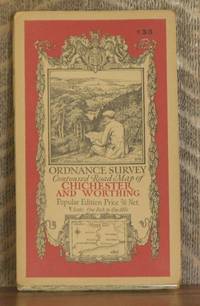
ORDNANCE SURVEY CONTOURED ROAD MAP OF CHICHESTER AND WORTHING Popular edition Scale 1 inch to 1 mile- Sheet # 133
de Ordnance Survey
- Usado
- Muy bueno
- Estado
- Usado - Muy bueno
- Edición
- Third revised edition
- Cantidad disponible
- 1
- Librería
-
Blue Hill, Maine, United States
- Precio
-
EUR 18.64
Mostrar detalles
Descripción:
Southampton: Ordnance Survey Office/ Charles Close Dir., 1929. Third revised edition. Map. Very Good. 4 X 7 in. high. unfolds to 29 1/2 X 22 inches. Condition of the book is VERY GOOD; Map is very clean, lightly rubbed at folds, but no splits or tears. Geography Ephemera
Precio
EUR 18.64
