Cartography And Maps from Ken Jackson
Novedades

Place Names of the Pacific Northwest Coast.
de Middleton, Lynn. Inscribed Copy.
- Estado
- Usado - Fine
- Estado de la sobrecubierta
- Good
- Edición
- 1st Edition
- Published
- 1969
- Encuadernación
- Hardcover
- Cantidad disponible
- 1
- Librería
-
Calgary, Alberta, CAN
- Precio
-
EUR 17.58
Mostrar detalles
Descripción:
Victoria: Elldee Publishing Company, 1969 First edition in hardcover with dust jacket. Inscribed by Ms, Middleton on the half-title page. 226 pp. Endpaper maps, illustrations. Jacket has rubbing and some scraping with a 1" tear at the top of the rear panel. Fine/Good. Precio
EUR 17.58

The Mapmaker's Eye: Nova Scotia Through Early Maps
de Dawson, Joan
- Estado
- Usado - Very Good
- Edición
- 1st Edition
- Published
- 1988
- Encuadernación
- Soft cover
- ISBN
- 9780921054122
- Cantidad disponible
- 1
- Librería
-
Calgary, Alberta, CAN
- Precio
-
EUR 28.15
Mostrar detalles
Descripción:
Halifax: Nimbus Publishing & The Nova Scotia Museum, 1988 First printing in oblong paper covers. There is a crimp on the front cover that runs faintly through half of the book. Pages are clean and unmarked. Very Good. Precio
EUR 28.15

Más fotos
La Sahara a L'Holocene: Mali
de Large Map
- Estado
- Usado - Very Good
- Published
- 1988
- Encuadernación
- Map
- Cantidad disponible
- 1
- Librería
-
Calgary, Alberta, CAN
- Precio
-
EUR 21.10
Mostrar detalles
Descripción:
Nicole Petit-Maire, 1988 Large fold-out colour map. Measures 40 by 34 inches unfolded. Vey minor wear. Photograph on request. Precio
EUR 21.10
Más fotos
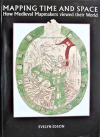
Mapping Time and Space. How Medieval Mapmakers Viewed Their World
de Edson, Evelyn
- Estado
- Usado - Fine
- Estado de la sobrecubierta
- Near Fine
- Edición
- 1st Edition.
- Published
- 1997
- Encuadernación
- Hardcover
- ISBN
- 9780712345354
- Cantidad disponible
- 1
- Librería
-
Calgary, Alberta, CAN
- Precio
-
EUR 105.66
Mostrar detalles
Descripción:
London: The British Library., 1997 First edition hardcover in dust jacket. 210 pp. Illustrations, notes, bibliography, index. Minor wrinkle to jacket otherwise Fine/Fine. Precio
EUR 105.66
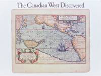
The Canadian West Discovered
de Javorski, Mary
- Estado
- Usado - Near Fine
- Edición
- 1st Edition.
- Published
- 1989
- Encuadernación
- Soft cover
- ISBN
- 9780919224339
- Cantidad disponible
- 1
- Librería
-
Calgary, Alberta, CAN
- Precio
-
EUR 13.35
Mostrar detalles
Descripción:
Calgary, Alberta: Glenbow Museum., 1989 First printing in oblong trade paperback. Exhibition catalogue. 75 pp. Over 50 reproductions of old maps in both colour and black and white. Minor rubbing to covers. Near Fine. Precio
EUR 13.35
Más fotos
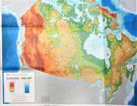
Canada-Relief. Large Fold-Out Colour Map
- Estado
- Usado - Very Good
- Published
- 1976
- Encuadernación
- Soft cover
- Cantidad disponible
- 1
- Librería
-
Calgary, Alberta, CAN
- Precio
-
EUR 21.10
Mostrar detalles
Descripción:
Ottawa: Energy, Mines and Resources Canada/Macmillan of Canada., 1976 Geographical Map Series No. 1. Measures 42" by 32". Scale 1" to 118 miles. There is a 4" tear to the middle fold at right edge otherwise fine. Very Good. Precio
EUR 21.10
Más fotos
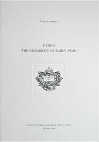
Cyprus. the Reliability of Early Maps
de Campbell, Tony
- Estado
- Usado - Fine
- Edición
- 1st Edition
- Published
- 1994
- Encuadernación
- Soft cover
- ISBN
- 9789963420469
- Cantidad disponible
- 1
- Librería
-
Calgary, Alberta, CAN
- Precio
-
EUR 35.19
Mostrar detalles
Descripción:
Nicosia, Cypress.: Bank of Cyprus Cultural Foundation., 1994 First printing in stapled card covers. 39 pp. Colour plates, notes. Fine. Precio
EUR 35.19
Más fotos
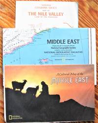
Maps: The Middle East. Lot of 8
- Estado
- Usado - Very Good
- Encuadernación
- Map
- Cantidad disponible
- 1
- Librería
-
Calgary, Alberta, CAN
- Precio
-
EUR 12.65
Mostrar detalles
Descripción:
National Geographic Society Most about Very Good. Precio
EUR 12.65
Más fotos
Maps: Europe. Lot of 8
- Estado
- Usado - Very Good
- Encuadernación
- Map
- Cantidad disponible
- 1
- Librería
-
Calgary, Alberta, CAN
- Precio
-
EUR 11.94
Mostrar detalles
Descripción:
National Geographic Society Most about Very Good. Precio
EUR 11.94
Más fotos
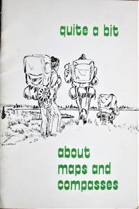
Quite a Bit About Maps and Compasses
de Cunningham, Harry A.
- Estado
- Usado - Very Good
- Published
- 1977
- Encuadernación
- Soft cover
- Cantidad disponible
- 1
- Librería
-
Calgary, Alberta, CAN
- Precio
-
EUR 10.53
Mostrar detalles
Descripción:
Winnipeg, Manitoba: Manitoba Department of Renewable Resources., 1977 Reprint in stapled paper covers. 32 pp. Figures, photographs. Minor wear and light soiling to covers. Very Good. Precio
EUR 10.53
Map of Manitoba Canada. Showing Mineral Occurences
- Estado
- Usado - Good
- Published
- 1927
- Encuadernación
- Soft cover
- Cantidad disponible
- 1
- Librería
-
Calgary, Alberta, CAN
- Precio
-
EUR 14.05
Mostrar detalles
Descripción:
Winnipeg: Department of Agriculture and Immigration., 1927 Large fold-out map with mineral deposits marked in red. Measures 26" by 44" unfolded. Tearing to some seams, creasing to edges. Good. Precio
EUR 14.05
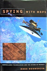
Spying With Maps. Surveillance Technologies and the Future of Privacy
de Monmonier, Mark
- Estado
- Usado - Fine
- Estado de la sobrecubierta
- Fine
- Edición
- 1st Edition.
- Published
- 2002
- Encuadernación
- Hardcover
- ISBN
- 9780226534275
- Cantidad disponible
- 1
- Librería
-
Calgary, Alberta, CAN
- Precio
-
EUR 10.53
Mostrar detalles
Descripción:
Chicago: Chicago: University of Chicago Press 2002., 2002 First edition hardcover in dust jacket. 239 pp. Illustrations, notes, index. Fine/Fine. Precio
EUR 10.53
Más fotos
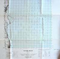
Fold-Out Topographical Survey Map. Victoria Beach, Manitoba
- Estado
- Usado - Very Good
- Published
- 1957
- Encuadernación
- Soft cover
- Cantidad disponible
- 1
- Librería
-
Calgary, Alberta, CAN
- Precio
-
EUR 17.58
Mostrar detalles
Descripción:
(Ottawa): The Army Survey Establishment/Department of National Defence., 1957 Map is scale 1: 50, 000 with water shaded in blue. Measures 30" by 22" with border. Shows: Houses schools, church, post officer, lighthouse, etc. Minor wear. Very Good. Precio
EUR 17.58
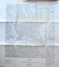
Fold-Out Topographical Survey Map. Root River, Northwest Territories
- Estado
- Usado - Very Good
- Published
- 1957
- Encuadernación
- Soft cover
- Cantidad disponible
- 1
- Librería
-
Calgary, Alberta, CAN
- Precio
-
EUR 17.58
Mostrar detalles
Descripción:
(Ottawa): The Army Survey Establishment/Department of National Defence., 1957 Map is scale 1: 250, 000 with lakes shaded in blue. Measures 30" by 22" with border. Shows: Roads, cart track, trails, railways, etc. Minor wear. Very Good. Precio
EUR 17.58
Más fotos
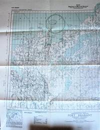
Fold-Out Topographical Survey Map. Port Brabant Northwest Territories (District of Mackenzie). Aeronautical Edition
- Estado
- Usado - Very Good
- Published
- 1943
- Encuadernación
- Soft cover
- Cantidad disponible
- 1
- Librería
-
Calgary, Alberta, CAN
- Precio
-
EUR 17.58
Mostrar detalles
Descripción:
Ottawa: Hydrographic and Map Service., 1943 Map is scale 1 inch to 8 miles with lakes shaded in blue. Measures 27" by 24" with border. Shows: Towns, settlements, trading post, RCMP, seaplane anchorage, etc. Minor wear. Very Good. Precio
EUR 17.58
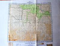
Fold-Out Topographical Survey Map in Co Lour. Sheet 83 N.W. Grande Prairie, Alberta
- Estado
- Usado - Near Fine
- Published
- 1941
- Encuadernación
- Soft cover
- Cantidad disponible
- 1
- Librería
-
Calgary, Alberta, CAN
- Precio
-
EUR 17.58
Mostrar detalles
Descripción:
Ottawa: Geological Survey of Canada/Department of Mines., 1941 Map is scale 1 inch to 8 miles and measures 24" by 30" with border. Includes: Boundries, Railways, Abandoned Railway Grades, Main Highways, Secondary Roads, Towns, Villages, Telegraph or Telephone Lines, Ferries, Marsh or Swamp, Lookout Towers, and gives height in feet. One small tear, minor wear. Very Good. Precio
EUR 17.58
Fold-Out Hydrographical Colour Map. Plans in the Strait of Georgia, British Columbia
- Estado
- Usado - Very Good
- Published
- 1966
- Encuadernación
- Soft cover
- Cantidad disponible
- 1
- Librería
-
Calgary, Alberta, CAN
- Precio
-
EUR 21.10
Mostrar detalles
Descripción:
Ottawa: The Canadian Hydrographic Service., 1966 Measures 32" by 29" with border. Shows: False Bary, Welcome Passage, Departure Bay, Flat Top Islands, with tidal information and fathoms and feet to metres chart. Minor wear. Very Good. Precio
EUR 21.10
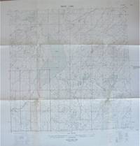
Fold-Out Topographical Survey Map. Trout Lake, Northwest Territories
- Estado
- Usado - Very Good
- Published
- 1956
- Encuadernación
- Soft cover
- Cantidad disponible
- 1
- Librería
-
Calgary, Alberta, CAN
- Precio
-
EUR 17.58
Mostrar detalles
Descripción:
(Ottawa): The Army Survey Establishment/Department of National Defence., 1956 Map is scale 1: 250, 000 with lakes shaded in blue. Measures 30" by 22" with border. Shows: houses, buildings, church, cemetery, quarry, sand or gravel pit, lighthouse, irrigation canals, etc. One small tear at one fold, small chip and some creasing at top edge, minor age toning to exposed areas… Saber más sobre este artículo Precio
EUR 17.58
Más fotos
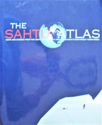
The Sahtu Atlas. Maps and Stories From the Sahtu Settlement Area in Canada's Northwest Territories
de Kershaw, Robert, Managing Editor. Cartography By James Auld
- Estado
- Usado - Fine
- Estado de la sobrecubierta
- Fine
- Published
- 2005
- Encuadernación
- Hardcover
- ISBN
- 9780973763003
- Cantidad disponible
- 1
- Librería
-
Calgary, Alberta, CAN
- Precio
-
EUR 49.29
Mostrar detalles
Descripción:
Sahtu Gis Project., 2005 Second printing hardcover in tall glossy boards with dust jacket. 68 pp. Tables, photographs, maps. Fine/Fine. Please ignore the shadow on the photos. Precio
EUR 49.29

Más fotos
Cyprus on the Table 1878-1920
de Gole, Susan
- Estado
- Usado - Very Good
- Edición
- 1st Edition.
- Published
- 1996
- Encuadernación
- Soft cover
- ISBN
- 9789963420605
- Cantidad disponible
- 1
- Librería
-
Calgary, Alberta, CAN
- Precio
-
EUR 49.29
Mostrar detalles
Descripción:
Nicosia, Cypress.: Bank of Cyprus Cultural Foundation., 1996 First printing in tall card covers 61 pp. Footnotes, colour plates, maps. Small bump to top edge of foredge has caused some light crimping, faint spine lean. otherwise fine. Very Good. Precio
EUR 49.29
